Ribblehead, Yorkshire Dales
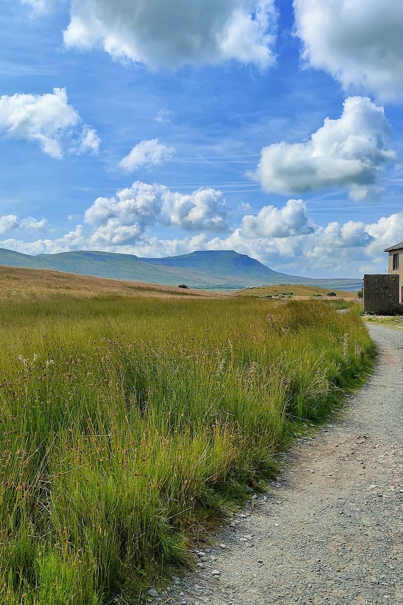
Whernside from Ribblehead
route · Countryside walk
Place photograph
8.6
Wildland
Half day
Time
Check
Cost
Dramatic
Feel
Why it's Wildland
8.6A long, steady climb leads to the 736-metre summit of Whernside, Yorkshire’s highest peak, before a steeper descent returns beneath the arches of Ribblehead Viaduct.
This is a proper high-level Dales walk, not just a summit tick: the climb opens onto a long ridge with far-reaching views, while the return brings you back to one of Britain’s most striking railway landmarks.
Dramatic · Big-sky · Wild
Find your way
Open mapRibblehead, Yorkshire Dales
Opening map…
Know this place a little better?
The experience
Take the National Park’s 7.5-mile route from Ribblehead to the summit and back. Expect a long, steady ascent, a high ridge and a steeper descent, with the viaduct framing the start and finish.
Things to do
Climb Whernside from Ribblehead
Follow the National Park’s 7.5-mile route to the highest point in Yorkshire, climbing steadily to the ridge before a steeper descent and a final flat section beneath Ribblehead Viaduct.
Pause on the high-level ridge
Take in the ridge and, on a clear day, look towards the Howgills, Lake District and Morecambe Bay.
Finish beneath Ribblehead Viaduct
The route returns across a final flat section beneath the viaduct, the striking landmark from which the National Park route begins.
Make a day of it
Quick escape · Check before setting out; no shorter summit itinerary is verified in the supplied sources.
Quick Escape: Ribblehead and the lower approach
- 01
Begin at Ribblehead and take in the viaduct, the National Park route’s stated starting landmark.
- 02
Only continue onto the hill if time, weather and fitness allow; the verified summit route is 7.5 miles.
Half day · Check before setting out; the National Park source gives distance but not a duration.
Half day: Whernside from Ribblehead
- 01
Start at Ribblehead Viaduct or the nearby Ribblehead station.
- 02
Follow the National Park’s 7.5-mile route up the long, steady climb to Whernside’s summit.
- 03
Take in the high-level ridge and, on a clear day, views towards the Howgills, Lake District and Morecambe Bay.
- 04
Descend by the steeper route and finish beneath Ribblehead Viaduct.
Verified history
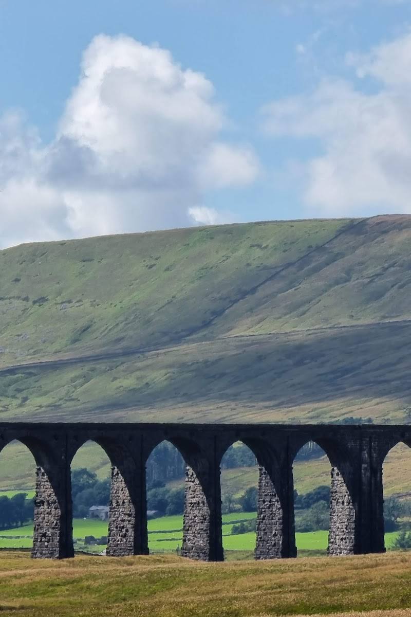
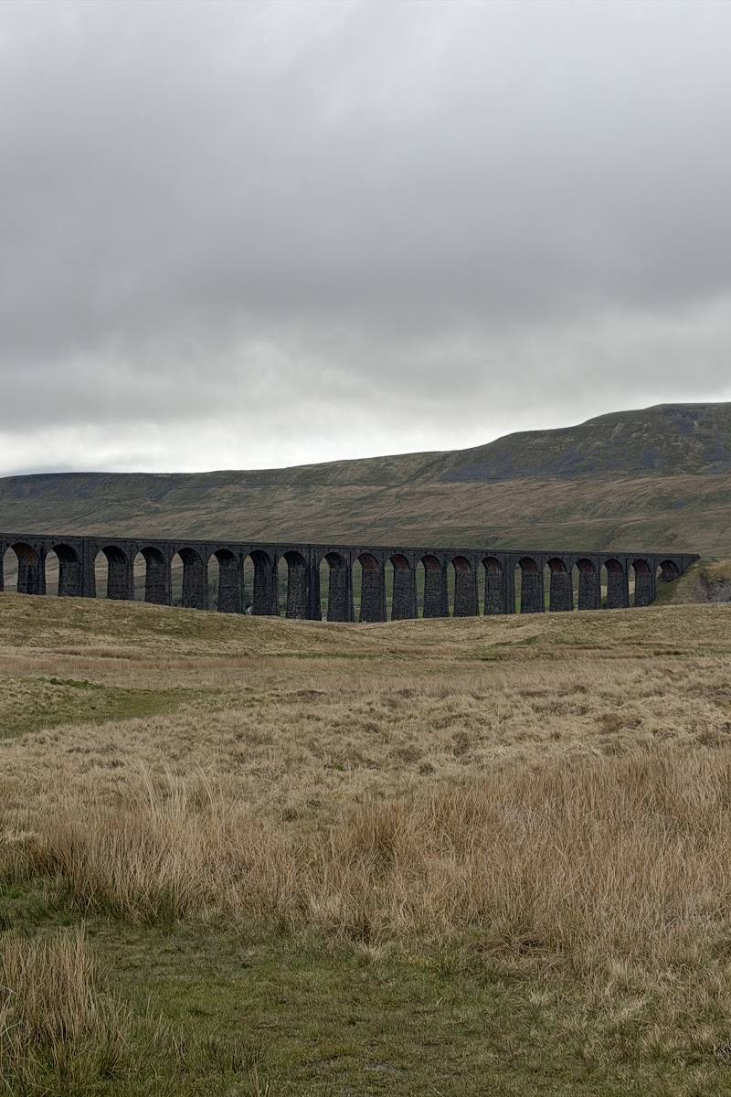
Ribblehead Viaduct is the route’s landmark starting point. The supplied walking account describes it as a 24-arch railway viaduct built in the 1870s on the Settle–Carlisle line. The Yorkshire Dales National Park identifies the viaduct as the start of its Whernside route.
Hidden details
Look back to the viaduct on the descent — The National Park route finishes with a flat section beneath Ribblehead Viaduct, giving the railway landmark a second perspective after the summit ridge.
When to go
· Choose a clear forecast and allow enough daylight for a sustained hill walk; no specific best time is established by the supplied sources.
The supplied sources do not establish a best season. Higher ground can be colder and windier, so check the forecast and conditions before setting out.
The Yorkshire Dales National Park advises that it gets colder and windier at higher elevations and recommends suitable equipment and checking hill-safety advice.
The route
- distance
- 12.5 km (7.5 miles)
- difficulty
- Long, steady ascent with a steeper descent; suitable hill-walking ability and preparation required.
- route shape
- Out-and-back is not specified; the National Park describes an ascent and descent returning beneath Ribblehead Viaduct.
- start point
- Ribblehead Viaduct, Ribblehead
- parking start
- Ribblehead, LA6 3AS (SD 766 793); Ribblehead station is close to the start.
- Whernside summit, 736 metres
- Long, high-level ridge
- Views towards the Howgills, Lake District and Morecambe Bay on a clear day
- Ribblehead Viaduct
Worth pairing with
Ribblehead Viaduct
The National Park route starts from this landmark and finishes beneath it, making it an integral part of the walk rather than a separate detour.
Station Inn
Listed by the National Park as a refreshment option near the route; check current availability.
What to look for
- 01
The high-level ridge and views towards the Howgills, Lake District and Morecambe Bay on a clear day
- 02
the Ribblehead Viaduct below the descent.
The story
Victorian railway heritage at Ribblehead Viaduct and the Settle–Carlisle line.
Best time to go
Check hill and weather conditions before setting out; higher ground can be colder and windier.
Choose a clear-weather day for the broad views; conditions become colder and windier higher up.
How long to spend
Half day
Perfect for
Walkers · Photographers · History lovers
Route at a glance
Duration
Half day
Terrain
Hills, Remote countryside
Parking / start
Ribblehead, LA6 3AS (SD 766 793), according to the Yorkshire Dales National Park. Check current arrangements before travelling.
Before you go
Address
Google rating
Practical information
Opening & access
A walking route to Whernside’s summit from Ribblehead. The Yorkshire Dales National Park lists parking at Ribblehead and Ribblehead station as a nearby public-transport option. Check conditions and route details before setting out.
Check before visiting
Parking
Ribblehead, LA6 3AS (SD 766 793), according to the Yorkshire Dales National Park. Check current arrangements before travelling.
Check before visiting
Toilets
None listed by the Yorkshire Dales National Park; check before visiting.
Check before visiting
Food & drink
The National Park lists the Station Inn and, sometimes, a tea wagon in the parking area. Check availability before travelling.
Check before visiting
Dogs
Check the Yorkshire Dales National Park’s current guidance for walking with dogs and follow countryside rules.
Check before visiting
Accessibility
A sustained hill climb and steeper descent; not described as an accessible route. Check current route conditions and suitability before setting out.
Check before visiting
Cost
Check before visiting
Check before visiting
Gallery
Place photographs
Keep exploring
Around Whernside from Ribblehead
Within 50 km · approximate straight-line distances