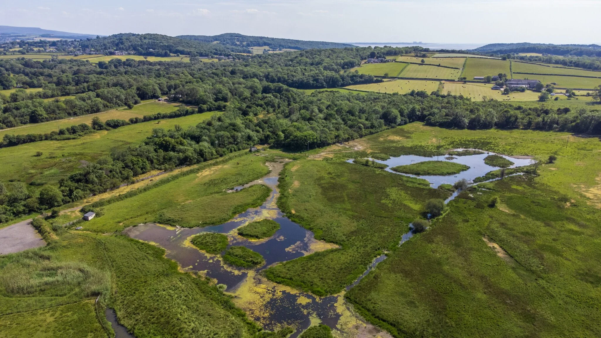
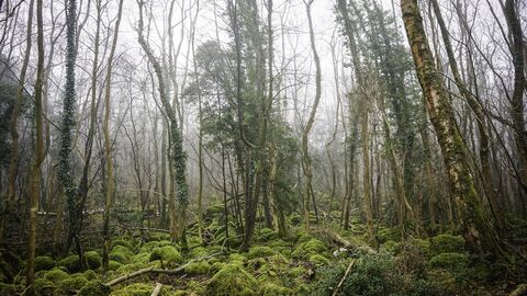
Ingleborough, Yorkshire Dales National Park
Ingleborough Summit
route · Countryside walk
Place photograph
8.2
Wildland
Full day
Time
Check
Cost
Dramatic
Feel
Why it's Wildland
8.2The Clapham approach makes a substantial day of the climb, threading past Ingleborough Cave, Trow Gill and Gaping Gill before reaching the broad summit of one of the Yorkshire Three Peaks.
Ingleborough earns its place through the combination of a serious mountain walk and striking limestone scenery: caves, a dramatic gorge and a high, expansive summit. It is not a casual stroll—the 17 km route is long, and poor visibility can make summit navigation difficult.
Dramatic · Wild · Big-sky
Find your way
Open mapIngleborough, Yorkshire Dales National Park
Opening map…
The experience
Follow the National Park Authority’s 17 km Clapham route, passing Ingleborough Cave, Trow Gill and Gaping Gill on the way to the 723 m summit. Allow a full day, carry suitable equipment and be prepared to navigate carefully in poor visibility.
Things to do
Climb to Ingleborough’s summit
Walk the National Park Authority’s long route from Clapham to the 723 m summit. Navigation can be difficult in poor visibility, so plan carefully and carry suitable equipment.
Full day
Explore the limestone approach
The Ingleborough Estate Nature Trail describes a 1.3-mile woodland trail leading towards Ingleborough Cave and the wider limestone landscape. Check trail access, any charges and current conditions before visiting.
Make a day of it
Quick escape · Full day
The full Clapham-to-summit walk
- 01
Start in Clapham and follow the Yorkshire Dales National Park Authority’s 17 km route.
- 02
Pass Ingleborough Cave, Trow Gill and Gaping Gill on the way up.
- 03
Continue to the 723 m summit, taking particular care with navigation if visibility is poor.
- 04
Return by the route you planned; check the route guidance and conditions before setting out.
Half day · Check route and return time before setting out; no shorter route duration is specified in the supplied research.
Make a half day of the lower limestone approach
- 01
Start from the Clapham approach and explore only as far as your time, fitness and conditions allow.
- 02
Take in the limestone scenery and the approach towards Ingleborough Cave and Trow Gill.
- 03
Turn back with enough time to return safely; the supplied sources do not specify a shorter circuit or confirm access arrangements for a particular turnaround point.
Verified history
The supplied research describes archaeological features on Ingleborough’s summit plateau recorded as a large univallate hillfort. It does not establish who built it, when it was built, or the details of its use.
When to go
May · June · July · August · September · Start early for the full-day ascent. Avoid relying on a summit visit when visibility is poor; check the forecast and conditions before setting out.
The source row suggests May–September for milder weather, longer days and less muddy trails. It also cautions that winter snow and ice can make the ascent more challenging; mountain weather should be checked in any season.
It gets colder and windier higher up. The Yorkshire Dales National Park Authority warns that summit navigation can be difficult, particularly in poor visibility; a compass may be needed in cloudy conditions. Check the forecast, route advice and equipment requirements before leaving.
The route
- ascent
- Not stated in supplied sources
- stiles
- Not stated in supplied sources
- surface
- Not stated in supplied sources
- distance
- 17 km (10 miles)
- duration
- Full day; exact walking time not stated
- difficulty
- Long hill walk; suitable equipment and careful navigation are important
- waymarking
- The source row describes well-marked paths; confirm current route conditions and navigation requirements.
- route shape
- Not stated in supplied sources
- start point
- Clapham
- parking start
- Clapham, LA2 8EF (SD 745 692), as listed by the Yorkshire Dales National Park Authority. Check current arrangements.
- shorter alternative
- The Ingleborough Estate Nature Trail describes a 1.3-mile woodland trail towards Ingleborough Cave. It is a separate shorter option, not a verified shortened summit route; check current access and arrangements.
- Ingleborough Cave
- Trow Gill
- Gaping Gill
- Ingleborough summit at 723 m
- Limestone scenery
Worth pairing with
Ingleborough Cave and the Ingleborough Estate Nature Trail
The estate trail’s site describes the woodland approach to Ingleborough Cave and the surrounding limestone scenery. Check current trail and cave opening arrangements, tickets and access before visiting.
Clapham village
The National Park Authority lists pubs, cafés and shops in Clapham, as well as parking and public toilets. Check current opening times and arrangements.
What to look for
- 01
Notice the limestone scenery around Ingleborough Cave, Trow Gill and Gaping Gill, then look across the broad summit plateau. The supplied research also describes archaeological features recorded as a large univallate hillfort
- 02
no specific visible remains are identified in the sources.
The story
The supplied research describes archaeological features on the summit plateau recorded as a large univallate hillfort.
Best time to go
May–September is suggested by the supplied source row, but conditions vary; check the forecast and hill conditions before any ascent. Winter snow and ice can make the route more challenging.
The source row recommends May–September for milder weather and longer days, but mountain conditions can change quickly. Set out early enough for a full-day walk and check the forecast before leaving.
How long to spend
Full day
Perfect for
Walkers · Photographers · Wildlife lovers
Route at a glance
Duration
Full day
Terrain
Hills, Valley
Parking / start
The Yorkshire Dales National Park Authority lists parking in Clapham, LA2 8EF (SD 745 692). Check current arrangements before travel.
Practical information
Opening & access
A long, strenuous hill walk from Clapham to the 723 m summit. The Yorkshire Dales National Park Authority describes the route and provides parking and public transport details. Summit navigation can be difficult in poor visibility; check conditions and prepare before setting out.
Check before visiting
Parking
The Yorkshire Dales National Park Authority lists parking in Clapham, LA2 8EF (SD 745 692). Check current arrangements before travel.
Check before visiting
Toilets
The National Park Authority lists public toilets in the Clapham National Park car park. Check current availability before visiting.
Check before visiting
Food & drink
The National Park Authority lists pubs, cafés and shops in Clapham; check current opening details before visiting.
Check before visiting
Dogs
The source row describes the route as dog friendly, but check current local guidance and conditions before taking a dog.
Check before visiting
Accessibility
The summit route is a long hill walk over rugged terrain; it is not wheelchair accessible according to the source row. Summit navigation can be difficult in poor visibility, and conditions become colder and windier at height.
Cost
Check before visiting
Check before visiting
Water
No water activity or swimming permission is evidenced; do not assume access to water for recreation.
Gallery
Place photographsKeep exploring
Around Ingleborough Summit
Within 50 km · approximate straight-line distances
 Place photograph7.4
Burns Beck Moss
Old Scotch Road, Killington, near Sedbergh, Cumbria, LA6 2HB
19.8 km away
Janet's Foss
Near Malham, Yorkshire Dales National Park, North Yorkshire
20.4 km away
Hyning Scout Wood
Between Yealand Conyers and Warton, Arnside & Silverdale, Lancashire
23.9 km away