Minginish Peninsula, west coast of the Isle of Skye, near Carbost, Scotland
Talisker Bay
Beach
Place photograph
8.0
Wildland
1–2 hours
Time
Check
Cost
Dramatic
Feel
Why it's Wildland
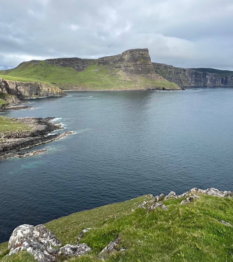
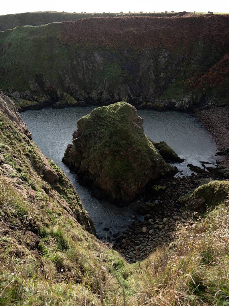
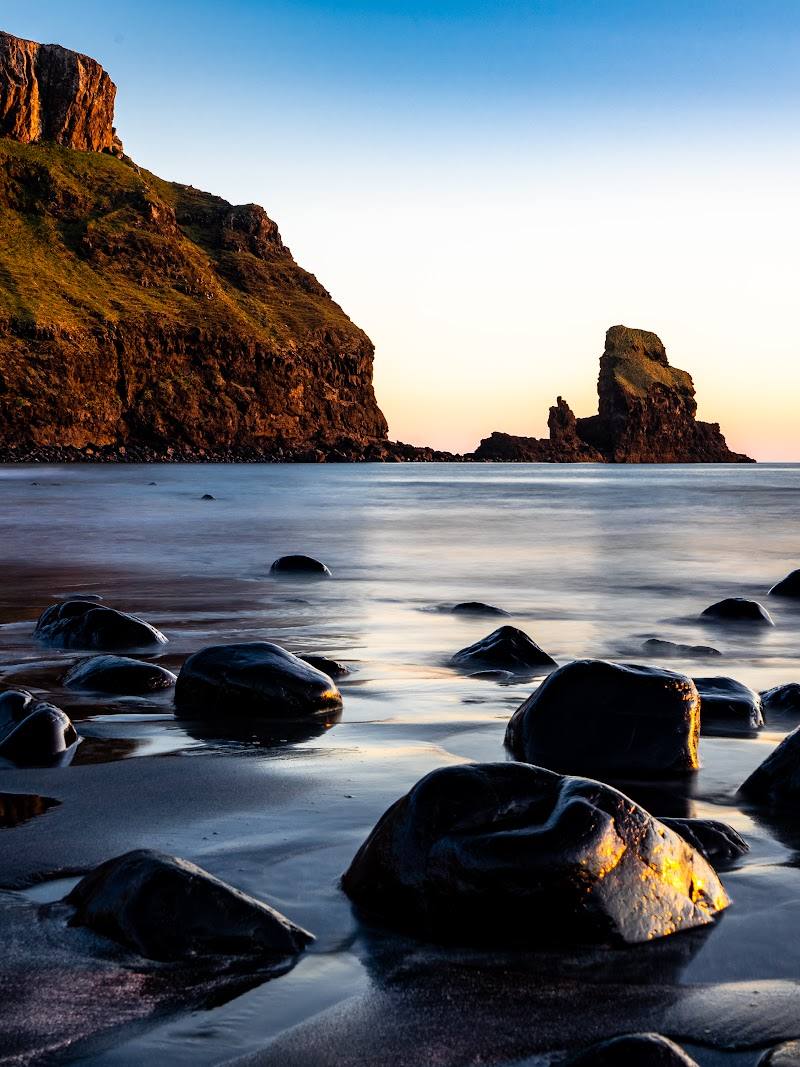
8.0A short walk opens onto a west-facing bay of marbled grey sand, steep green cliffs and a dramatic sea stack. In rough weather, the wind can drive spray from the shore and the nearby waterfall back upwards.
Talisker Bay earns its place for the way a brief approach opens into a remarkably dramatic Atlantic shore: grey sand, enclosing cliffs and a sea stack at the bay’s southern end. It feels especially compelling in changing weather or evening light, but the limited parking and exposed coast reward a considered visit.
Dramatic · Wild · Atmospheric
Find your way
Open mapMinginish Peninsula, west coast of the Isle of Skye, near Carbost, Scotland
Opening map…
Know this place a little better?
The experience
Allow around 1–2 hours for the walk and time on the shore. Follow the track from the road end, pass Talisker House and the burn crossing, then continue to the bay. Check tides if you want to spend time on the sand: very high tides can cover it. Parking is limited, so arrive prepared to turn back if there is nowhere suitable to stop.
Things to do
Walk the track to the bay
Follow the short approach from the road end, passing Talisker House and a burn crossing before the beach comes into view.
About 20 minutes each way according to one walk guide
Find the sea stack
Look towards the southern end of the bay for the prominent stack that punctuates the shoreline.
Watch the shore at low tide
The beach’s grey sand is most exposed at low tide; very high tides can cover the sand, so check tide times before planning a beach stop.
Look for wind-driven spray
On wild, windy days, observe how the wind affects the waves and the spray at the nearby waterfall. Conditions can be exposed; keep a safe distance from the shore.
Make a day of it
Quick escape · About 1 hour, without stops
Quick Escape: the bay and back
- 01
Park only where permitted and where your vehicle will not obstruct the road, gates or turning space.
- 02
Follow the track towards the beach, passing Talisker House and crossing the burn.
- 03
Spend time on the shore, looking towards the sea stack at the southern end of the bay.
- 04
Return by the same route.
Half day · Half day
Make a half day of it: beach, house and changing light
- 01
Check tide times and current parking advice before driving the single-track road.
- 02
Walk to the bay at an unhurried pace, pausing at Talisker House and the burn crossing.
- 03
Explore the shore and look for the sea stack; allow time to watch how wind and waves change the scene.
- 04
Return along the same track. Consider the west-facing bay for evening light, but plan the drive and parking accordingly.
Verified history
Talisker House dates to about 1720 and was home to the heir to Clan Macleod’s chieftain. Dr Samuel Johnson and his biographer James Boswell stayed there in 1773 during their tour of the Hebrides; their host was Colonel John Macleod, 4th of Talisker. The house’s last Macleod resident, Donald Macleod, left in 1820. The estate later passed to Hugh MacAskill, who completed the clearance of crofting families from the estate; in 1830 he founded Talisker Distillery at Carbost, several miles away.
Hidden details
The house before the beach — The walk passes Talisker House, a circa-1720 building associated with the Macleod family and the 1773 visit by Johnson and Boswell.
A west-facing sunset shore — The bay faces almost due west, making the shore a notable place to watch evening light when conditions and access allow.
A rare moth connection — Britain Express reports that the Talisker estate is an SSSI, partly because it supports two rare moth species, including the Talisker burnet moth. The supplied source does not establish that visitors are likely to see them on the beach walk.
When to go
· Later evening for west-facing light; early morning or later evening may also be quieter for parking.
The supplied sources do not establish a best season. Beach access and the amount of exposed sand depend on tide; parking is reported to become busy in mid-summer.
The shore is exposed to Atlantic weather. Wind can whip across the moorland and drive spray; check the forecast and take care near the water. One walk guide describes the route as suitable for most weather conditions, but conditions at the bay can still be rough.
The route
- surface
- Track; the final section is described as rougher
- distance
- 2.9 km return
- duration
- About 40 minutes walking without stops; approximately 20 minutes each way
- difficulty
- Easy
- waymarking
- A blue sign marked “To the Beach” is described at the route start.
- route shape
- Out and back
- start point
- The small parking/turning area at the end of the single-track road, subject to current parking restrictions and signs.
- parking start
- Parking is limited and sources give differing descriptions of the arrangement. One recommends a small area about 500 metres before the road end; another describes a small parking/turning area at the road end. Do not obstruct passing places, gates or the turning area. Check current local advice.
- Talisker House, dating to circa 1720
- Burn crossing on the approach
- Grey-sand beach framed by cliffs
- Sea stack at the southern end of the bay
Worth pairing with
Talisker Distillery, Carbost
A historically relevant pairing: Talisker Distillery was founded at Carbost in 1830 by Hugh MacAskill, who acquired the Talisker estate. Check current visitor arrangements separately before planning a visit.
What to look for
Look for the sea stack at the southern end of the bay, the marbled grey sand at low tide, the steep cliffs enclosing the shore and the effects of wind on the waves and waterfall spray.
The story
Talisker House, Clan Macleod and the history of the Talisker estate and distillery
Best time to go
No single season is established by the supplied sources. Choose a clear or settled spell for beach time; dramatic weather can bring striking wave and spray effects, but conditions may be exposed.
For evening light, the bay’s west-facing aspect is a reason to consider a later visit. An early morning or later evening visit, or a quieter month, may also help with limited parking. Check tide times if beach time matters.
How long to spend
1–2 hours
Perfect for
Walkers · Photographers · Families
Before you go
Google rating
Practical information
Opening & access
A walk from the end of the single-track road leads to the beach. Sources describe a public route, but parking is limited and accounts differ on whether to use a small parking area short of the road end or the turning area. Do not obstruct passing places, gates or the turning area; check current local signs before setting out.
Check before visiting
Parking
Limited parking. Sources give differing descriptions of the parking arrangements: one identifies a small area about 500 metres before the road end; another describes a small parking/turning area at the road end. Do not park in passing places, on verges, at gates or where vehicles need to turn. Check current conditions and signs.
Check before visiting
Toilets
Check before visiting
Check before visiting
Food & drink
Check before visiting
Check before visiting
Dogs
Livestock graze along the route. Keep dogs on a lead where sheep are present or signs require it.
Accessibility
The approach is described as a short walk on a well-trodden path or track, but the final section is rougher. No accessible facilities or step-free access details are supplied.
Cost
Check before visiting
Check before visiting
Water
Sea
Gallery
Place photographs
Keep exploring
Around Talisker Bay
Within 50 km · approximate straight-line distances