Neist Point, Duirinish Peninsula, Isle of Skye, near Glendale, Scotland
Neist Point Lighthouse
Viewpoint
Place photograph
8.4
Wildland
1–2 hours
Time
Check
Cost
Dramatic
Feel
Why it's Wildland
8.4At Skye’s western edge, a steep path leads to a lighthouse set among high cliffs, with wide views over the sea.
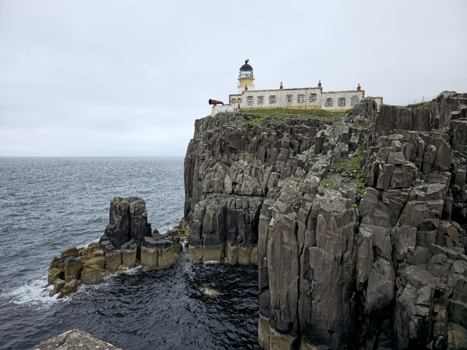
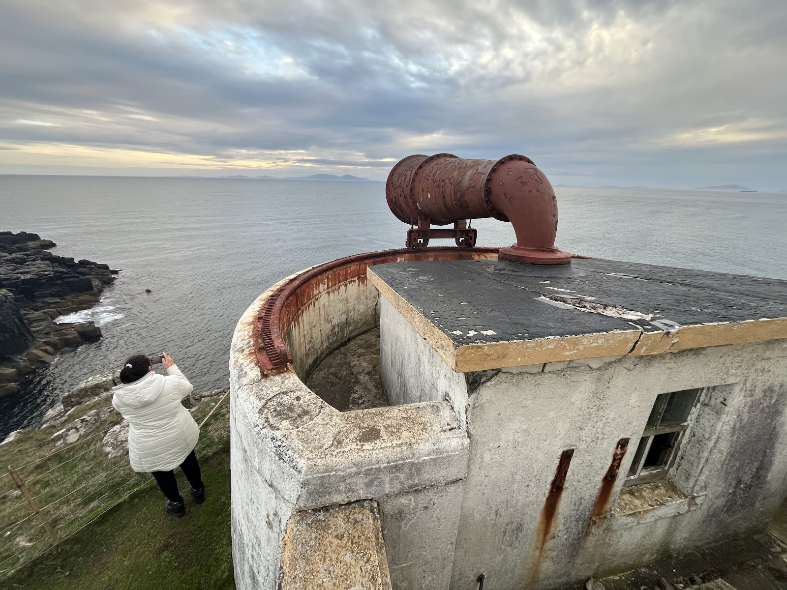
Neist Point earns its place for the combination of a dramatic sea-cliff walk, a working lighthouse on Skye’s western tip and far-reaching coastal views. It is a short outing, but the exposed headland and steep return make weather and conditions an essential part of the plan.
Dramatic · Wild · Big-sky
Find your way
Open mapNeist Point, Duirinish Peninsula, Isle of Skye, near Glendale, Scotland
Opening map…
Know this place a little better?
The experience
Allow around 45 minutes for the 2.2 km return walk without stops, and longer to pause at viewpoints. The route follows the same path down and back. The lighthouse is not open to visitors.
Things to do
Walk the path to the lighthouse
Take the concrete path from the road-end car park down to the headland and return the same way. The route is steep in places and the uphill return may need breaks.
About 45 minutes walking without stops; allow longer for breaks
Pause for the cliff and sea views
Take in the high cliffs and open-water views from the path and headland. Keep well back from the cliff edge, particularly in wind or poor visibility.
Make a day of it
Quick escape · About 45 minutes walking, plus time for stops
Quick Escape: the lighthouse walk
- 01
Park at the end of the single-track road, if space is available.
- 02
Follow the concrete path down towards the headland and lighthouse.
- 03
Pause for the coastal views, then return by the same path, allowing extra time for the steep climb back.
Half day · Allow half a day, including the walk and time for stops
Make a half day of it: walk, viewpoints and wildlife watching
- 01
Check the weather and visibility before driving to the start.
- 02
Walk the out-and-back path, taking breaks on the steep sections.
- 03
Spend time viewing the cliffs and looking for seabirds from a safe distance.
- 04
Allow extra time at the end to enjoy the views before returning up the path.
Verified history
The supplied source reports that Neist Point Lighthouse was designed by David Alan Stevenson and first lit in 1909. It was automated in 1990 and is operated by the Northern Lighthouse Board. The lighthouse tower is not open to visitors.
Hidden details
The lighthouse is not open to visitors — The walk reaches the headland and lighthouse setting, but the lighthouse itself is not open to the public.
The lighthouse is hidden from the car park — The walk source notes that the lighthouse cannot be seen from the start of the path; it recommends looking back along the cliff to the right of the car park for a view.
When to go
· Sunset for the light, provided weather and visibility are suitable.
The supplied sources recommend sunset light but do not establish a generally best season. The exposed cliff route is unsuitable in some weather, especially strong winds or mist.
Do not attempt the cliff route in windy conditions or mist, when visibility is low. The path is steep and can be slippery or difficult in wet weather; wear suitable footwear and warm, windproof layers.
The route
- surface
- Concrete path; steep in places
- distance
- 2.2 km return
- duration
- About 45 minutes without stops; allow longer for exploring and breaks
- difficulty
- Average; short route with a steep path
- route shape
- Out and back on the same path
- start point
- At the end of the single-track road near Glendale, at the car park
- parking start
- Small car park at the road end; it can fill quickly. Further roadside spaces are reported farther back along the road.
- Views of the high cliffs
- The lighthouse on the headland
- Open sea views
What to look for
- 01
Look for the lighthouse and its setting beneath the high cliffs
- 02
the walk also offers views back towards the headland from the path. Seabirds are noted along the cliffs. Keep a safe distance from cliff edges.
The story
Lighthouse and maritime navigation
Best time to go
No specific best season is verified. Choose a calm, clear day; sunset is noted for its light, but avoid the route in strong winds or mist.
Sunset is recommended for the light on the cliffs and lighthouse, but only go if conditions are calm and visibility is good.
How long to spend
1–2 hours
Perfect for
Walkers · Photographers · Wildlife lovers
Practical information
Opening & access
A walk from the car park at the end of the single-track road reaches the headland. The steep concrete path is exposed and can be hazardous in wind, mist or poor weather. The lighthouse itself is not open to visitors.
Parking
A small car park is reported at the end of the single-track road; it can fill quickly. Additional roadside spaces farther back along the road are reported. Check conditions before setting out.
Check before visiting
Toilets
Check before visiting
Check before visiting
Food & drink
None reported on site; bring supplies and check nearby options before visiting.
Check before visiting
Dogs
Dogs are reported as welcome, but keep them under close control near the cliffs and supervise them carefully.
Accessibility
The route is steep and uneven in places and is not reported as wheelchair accessible. Avoid in windy or misty conditions; take care near cliff edges.
Cost
Check before visiting
Check before visiting
Water
Sea
Gallery
Place photographs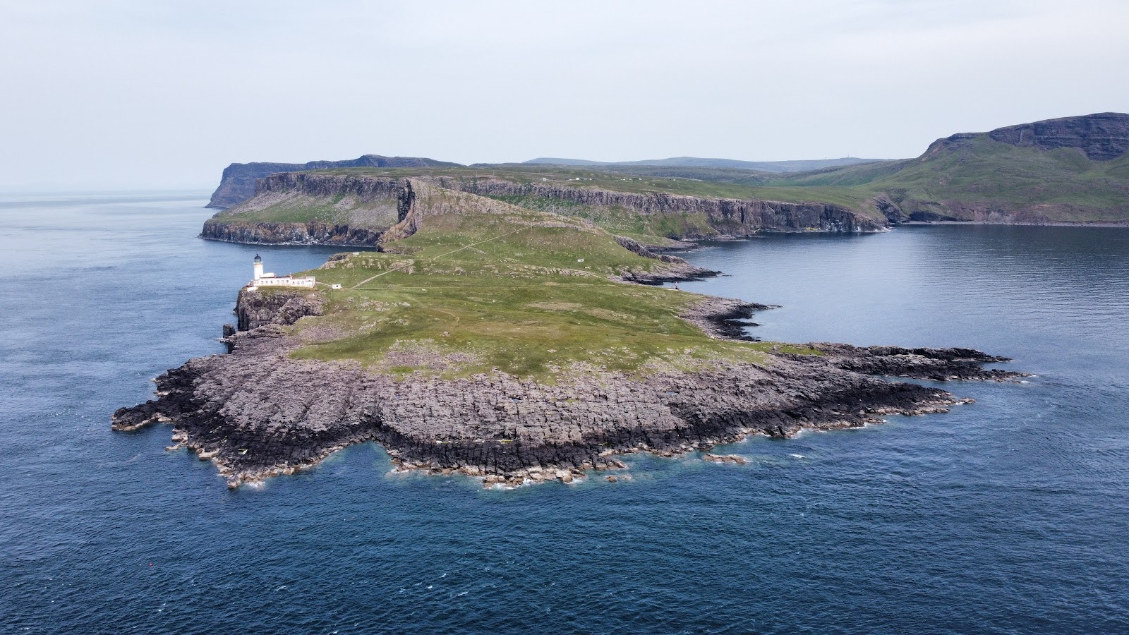
Keep exploring
Around Neist Point Lighthouse
Within 50 km · approximate straight-line distances