Quiraing, Trotternish Ridge, Isle of Skye
Quiraing Circuit
route · Countryside walk
Place photograph
9.2
Wildland
2–4 hours
Time
Check
Cost
Dramatic
Feel
Why it's Wildland
9.2A vast landslip has left the Trotternish Ridge folded into cliffs, hidden plateaus and striking rock pinnacles. The circuit passes the Needle, the Table and the Prison, with the rugged landscape changing character as the path enters the little valley beneath the ridge.
This is a genuinely dramatic highland walk where the land itself is the story: an ancient, still-active landslip has created a landscape of sheer cliffs, secluded plateaus and unmistakable pinnacles. The full circuit is rewarding but exposed, with uneven ground and steep drops; wind, rain or poor visibility can make it unsuitable.
Dramatic · Wild · Big-sky · Atmospheric
Find your way
Open mapQuiraing, Trotternish Ridge, Isle of Skye
Opening map…
Know this place a little better?
The experience
Walk the circuit from the car park, taking time to explore the characteristic rock formations and the valley beneath the ridge. The route is rough and exposed in places, so treat weather and visibility as deciding factors rather than afterthoughts.
Things to do
Walk the Quiraing Circuit
Follow the circular route across the Trotternish landslip, through its little valley and past dramatic cliffs and rock formations. The path is rough and can be muddy or slippery; avoid the route in strong winds or mist.
About 2 hours without stops; allow longer overall
Find the Needle, the Table and the Prison
Look for the Quiraing’s three signature formations: the Needle, the flat grass-covered Table and the jagged peaks known as the Prison.
Look across the ridge on a clear day
From the route, take in the cliffs, hidden plateaus and wide views towards the Sound of Raasay and the Outer Hebrides when visibility allows.
Make a day of it
Quick escape · Under 1 hour
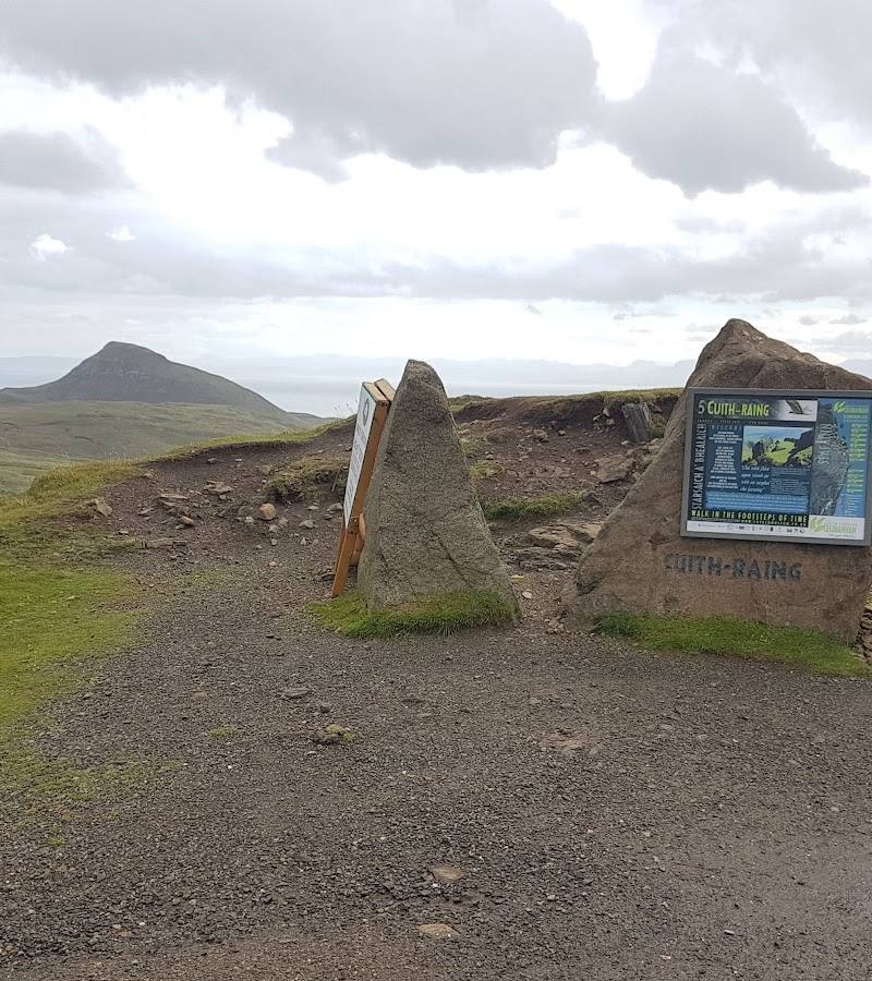
The Quiraing from the car park
- 01
Take in the ridge and the Prison from the car park and nearby viewpoint area.
- 02
If conditions are safe and visibility is good, walk a short section of the trail and return the way you came.
- 03
Do not continue onto exposed ground in strong winds, mist or unsafe conditions.
Half day · About 2 hours walking without stops; allow longer to explore
Complete the Quiraing Circuit
- 01
Start at the car park on the single-track road between Staffin and Uig.
- 02
Follow the loop past the landslip’s rock formations and the little valley.
- 03
Pause at the Needle, the Table and the Prison, then return to the same car park.
- 04
Only attempt the full circuit when weather and visibility are suitable; the route is rough and has exposed sections.
Verified history
The Quiraing is part of the Trotternish Ridge and was formed by a massive landslip. A local guide describes it as ancient and still active, with continuing movement visible in cracks and bulges on the narrow road leading to the car park. The supplied sources do not provide a dated account of the landslip.
Hidden details
The Table is a grass-covered plateau — Among the sharp cliffs and pinnacles, look for the Table: a comparatively flat, grass-covered plateau tucked into the landslip landscape.
The landscape is still shifting — The Quiraing is described as an active landslip. The local guide reports cracks and bulges on the narrow road leading to the car park as visible signs of movement.
When to go
· A clear, calm morning; sunrise is suggested by the local guide for low-angle light, but safe conditions matter more than the hour.
The supplied sources do not identify a reliably best season. Weather and visibility are the key considerations: the route is not recommended in strong winds or mist, and rain can make the path slick and muddy.
Conditions can change rapidly. Strong winds on exposed ground, rain-slick or muddy paths, and thick fog that reduces visibility are specifically noted hazards. Check the forecast and current conditions before setting out.
The route
- ascent
- 391 m according to Family Can Travel; its account reports 405 m from its own tracking data.
- surface
- Rough, uneven path; loose rock and muddy or slippery sections may occur
- distance
- 6.8 km according to IsleofSkye.com; Family Can Travel gives 8.4 km / 5.2 miles for the circuit. Confirm route measurements before publishing as definitive.
- duration
- About 2 hours without stops, according to IsleofSkye.com
- difficulty
- Hard according to IsleofSkye.com; Family Can Travel describes it as moderately difficult. Rough ground and exposed sections; suitability depends on conditions and experience.
- route shape
- Loop, returning to the same car park
- start point
- Quiraing car park on the highest part of the single-track road between Staffin and Uig
- parking start
- Car park at the route start. IsleofSkye.com reports paid parking and advises against parking on the verge; check current charges and arrangements.
- shorter alternative
- Enjoy the views from the car park and, only if conditions are safe, walk a short out-and-back section before returning. The source describes the car park views as worthwhile.
- The Needle
- The Table
- The Prison
- Cliffs and hidden plateaus formed by the landslip
- Little valley on the circuit
- Views towards the Sound of Raasay and the Outer Hebrides on a clear day
What to look for
- 01
The Needle, a tall slender rock tower
- 02
the Table, a grass-covered plateau
- 03
and the Prison, a group of craggy peaks. Notice how the cliffs and hidden plateaus reveal themselves as the path follows the landslip.
The story
Geological landscape; ancient and still-active landslip
Best time to go
Check conditions before travelling; choose a clear, calm day. The route is not recommended in strong winds or mist.
Choose a clear day with light winds for safer footing and views across the surrounding sea and islands. The local guide recommends sunrise for low-angle light on the ridge, but conditions take priority.
How long to spend
2–4 hours
Perfect for
Walkers · Photographers · Families · Teens
Route at a glance
Duration
2–4 hours
Terrain
Hills, Remote countryside
Parking / start
Car park at the highest point of the single-track road between Staffin and Uig. The supplied guide reports paid parking and warns against parking on the verge; check current arrangements before visiting.
Before you go
Address
Google rating
Practical information
Opening & access
The circuit starts and finishes at the Quiraing car park on the single-track road between Staffin and Uig. The supplied sources describe a well-trodden walking route; check current access and conditions before setting out.
Check before visiting
Parking
Car park at the highest point of the single-track road between Staffin and Uig. The supplied guide reports paid parking and warns against parking on the verge; check current arrangements before visiting.
Check before visiting
Toilets
Check before visiting
Check before visiting
Food & drink
Check before visiting
Check before visiting
Dogs
Check before visiting
Check before visiting
Accessibility
A rough, uneven hill path with steep slopes and occasional exposed sections. The full circuit is not described as suitable for all abilities or conditions; check current conditions and assess your experience before setting out.
Check before visiting
Cost
Paid parking reported; check current charges
Check before visiting
Water
Check before visiting
Check before visiting
Gallery
Place photographs
Keep exploring
Around Quiraing Circuit
Within 50 km · approximate straight-line distances