Rhossili, Gower Peninsula, Swansea, Wales
Worm’s Head
Coastal reserve
Place photograph
8.1
Wildland
Half day
Time
Check
Cost
Dramatic
Feel
Why it's Wildland
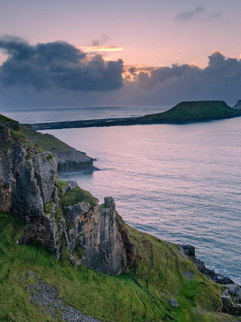
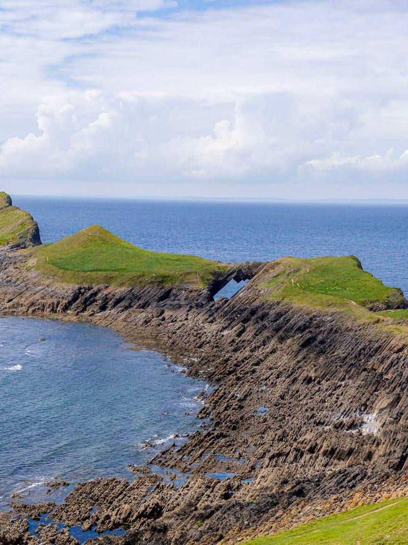
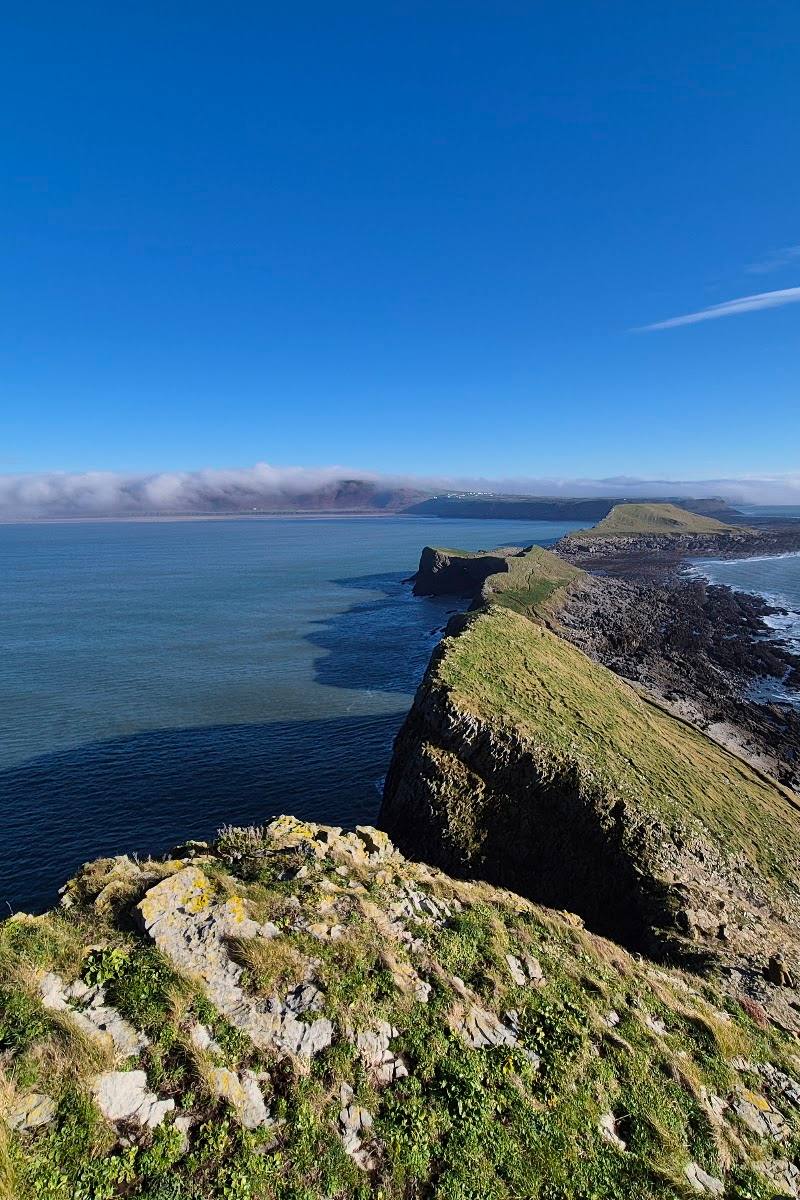
8.1A long, sea-serpent-shaped headland reaches out from Rhossili Bay, becoming an island when the tide covers its rocky causeway. Its three linked sections include the Middle Head and a collapsed sea cave known as the Devil’s Bridge.
Worm’s Head makes a coastal walk feel like an expedition: the route crosses a tidal causeway to a dramatic, rugged headland, with the tide itself setting the limits of your visit. The access window demands planning, not guesswork.
Dramatic · Wild · Remote
Find your way
Open mapRhossili, Gower Peninsula, Swansea, Wales
Opening map…
Know this place a little better?
The experience
Plan around the tide, then walk out from Rhossili across the rocky causeway and explore only within the safe crossing window. The full out-and-back is described as a moderate coastal walk with rocky sections; check tide times and conditions before committing.
Things to do
Walk to the old coastguard station
Take the headland approach from Rhossili and use the old coastguard station as a shorter out-and-back objective. The supplied guide gives about 1.3 km from the car park to the station.
Around 1–2 hours return; allow for your pace and conditions.
Cross the tidal causeway
Reach the island over the rocky causeway only during the reported safe window around low tide. Check current tide times and local guidance; do not rely on an approximate timetable alone.
Allow several hours for the full walk; the supplied guide estimates 3–4 hours for its 7.5 km out-and-back.
Look for the Devil’s Bridge
On the Middle Head, look for the collapsed sea cave known as the Devil’s Bridge, described in the supplied visitor information.
Watch for grey seals
The supplied visitor information mentions regular grey seal sightings along the surrounding coast. Keep a respectful distance and do not assume a sighting is guaranteed.
Make a day of it
Quick escape · About 1–2 hours for a shorter walk to the old coastguard station and back; confirm conditions and tide access before setting out.
Quick Escape: Rhossili headland walk
- 01
Start from the National Trust car park at Rhossili.
- 02
Walk towards the old coastguard station on the headland.
- 03
Enjoy the coastal outlook and return by the same route; do not cross the causeway unless tide times and local guidance confirm it is safe.
Half day · The supplied guide describes a 7.5 km out-and-back taking 3–4 hours; allow for the tide window and check conditions before attempting the crossing.
Make a Half Day of It: cross to Worm’s Head
- 01
Begin at the National Trust car park in Rhossili.
- 02
Walk to the old coastguard station, then check the crossing is within the safe tide window.
- 03
Cross the rocky causeway and continue over the headland only if conditions and timing permit.
- 04
Return across the causeway before the safe window closes.
Verified history
The supplied visitor information describes Worm’s Head as a roughly one-mile limestone headland and tidal island formed from three linked sections, with a rocky causeway and a collapsed sea cave on the Middle Head known as the Devil’s Bridge. No dates or further history are established by the supplied sources.
Folklore & legend
A supplied walking guide says the name is associated with the Norse word “Wurm”, meaning dragon, and relates a local legend that Viking invaders saw the headland as a giant sleeping sea-serpent. The same guide says a blowhole is said to boom and hiss in stormy weather, reinforcing the dragon story; these are presented as legend, not verified history.
Hidden details
The causeway is the crucial part of the plan — The guide reports that the rocky causeway is accessible only for about 2½ hours either side of low tide. Check current tide information and local notices before crossing, and plan to return within the safe window.
A cave feature on the Middle Head — The collapsed sea cave known as the Devil’s Bridge is identified on the Middle Head in the supplied visitor information.
When to go
· Time the crossing to the safe window around low tide; check exact tide times before visiting.
The supplied sources establish that access depends on the tide, but do not support a particular best season.
The route has rocky sections and is exposed coastal walking. Check current weather, sea conditions and local advice before setting out; the supplied guide notes that a blowhole may boom and hiss in stormy weather.
The route
- ascent
- 230 m elevation gain, according to the supplied walking guide
- surface
- Rocky sections; rocky causeway
- distance
- 7.5 km out and back, according to the supplied walking guide
- duration
- 3–4 hours, according to the supplied walking guide
- difficulty
- Moderate, according to the supplied walking guide
- route shape
- Out and back
- start point
- National Trust car park, Rhossili, according to the supplied walking guide
- parking start
- National Trust car park at Rhossili, according to the supplied walking guide; check current arrangements
- shorter alternative
- Walk from the Rhossili car park to the old coastguard station and return without crossing the causeway; check conditions and local guidance.
- Rocky tidal causeway
- Three linked headland sections
- Collapsed sea cave known as the Devil’s Bridge on the Middle Head
- Reported grey seal sightings along the surrounding coast
What to look for
Notice the three linked sections of the headland and, on the Middle Head, the collapsed sea cave called the Devil’s Bridge. Look for grey seals along the surrounding coast, as sightings are reported in the supplied source.
The story
Local legend: the name is associated with the Norse word “Wurm”, meaning dragon; the headland’s shape was said to resemble a sleeping sea-serpent.
Best time to go
Check conditions and tide times before visiting; no specific best season is established by the supplied evidence.
Plan the crossing around low tide, allowing time to return before the causeway becomes impassable. Check current tide times and local notices before setting out.
How long to spend
Half day
Perfect for
Walkers · Photographers · Wildlife lovers
Before you go
Address
Listed hours
- Monday: Open 24 hours
- Tuesday: Open 24 hours
- Wednesday: Open 24 hours
- Thursday: Open 24 hours
- Friday: Open 24 hours
- Saturday: Open 24 hours
- Sunday: Open 24 hours
Check before visiting.
Google rating
Practical information
Opening & access
The rocky causeway to the tidal headland is reported as crossable only for about 2½ hours either side of low tide. Check current tide times and local guidance before setting out; do not attempt the crossing outside the safe window.
Check before visiting
Parking
The supplied walking guide identifies the National Trust car park at Rhossili as the walk start. Check current parking arrangements before travelling.
Check before visiting
Toilets
Check before visiting
Check before visiting
Food & drink
Check before visiting
Check before visiting
Dogs
Check before visiting
Check before visiting
Accessibility
The route includes a rocky causeway and rough sections; the supplied guide describes it as moderate. Not suitable for assuming step-free access.
Cost
Check before visiting
Check before visiting
Water
Sea
Gallery
Place photographs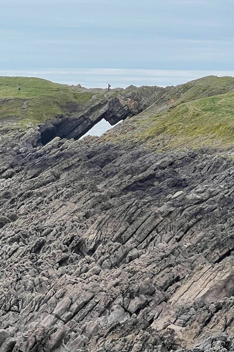
Keep exploring
Around Worm’s Head
Within 50 km · approximate straight-line distances