Thrislington, County Durham
Thrislington National Nature Reserve
route · Countryside walk
Source image
6.8
Wildland
Half day
Time
Check
Cost
Wild
Feel
Why it's Wildland
6.8A walk through one of Great Britain’s important expanses of primary Magnesian limestone grassland, with a remarkable conservation story: turf was moved ahead of a quarry extension and the translocation is regarded as a national success.
Thrislington earns its place for rare limestone grassland and the unusual story of a habitat moved to survive quarrying. The strongest sourced way to experience it is the longer trail linking Thrislington with Ferryhill Carrs, where grassland, fen, woodland and open water make a varied walk.
Wild · Peaceful
Find your way
Open mapThrislington, County Durham
Opening map…
The experience
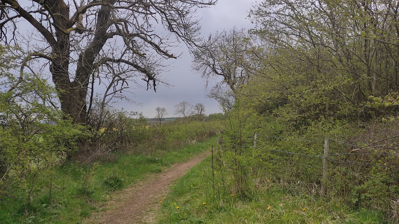
Follow the Ferryhill Carrs and Thrislington walking trail between two protected reserves. Allow up to three hours for the 8.5 km route, and expect grassy paths, gates, stiles and steps; slopes can become steep and muddy in poor weather.
Things to do
Walk the Ferryhill Carrs and Thrislington trail
Follow an 8.5 km public-rights-of-way trail linking two protected reserves. Expect grassy paths, kissing gates, stiles and steps; steep slopes can become muddy in poor weather.
Up to 3 hours
Look for orchids in the grassland
A botanical visit recorded common spotted orchid, fragrant orchid, common twayblade, lesser butterfly-orchid and dark-red helleborine in the NNR and quarry grassland. Sightings vary; treat these as species to look for, not guaranteed finds.
Explore the habitat mosaic at Ferryhill Carrs
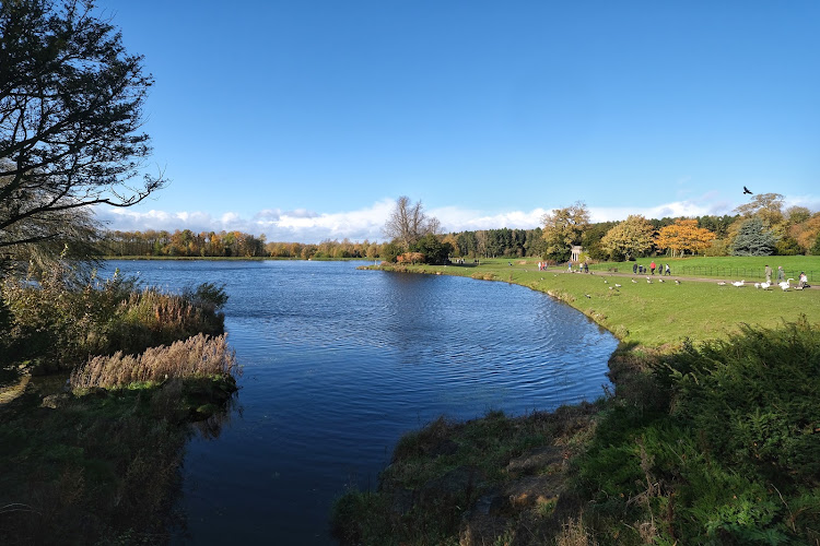
Notice the changes between fen, open water, ancient semi-natural woodland, grassland and scrub. The reserve is also described as a haven for several bird species.
Watch for butterflies and listen for bullfinches
A botanical visit recorded several butterfly species at Thrislington. The trail interpretation describes the male bullfinch’s bright pink-red breast and cheeks and its piping call.
Make a day of it
Quick escape · Check before visiting; no short circuit duration is sourced.
Quick Escape: a short look at the limestone grassland
- 01
Choose a public-rights-of-way approach to Thrislington and check the route and access conditions before setting out.
- 02
Spend your time looking closely at the grassland for flowering plants and orchids.
- 03
Turn back along the same path; a shorter loop is not established by the supplied sources.
Half day · Allow up to 3 hours for the 8.5 km trail.
Make a Half Day of It: Ferryhill Carrs and Thrislington trail
- 01
Use the nearest postcode DL17 8BL as a navigation reference and check parking arrangements; there are no formal spaces, though some parking is available on Cleves Avenue.
- 02
Follow the signed public-rights-of-way trail between Ferryhill Carrs and Thrislington.
- 03
Pause at Ferryhill Carrs to take in its fen, open water, woodland, grassland and scrub habitats.
- 04
At Thrislington, look for the rare limestone grassland and the conservation work that translocated turf ahead of quarry extension.
- 05
Drinks and snacks are available from Duncombe Stores on Cleves Avenue; check current availability.
Verified history
In the 1980s, quarry operator Tarmac, then CRH plc, sought to extend Thrislington Quarry. Natural England led a successful campaign to move turf before the extension proceeded; the translocation took place between 1982 and 1990. A Natural History Society of Northumbria account describes the initiative as a national success, while noting that the grass mix has changed since the move.
Hidden details
A grassland rescued by moving its turf — The conservation story is unusually physical: turf was translocated between 1982 and 1990 ahead of quarry extension. The account says the initiative is still considered a national success, although the grass mix has changed.
A small-scale orchid hunt — A recorded botanical visit listed five orchid species across the NNR and quarry grassland. Look carefully rather than expecting a broad, showy display everywhere.
When to go
· No specific time of day is established by the supplied sources.
Summer is supported by a botanical account that recorded orchids and butterflies during a bright summer visit. The sources do not establish precise peak dates.
The trail source warns that slopes can be steep and muddy in bad weather. Wear suitable footwear and check current conditions.
The route
- stiles
- Kissing gates, stiles and steps are present.
- surface
- Grassy paths; slopes may become muddy in bad weather.
- distance
- 8.5 km / 5.2 miles
- duration
- Allow up to 3 hours
- difficulty
- Not formally graded; grassy paths with steep muddy slopes in bad weather.
- waymarking
- Check the supplied trail guide for current route instructions; waymarking is not described in the excerpt.
- route shape
- Not specified in the supplied trail description.
- start point
- Ferryhill Carrs and Thrislington trail; exact start point is not specified.
- parking start
- No formal parking spaces; some parking is available on Cleves Avenue. Nearest postcode DL17 8BL.
- Thrislington’s important primary Magnesian limestone grassland
- Ferryhill Carrs’ fen, open water, woodland, grassland and scrub
- The habitat-translocation conservation story
Worth pairing with
Ferryhill Carrs
A protected reserve on the same walking trail, with fen, open water, ancient semi-natural woodland, grassland and scrub.
Duncombe Stores, Cleves Avenue
The trail information identifies the store as a place to get drinks and snacks. Check current availability before relying on it.
What to look for
Look closely at the limestone grassland for orchids and other small flowering plants. At Ferryhill Carrs, notice the contrast between fen, open water, woodland, grassland and scrub. The trail’s interpretation also highlights the bullfinch.
The story
Habitat conservation; quarrying and grassland translocation
Best time to go
Summer for orchids and grassland flowers; the sourced botanical visit took place on a bright summer’s day.
Summer is the best-supported season for botanical interest: a recorded visit found orchids and numerous butterflies. Exact peak flowering dates are not established by the supplied sources.
How long to spend
Half day
Perfect for
Walkers · Wildlife lovers · Photographers · Dogs
Route at a glance
Duration
Half day
Terrain
Wetland, Farmland
Parking / start
No formal parking spaces are identified for the Ferryhill Carrs and Thrislington trail; some parking is available on Cleves Avenue. Check before visiting.
Practical information
Opening & access
The Ferryhill Carrs and Thrislington walking trail follows public rights of way. The source describes grassy paths, with steep muddy slopes in poor weather; check current route conditions before setting out.
Check before visiting
Parking
No formal parking spaces are identified for the Ferryhill Carrs and Thrislington trail; some parking is available on Cleves Avenue. Check before visiting.
Check before visiting
Toilets
Check before visiting
Check before visiting
Food & drink
Drinks and snacks are available from Duncombe Stores on Cleves Avenue, according to the trail information.
Dogs
Keep dogs under close control on the public-rights-of-way trail.
Accessibility
The trail includes grassy paths, steep muddy slopes in bad weather, kissing gates, stiles and steps. It is not described as step-free.
Cost
Check before visiting
Check before visiting
Water
Open water is mentioned at Ferryhill Carrs; no swimming or paddling permission is evidenced.
Gallery
Place photographsKeep exploring
Around Thrislington National Nature Reserve
Within 50 km · approximate straight-line distances