Houghall, on the southern edge of Durham City, County Durham
Houghall Discovery Trail
route · Woodland walk
Source image
5.7
Wildland
1–2 hours
Time
Check
Cost
Peaceful
Feel
Why it's Wildland
5.7A woodland trail south of Durham where bluebell-season paths meet a documented story of coal mining and the area's later use for university science and woodland planting.
The appeal is more than a leafy walk: Houghall’s woods have spring bluebells and interpretation about the area’s mining and more recent history. It offers a woodland escape close to Durham, though route finding and wet-weather conditions warrant preparation.
Peaceful · Seasonal
Find your way
Open mapHoughall, on the southern edge of Durham City, County Durham
Opening map…
The experience
A moderate woodland loop near Durham, with bluebells reported in May and interpretation covering the area's history. Route sources give differing distances and timings, and warn that some signposting or sections may be problematic; check the route before setting off.
Things to do
Walk the Houghall Discovery Trail
Follow a mapped woodland loop. AllTrails lists a 2.9-mile loop of moderate difficulty; another route source gives differing measurements, so verify the route and current conditions before setting off.
About 1–1.5 hours according to AllTrails
See the bluebells
A local walk account highlights Houghall’s bluebells in May. Timing varies, so treat this as a seasonal possibility rather than a guaranteed display.
Look for the history interpretation
Read trail signs described by a local walk account as covering the area's ancient history, mining past and later woodland planting.
Extend the walk through Durham
The Durham City route guide links the Houghall trail with city streets and riverside paths, and identifies Durham Cathedral and Castle and Crook Hall and Gardens as nearby places to visit.
The guide gives 2–3 hours for its 7 km route, excluding visits.
Make a day of it
Quick escape · 1–1.5 hours
A short woodland wander
- 01
Use a current route map to choose a manageable section of the Houghall woodland trail; sources report that some signposting can be unclear.
- 02
Look for bluebells if visiting in May, and pause to read any trail interpretation you encounter.
- 03
Return by the route you came rather than relying on an unverified shortcut.
Half day · About 2–3 hours
Houghall woods and the mining story
- 01
Follow a mapped Houghall Discovery Trail circuit, checking current route conditions before departure.
- 02
Allow time to explore the woodland and read the interpretation about ancient times, mining and the area's more recent history.
- 03
If the Pump House Tearoom or Restaurant is open and accessible, consider it as a stop; confirm details before relying on it.
Full Wildland day · Half day to full day; route guide gives 2–3 hours for its 7 km city-and-trail route, before additional visits.
Durham city and the Houghall trail
- 01
Use the Durham City and Houghall route guide to plan the city-to-woodland walk; it describes a route linking Durham's Market Place, riverside paths, Pelaw Woods and Houghall Discovery Trail.
- 02
Consider the guide's suggested Durham Cathedral and Castle, or Crook Hall and Gardens, checking opening and access details independently.
- 03
Finish in Durham's centre, where the guide mentions cafés and shops.
Verified history
A local account describes interpretation along the woodland walk covering the area's ancient history, coal-mining past and more recent use for university science and woodland planting. The supplied Durham route guide also places the trail within a wider walk connecting it to the historic city. The sources do not provide specific dates or identify particular surviving mining structures on the trail, so none are asserted here.
Hidden details
The woodland's industrial story — Look for interpretation signs described as explaining Houghall's coal-mining heritage and later history; exact sign locations are not specified in the source.
When to go
May · No source-backed time-of-day recommendation available.
A local walking account specifically recommends May for Houghall's bluebells. Wet-weather bogginess is also reported, so conditions may affect comfort and route choice.
Woodland paths can be boggy in wet weather. Check current route conditions; one trail source reports overgrown sections and a closure affecting part of the route.
The route
- ascent
- AllTrails lists 272 ft; Hiiker lists 108 m. Figures may refer to different route variants.
- stiles
- The Durham City guide reports stiles on its longer city-and-trail route; the number and applicability to the shorter trail are unclear.
- surface
- Woodland paths, with wet-weather bogginess reported; the Durham City route guide also describes rough pasture and lanes on its longer route.
- distance
- AllTrails lists 2.9 miles (about 4.7 km); Hiiker describes a 4.9 km loop. A separate Durham City route guide gives a 7 km city-and-trail route. Confirm the intended route before setting off.
- duration
- AllTrails estimates 1–1.5 hours; Hiiker estimates about 1 hour 9 minutes. The Durham City route guide gives 2–3 hours for its longer 7 km route.
- difficulty
- Moderate according to AllTrails; Hiiker labels its route easy. Grading differs by source and route variant.
- waymarking
- Discovery trail symbol signs are described as acorns on the Durham City route guide. AllTrails users report signposting can be unclear in places.
- route shape
- Loop
- start point
- AllTrails describes a start from Houghall Lane. The Durham City route guide describes joining the trail from a car park by Shincliffe Bridge. Confirm the chosen start on a current map.
- parking start
- Parking is not consistently established: one supplied source mentions limited parking at the entrance, while the Durham City route guide describes a car park by Shincliffe Bridge. Check before travelling.
- shorter alternative
- Choose a shorter out-and-back woodland section and return the same way; a specific shorter mapped route is not documented in the supplied sources.
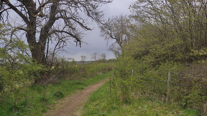
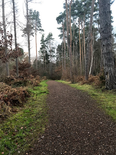
- Woodland paths and reported May bluebells
- Interpretation about the area's mining and later history
- Durham City and riverside connections on the longer route
Worth pairing with
Durham Cathedral and Castle
Named as a nearby visit in the Durham City and Houghall route guide; check opening and access details before travelling.
Crook Hall and Gardens
The route guide identifies Crook Hall and Gardens as a possible addition to a Durham-and-Houghall visit. Check current opening and access details.
Pump House
A local walk account recommends the Pump House Tearoom near the walk, and the Durham route guide identifies the Pump House Restaurant. Confirm which venue is operating, opening times and access before visiting.
What to look for
- 01
In May, look for bluebells. Notice the trail’s interpretation signs about the area's mining history and later use
- 02
the supplied sources also describe woodland wildlife including birds, squirrels, deer and foxes.
The story
Coal-mining heritage and the area's more recent university and woodland history
Best time to go
May for bluebells; woodland paths may be boggy in wet weather.
May for the reported bluebells. Choose a dry spell if possible, as woodland paths can become boggy after wet weather.
How long to spend
1–2 hours
Perfect for
Walkers · Families · Dogs · History lovers · Photographers
Route at a glance
Duration
1–2 hours
Terrain
Woodland, Riverside
Parking / start
Parking availability is not firmly established. One source mentions limited parking at the trail entrance; another route guide describes a car park by Shincliffe Bridge. Check before travelling.
Practical information
Opening & access
A waymarked woodland trail is described in the supplied sources. Some sections may be poorly signposted, overgrown or affected by closures; check current conditions and take a reliable map or route guide.
Check before visiting
Parking
Parking availability is not firmly established. One source mentions limited parking at the trail entrance; another route guide describes a car park by Shincliffe Bridge. Check before travelling.
Check before visiting
Toilets
Check before visiting
Check before visiting
Food & drink
The Durham City route guide identifies the Pump House Restaurant near the route; a separate source mentions the Pump House Tearoom by the walk. Check current opening and access before visiting.
Check before visiting
Dogs
A supplied trail source describes dog-friendly areas. Check current signage and local rules before visiting.
Check before visiting
Accessibility
The source row marks the trail wheelchair accessible, but the supplied route descriptions mention rough pasture, stiles and woodland paths. Suitability for a particular wheelchair or mobility aid is not established; check route conditions before setting out.
Check before visiting
Cost
Check before visiting
Check before visiting
Water
River Wear nearby; no swimming or paddling permission established.
Gallery
Place photographsKeep exploring
Around Houghall Discovery Trail
Within 50 km · approximate straight-line distances