7.9
Wildland
Full day
Time
Check
Cost
Dramatic
Feel
Why it's Wildland
7.9At 978 metres, Scafell Pike is England’s highest mountain. From the summit, on a clear day, the views reach across the surrounding fells towards the Irish Sea and Morecambe Bay.
Scafell Pike earns its place through the scale of its high mountain landscape and the effort needed to reach it: rocky paths climb from remote valleys to England’s highest summit. The Wasdale route is the shortest described, but it is still steep and challenging, with exposed navigation and rapidly changing mountain weather to take seriously.
Dramatic · Wild · Big-sky
Find your way
Open mapWestern Lake District, Cumbria
Opening map…
Know this place a little better?
The experience
Choose a route to suit your experience, allow ample time and prepare for serious mountain conditions. The Wasdale Head ascent is the shortest approach described; longer routes from other valleys offer a bigger day out. Carry navigation and suitable clothing, and check the forecast before setting off.
Things to do
Climb England’s highest mountain from Wasdale
Take the described out-and-back route from Wasdale Head via Lingmell Gill and Hollow Stones. It is the shortest approach in the source, but remains steep and challenging; follow the main route and avoid the less suitable scree branch unless properly experienced and conditions allow.
Around 3–4 hours for the summit and return; allow extra time as needed.
Compare the different valley approaches
The mountain can be approached from Wasdale, Borrowdale, Langdale and Eskdale. The longer routes vary in length and character; decide on the route and starting logistics before travelling.
About 4–8 hours for the routes described, depending on route.
Take in the summit views when visibility allows
Pause on the summit for views across the surrounding fells and, in clear conditions, towards the Irish Sea and Morecambe Bay. The summit is boulder-strewn, so take care underfoot and make sure you can identify the correct descent route.
Make a day of it
Quick escape · Around 3–4 hours to summit and return, according to the route guide; allow extra time as needed for conditions and your pace.
Wasdale summit return
- 01
Start from Wasdale Head National Trust car park.
- 02
Follow the route beside Lingmell Gill, climbing steeply towards Hollow Stones and the summit.
- 03
Reach Scafell Pike’s boulder-strewn top, then return by the same route.
- 04
Carry a map and compass and check the mountain forecast; do not rely on cairns alone in poor visibility.
Half day · About 4–8 hours, depending on route, according to the route guide.
Take the longer mountain approach
- 01
Choose an approach from Eskdale, Langdale or Borrowdale rather than the shorter Wasdale ascent.
- 02
Plan the route and start logistics in advance; the guide notes that some starting points are harder to access.
- 03
Allow time for steep ascents and rough, loose terrain, then descend by your planned route.
When to go
· Check the forecast and plan a suitably early start for the route selected; no specific best time of day is established by the supplied sources.
The supplied sources describe route options and changeable mountain weather but do not establish a reliably best season. Conditions can be severe in any season, so choose according to the forecast and your preparation.
Mountain weather is changeable. The route guide advises checking the mountain forecast and preparing for poor visibility; steep paths, loose rock and summit navigation become more challenging in adverse conditions. Carry suitable clothing, a map and compass, and know how to use them.
The route
- surface
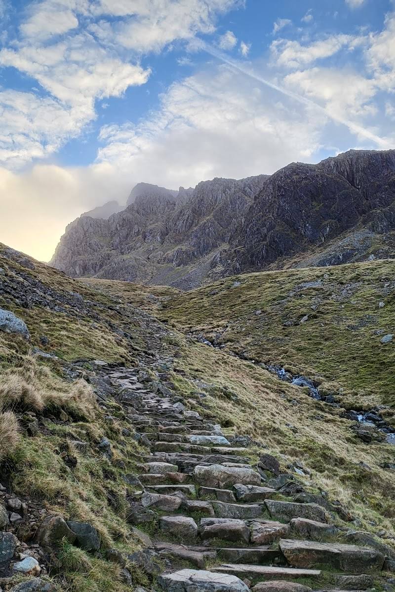
- Pitched stone path lower down; rocky, boulder-strewn and loose terrain higher up.
- distance
- Wasdale route: approximately 8.4 km / 5.2 miles return, according to the route guide.
- duration
- Around 3–4 hours for the Wasdale summit return; other approaches described take about 4–8 hours, depending on route.
- difficulty
- Challenging: steep ascents, scrambling on some routes and loose, varied terrain.
- waymarking
- Cairns mark parts of the route, but the source stresses that they are not a substitute for map-and-compass navigation, particularly in low cloud.
- route shape
- Wasdale approach: out and back by the same route. Other approaches vary.
- start point
- Wasdale Head National Trust car park for the shortest described approach. Other approaches start from different valleys; confirm the chosen route’s start before travelling.
- parking start
- The route guide identifies the National Trust car park at Wasdale Head. Check current parking arrangements before visiting.
- The climb beside Lingmell Gill
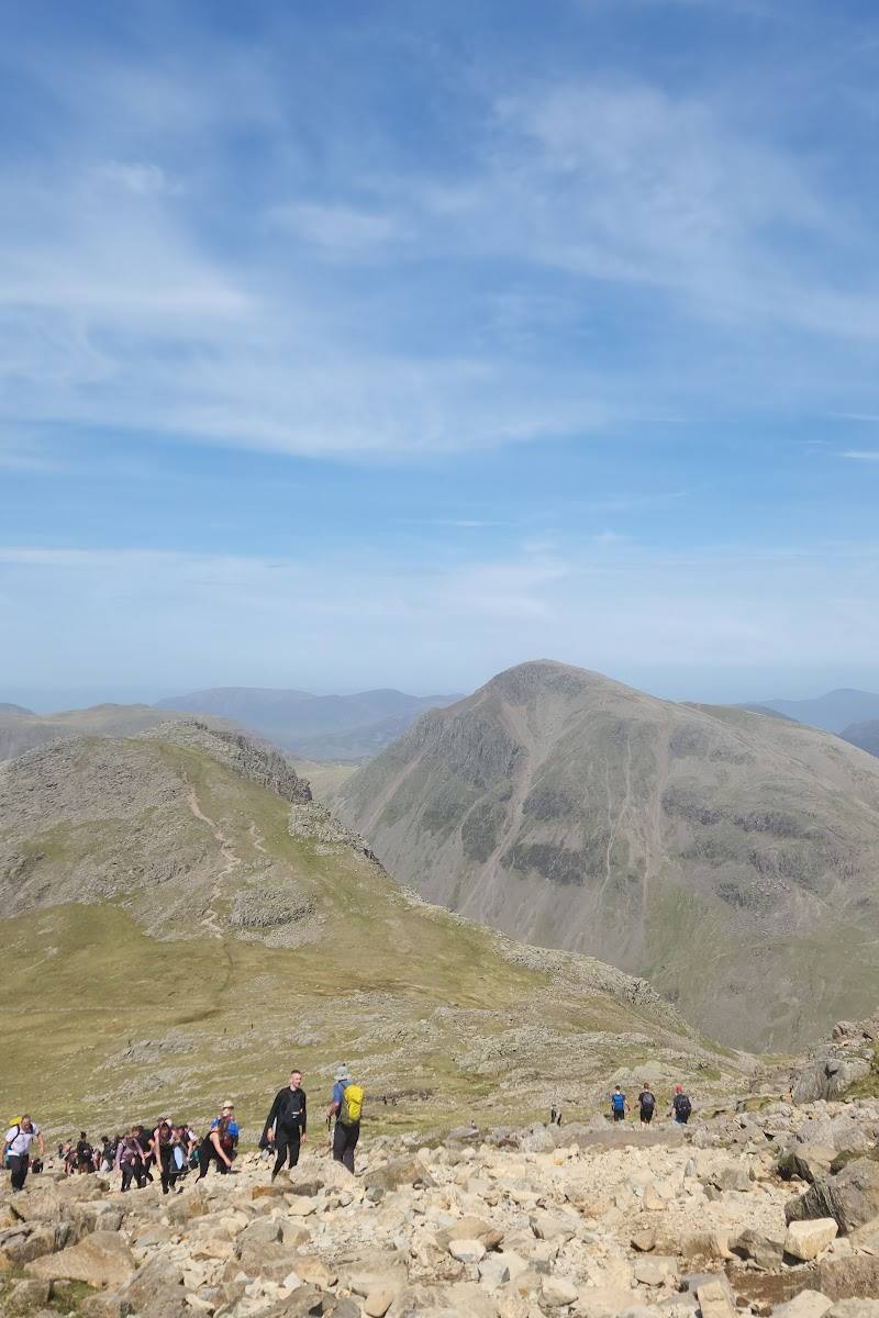
- The rocky ground at Hollow Stones and the summit
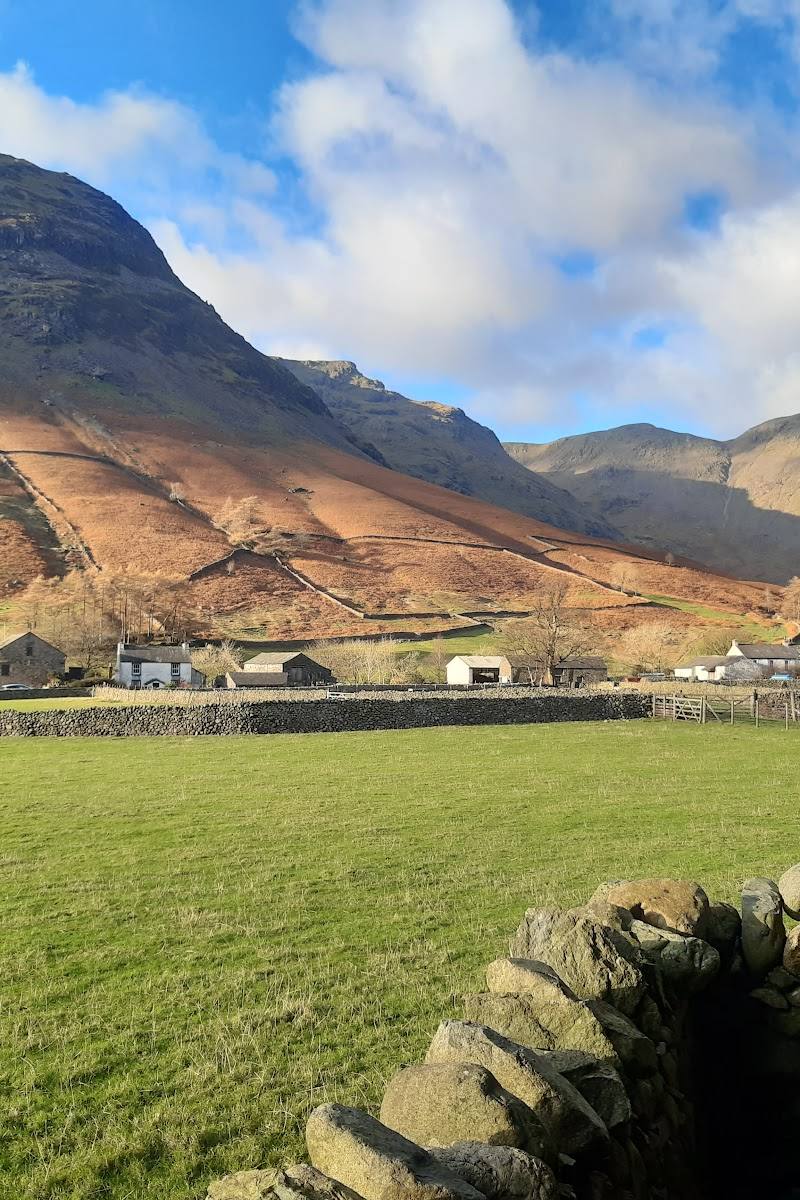
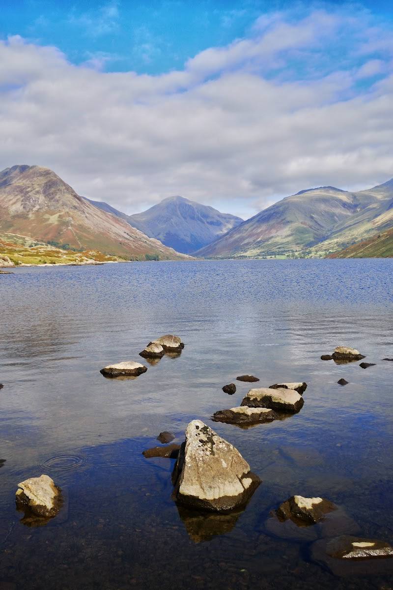
- Views towards Wastwater during the Wasdale ascent
- Summit views across the surrounding fells, Irish Sea and Morecambe Bay when visibility allows
What to look for
- 01
Notice how the landscape changes from the valley and streams to steep rocky slopes and the boulder-strewn summit. On the Wasdale approach, look back towards Wastwater as you climb
- 02
at the top, take in the surrounding fells and distant views if conditions allow.
The story
Check before visiting
Best time to go
Check mountain conditions before choosing a date; the supplied sources do not establish a single best season.
Choose a clear, settled forecast rather than relying on the season alone. Conditions can change rapidly with height, and cloud, wind, rain or snow can make navigation and rocky ground more difficult.
How long to spend
Full day
Perfect for
Walkers · Photographers · Groups
Before you go
Address
Google rating
Practical information
Opening & access
Several walking approaches are described, including the Wasdale Head route. This is a demanding mountain walk over steep, rocky and sometimes loose ground; paths and navigation become harder in poor visibility. Check current access and conditions before setting out, and do not treat the summit coordinates as a trailhead.
Check before visiting
Parking
Wasdale Head National Trust car park is identified as a route start in the supplied sources. Check current parking arrangements before travelling; other approaches have different start points.
Check before visiting
Toilets
Check before visiting
Check before visiting
Food & drink
Check before visiting
Check before visiting
Dogs
Check before visiting
Check before visiting
Accessibility
A strenuous mountain ascent, not a surfaced accessible stroll. The described approaches include steep climbing and rough, loose rock; suitability depends on fitness, experience, conditions and route choice.
Cost
Check before visiting
Check before visiting
Water
Check before visiting
Check before visiting
Gallery
Place photographs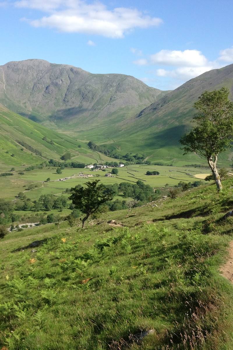
Keep exploring
Around Scafell Pike
Within 50 km · approximate straight-line distances