Brean, near Burnham-on-Sea, Somerset
National Trust - Brean Down
Coastal reserve
Place photograph
8.2
Wildland
Half day
Time
Paid
Cost
Dramatic
Feel
Why it's Wildland
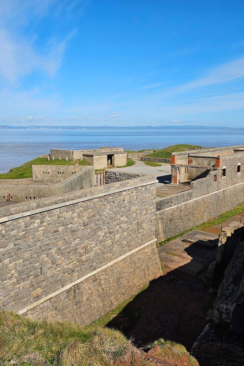
8.2A steep-sided headland reaches into the Bristol Channel, bringing broad coastal views together with a historic fort on its summit.
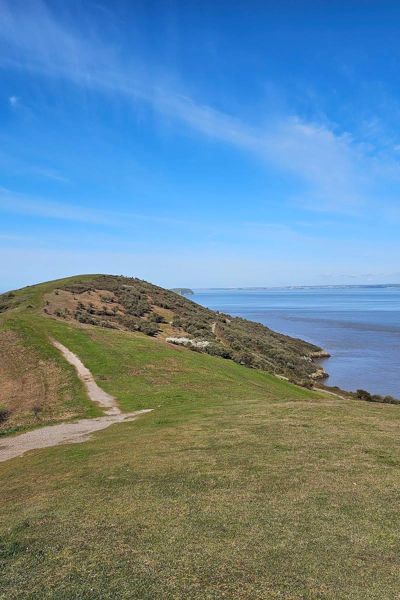
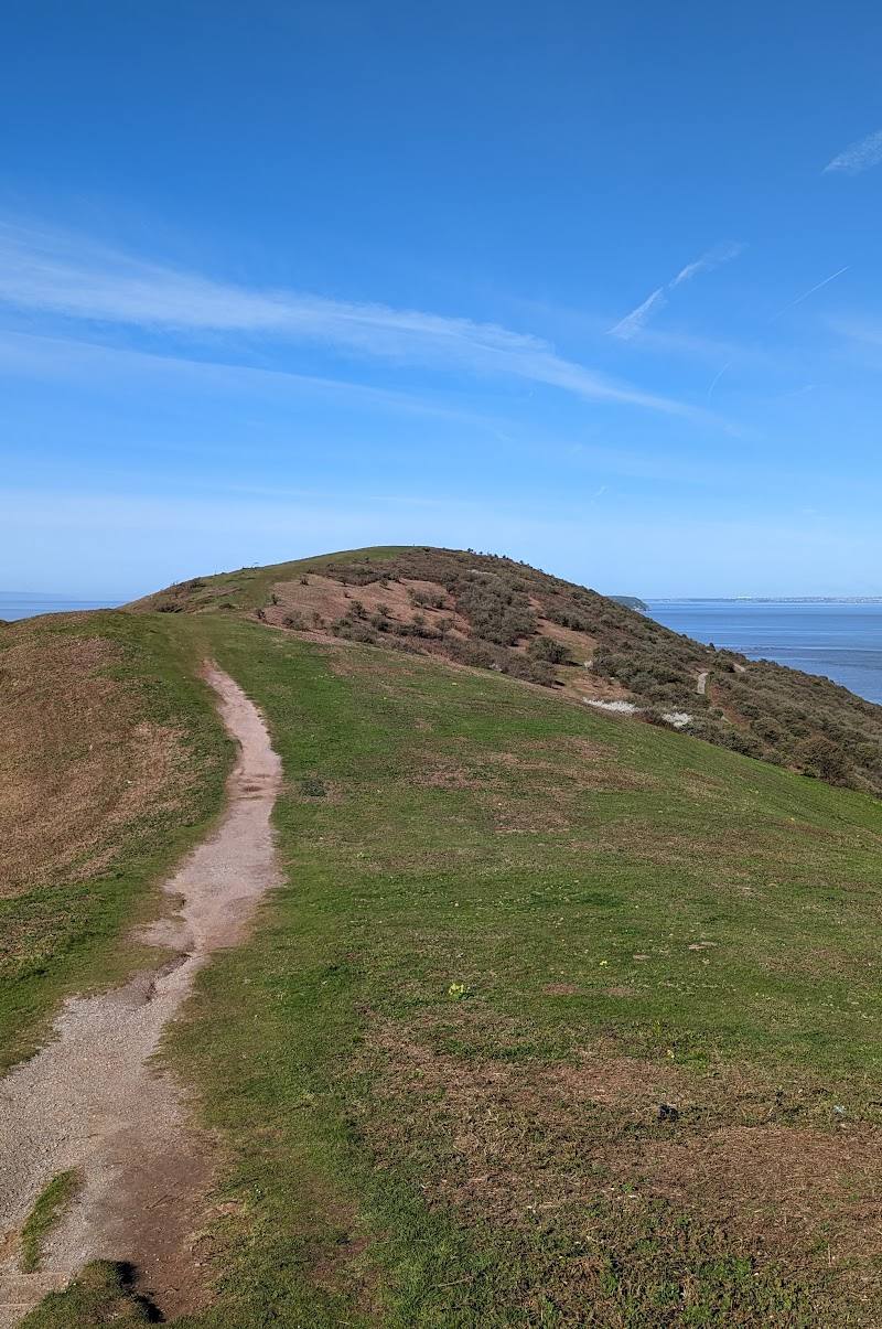
Brean Down makes a substantial coastal walk out of a striking headland: climb from the shore, follow the ridge towards the fort and look back across the Somerset coast. Its steep paths and exposed cliffs make it rewarding, but not a casual flat stroll.
Dramatic · Big-sky · Wild
Find your way
Open mapBrean, near Burnham-on-Sea, Somerset
Opening map…
Know this place a little better?
The experience
Allow time for the steep ascent and the walk out to the fort. Keep to the main paths around the cliffs, pause for the views, and check current access, weather and parking information before you go.
Things to do
Walk up to the summit fort
Climb the steep path from the car park at the foot of the Down to the fort on the summit. Keep to the main paths around the steep cliffs.
Make a day of it
Quick escape · Allow around 1–2 hours; the walk time is not confirmed in the supplied sources.
Quick Escape: climb to the fort
- 01
Start near the car park and café at the foot of Brean Down.
- 02
Take the steep main path up the Down, staying on the paths near the cliffs.
- 03
Reach the fort and pause for the views before returning the same way.
Half day · Half day; exact route duration is not established by the supplied sources.
Make a half day of it: explore the headland
- 01
Begin at the foot of the Down and check current café and parking information.
- 02
Walk up the steep path towards the summit fort.
- 03
Allow time to explore the fort and take in the coastal views.
- 04
Return to the starting point by the main path; do not approach cliff edges or low-tide mud.
Verified history
The supplied sources describe archaeological interest on Brean Down, including prehistoric field systems and the remains of a Roman temple. A fort built to defend the Bristol Channel also stands on the summit. A Heritage Open Days listing describes a broad history spanning from the Iron Age to the present, but does not provide a detailed account of individual events or dates.
When to go
· Daylight; the National Trust source lists the coastline as open from dawn to dusk.
The supplied sources do not establish a best season. Weather and ground conditions matter on the steep, exposed headland.
Check the forecast and current site advice before setting out. The cliffs are very steep, and the National Trust warns that deep mud at low tide can be dangerous.
The route
- ascent
- Steep climb from the car park to the Down and fort; no ascent figure supplied.
- surface
- Steep, uneven terrain is reported; the full path surface is not specified.
- distance
- A supplied visitor summary describes a 1.5-mile walk from the car park to the top; it does not clarify whether this is one way or a return distance.
- difficulty
- Steep climb; uneven terrain is reported for a guided walk.
- route shape
- Out and back suggested; confirm the route on site.
- start point
- Car park near Cove Café at the foot of Brean Down.
- parking start
- National Trust car park near Cove Café; check current charges and payment arrangements.
- Steep coastal ascent
- Fort on the summit
- Views across the Bristol Channel and Somerset coast
What to look for
- 01
Look for the fort on the summit and the changing views back towards the shore and across the Bristol Channel. The supplied sources also describe archaeological features, including prehistoric field systems and the remains of a Roman temple
- 02
their exact locations are not specified.
The story
Coastal fortification and archaeology
Best time to go
Check conditions before visiting; no source-supported seasonal peak is available.
The coastline is listed as open from dawn to dusk. Choose a clear, settled day for views and check conditions before setting out.
How long to spend
Half day
Perfect for
Walkers · History lovers · Photographers
Before you go
Address
Phone
Website
Listed hours
- Monday: 10am-5pm
- Tuesday: 10am-5pm
- Wednesday: 10am-5pm
- Thursday: 10am-5pm
- Friday: 10am-5pm
- Saturday: 10am-5pm
- Sunday: 10am-5pm
Check before visiting.
Google rating
Practical information
Opening & access
National Trust coastal site. The coastline is listed as open from dawn to dusk; check current access and conditions before setting out. The route up to the Down and fort is steep.
Check before visiting
Parking
National Trust car park near Cove Café at the foot of Brean Down. Charges and payment arrangements may change; check the National Trust page before travelling.
Check before visiting
Toilets
Toilets, including an accessible toilet, are listed beside the café; check current availability.
Check before visiting
Food & drink
A café is listed at the site. Check current opening times before visiting.
Check before visiting
Dogs
Dogs are allowed, according to the National Trust source. Keep to the main paths, particularly near steep cliffs, and check current signage.
Check before visiting
Accessibility
The car park and entrance are identified as wheelchair accessible in the source row. The climb to the Down and fort is steep, and the cliffs are very steep; this does not establish that the summit route is wheelchair accessible. Check the full access guide before travel.
Check before visiting
Cost
Paid
Water
Sea
Gallery
Place photographs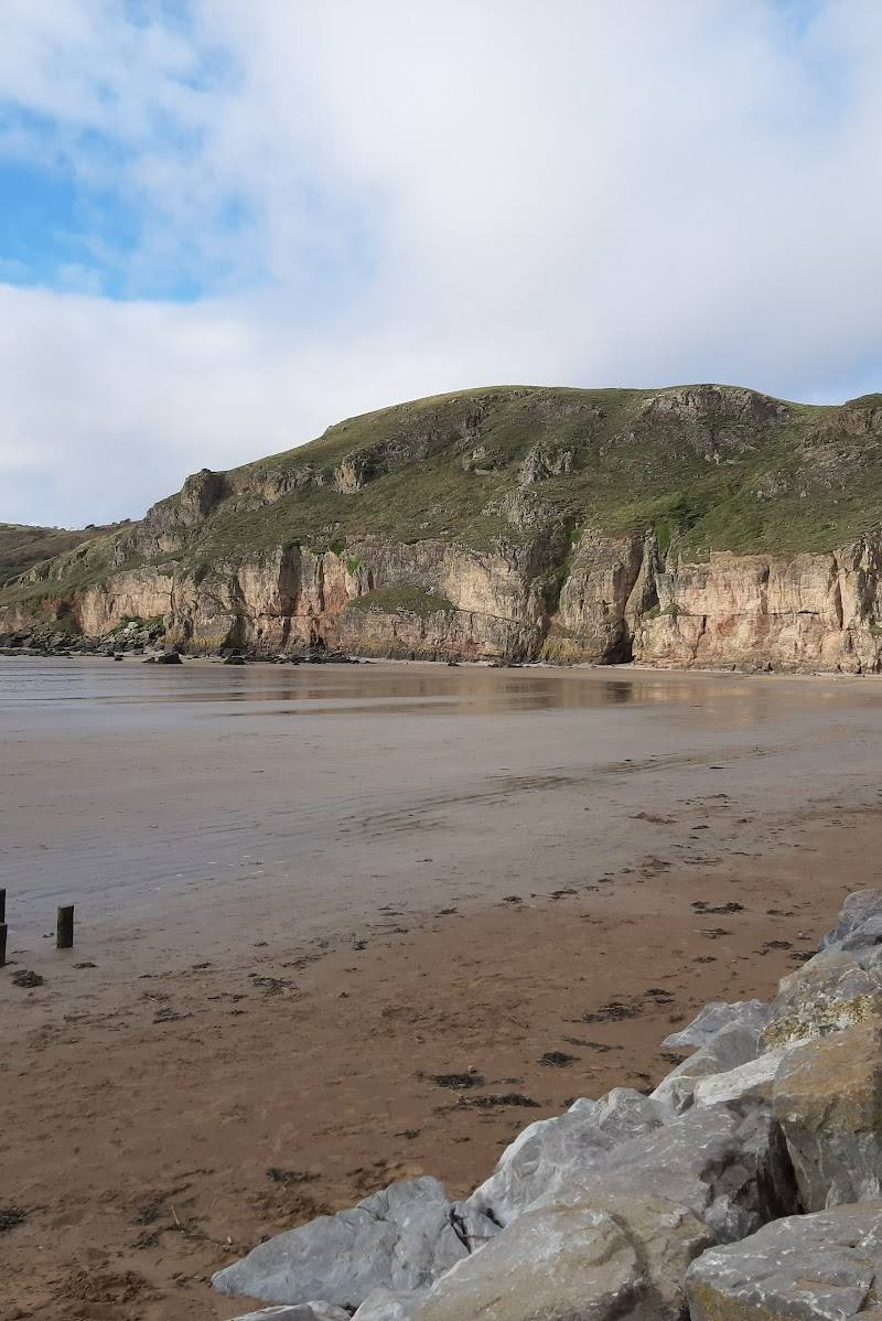

Keep exploring
Around National Trust - Brean Down
Within 50 km · approximate straight-line distances