Loch Hourn, Lochalsh, west coast of the Scottish Highlands
Loch Hourn
Lake
Place photograph
7.5
Wildland
Half day, Full day, Multi-day
Time
Check
Cost
Dramatic
Feel
Why it's Wildland
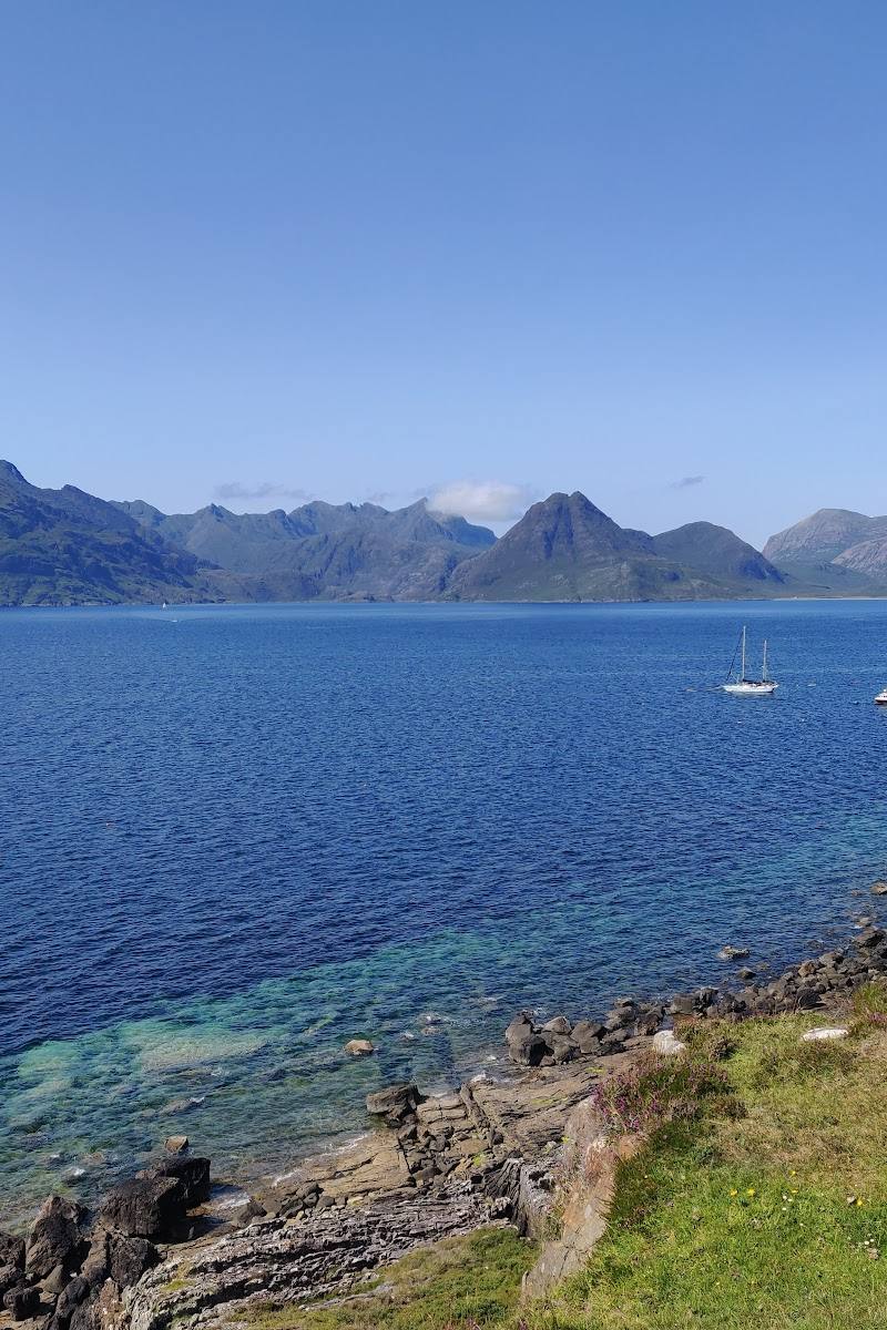
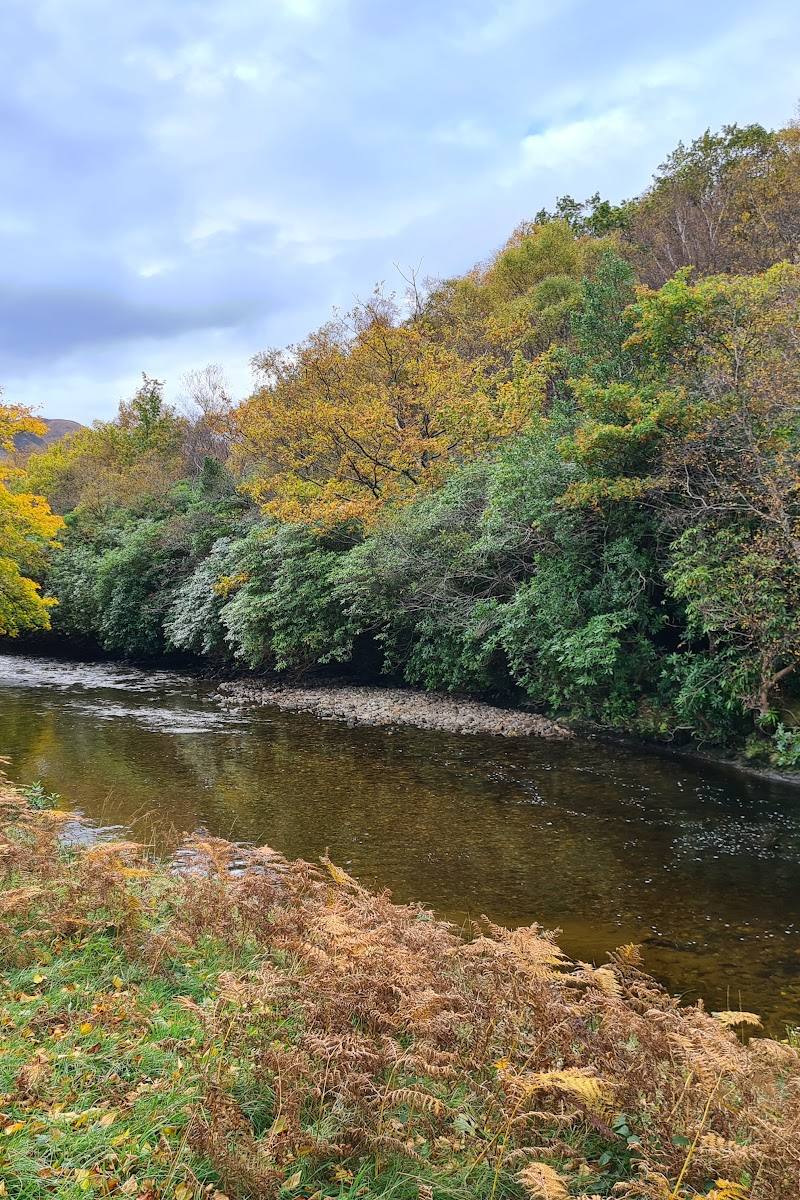
7.5A long, steep-sided sea loch narrows towards its head beneath Highland mountains. Its shores hold traces of a once-busy seasonal herring fishery, alongside the sparse settlements and difficult terrain that make this a place to explore deliberately rather than drop into casually.
Loch Hourn earns its place through the combination of a dramatic, narrowing sea loch, mountains rising straight from the water and a remarkable shoreline record of seasonal fishing and remote settlement. It feels genuinely far from the everyday—but reaching and exploring it calls for planning.
Dramatic · Wild · Remote · Secluded
Find your way
Open mapLoch Hourn, Lochalsh, west coast of the Scottish Highlands
Opening map…
Know this place a little better?
The experience
Come for the steep Highland shoreline and explore the loch’s history through the remains of seasonal fishing and settlement. Road access reaches only parts of the shore; longer walks are remote and can be demanding.
Things to do
Take in the sea-loch landscape
View the steep-sided loch and mountain setting from a confirmed shore-side access point. Much of the shoreline is not reached by road, so plan the approach in advance.
1–2 hours
Look for traces of the herring fishery
The archaeological survey recorded seasonal fishing stations, piers, cleared beaches, boat landings and fishermen’s bothies around the loch. Observe remains from a respectful distance and do not disturb them.
Make a day of it
Quick escape · 1–2 hours
A first look at the sea loch
- 01
Choose a shore-side access point at Kinloch Hourn or on the north shore near Arnisdale or Corran; verify access and conditions before setting out.
- 02
Spend time taking in the narrowing loch, steep mountain backdrop and changing views across the water.
- 03
Keep the visit to the accessible shoreline; much of the loch has no road access.
Half day · Half day
Shoreline history and a longer walk
- 01
Plan a visit to the loch from a verified access point, allowing for the remote drive and changing Highland weather.
- 02
Explore the shore or a suitable nearby coastal path, checking route conditions and access before departure.
- 03
Look for recorded traces of fishing and settlement, including boat landings, bothies and pier remains; do not enter or disturb structures.
- 04
For an experienced, well-equipped party, consider the demanding walk from Kinloch Hourn towards Barrisdale Bay only after checking current route information.
Verified history
Loch Hourn supported a seasonal herring fishery described in Thomas Pennant’s 1772 tour and in an account from 1795. A survey carried out between 2002 and 2009 recorded around 1,300 archaeological sites in the area, including fishing stations, piers, boat landings and fishermen’s bothies. It also recorded farms, townships and 171 shieling huts associated with transhumance. The survey describes Clyde-based vessels bringing salt and barrels to buy herring from local boats and cure it aboard.
Hidden details
A shoreline shaped by seasonal fishing — The archaeological survey recorded 82 cleared beaches or boat landings and 79 fishermen’s bothies along a six-kilometre stretch of the north shore of Inner Loch Hourn. These remains reveal how the seasonal fishery worked in a place now considered remote.
Shieling huts in the hills — The survey recorded 171 shieling huts, evidence of seasonal movement between settlements and higher grazing grounds.
When to go
May · June · July · August · September · Daylight hours, with enough time in hand for the remote approach and return.
Longer daylight in late spring and summer can make planning a visit or walk more practical. Conditions remain changeable in this exposed Highland landscape.
Weather can change rapidly. A supplied guide warns of demanding terrain and limited mobile reception; carry suitable navigation and check current conditions before walking.
Worth pairing with
Arnisdale and Corran
Small north-shore settlements identified as road-access points for experiencing the loch. Check local access and facilities before travelling.
Barrisdale Bay
A destination on the demanding walk from Kinloch Hourn described by the supplied guide. Treat it as a serious route, not a casual nearby stop; verify conditions and access before setting out.
What to look for
Look for traces of the fishing communities recorded along the shore: cleared beaches and boat landings, fishermen’s bothies and pier remains. The archaeological survey also recorded shieling huts linked to seasonal movement of livestock.
The story
Industry, Maritime, Archaeology
Best time to go
Late spring to early autumn for longer daylight and more workable conditions; check local weather and access before setting out.
Late spring to early autumn offers longer daylight for exploring this remote area, but weather can change quickly. Choose a settled forecast and check local access and conditions before travelling.
How long to spend
Half day, Full day, Multi-day
Perfect for
Photographers · Walkers · History lovers · Wildlife lovers
Practical information
Opening & access
A remote sea loch with limited road access along its shores. The source describes access by road to Kinloch Hourn and to the north-shore settlements of Arnisdale and Corran; much of the shoreline has no road access and is more often experienced by boat or on nearby walks. Check conditions and access arrangements before travelling. Access arrangements are unconfirmed. Check before visiting; do not enter private land or restricted structures.
Check before visiting
Parking
Parking details are not consistently verified. The supplied guide reports a small parking area at Kinloch Hourn; check locally before travelling.
Check before visiting
Toilets
Check before visiting.
Check before visiting
Food & drink
Check before visiting.
Check before visiting
Dogs
The source row marks Loch Hourn as dog-friendly; confirm any local restrictions and keep dogs under control around wildlife and livestock.
Accessibility
Remote Highland terrain and limited road access. Nearby walks may be challenging; the supplied guide describes steep, rough and undulating terrain on the route towards Barrisdale Bay. Check route and local conditions before setting out.
Check before visiting
Cost
Check before visiting
Check before visiting
Water
Sea loch; tidal salt water.
Gallery
Place photographsKeep exploring
Around Loch Hourn
Within 50 km · approximate straight-line distances
 Place photograph7.0
Silver Sands of Morar
Morar, near Mallaig, Lochaber, Scottish Highlands
19.4 km away
 Place photograph8.0
Point of Sleat Walk
Aird of Sleat, Sleat Peninsula, Isle of Skye, Highland
21.7 km away