Aird of Sleat, Sleat Peninsula, Isle of Skye, Highland
Point of Sleat Walk
route · Coastal walk
Place photograph
8.0
Wildland
Half day
Time
Check
Cost
Wild
Feel
Why it's Wildland
8.0A long out-and-back to Skye’s southernmost point, with a white-sand bay at Camas Daraich, a lighthouse and clear-day views towards Rum, Canna and Eigg.
This is a proper journey to a quiet corner of Skye: a rough moorland approach gives way to Camas Daraich’s bright bay and a lighthouse at the island’s southern tip. The island views reward a clear day, but boggy ground, repeated ups and downs and changeable weather make it more than a casual stroll.
Wild · Remote · Dramatic
Find your way
Open mapAird of Sleat, Sleat Peninsula, Isle of Skye, Highland
Opening map…
Know this place a little better?
The experience
An 8.9km out-and-back from the road-end car park near Aird. Allow about 3 hours 20 minutes without stops; the route is rough and repeatedly rises and falls. Camas Daraich and the lighthouse are the main rewards. Choose a clear day for island views and check tides if you want to see more sand at the bay.
Things to do
Walk across the moorland to Camas Daraich
Follow the initial track over heather moorland, then descend on a rough path to the white-sand bay. Check tide times if you want to see more sand exposed.
About 1–1.5 hours each way to the bay; estimate based on the sourced full-route time, not separately verified.
Continue to the Point of Sleat lighthouse
From the bay, partly retrace your steps and continue along the grassy path to the lighthouse at Skye’s southernmost point. Return by the same route.
About 3 hours 20 minutes for the full walk without stops.
Look across to the Small Isles
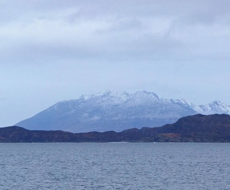
On a clear day, look out from the route and southern point towards Rum, Canna and Eigg.
Make a day of it
Quick escape · Allow around 2.5 hours; this is a shortened suggestion, not a separately verified route time.
Quick Escape: Camas Daraich and back
- 01
Start at the small parking area near Aird.
- 02
Follow the track across heather moorland and descend on the rough path to Camas Daraich.
- 03
Pause at the bay, checking tide conditions, then retrace your steps to the start.
Half day · About 3 hours 20 minutes walking without stops; allow longer for breaks and the beach.
Half Day: Walk to the Point of Sleat lighthouse
- 01
Begin at the road-end car park near Aird.
- 02
Cross the heather moorland and descend to Camas Daraich.
- 03
Continue along the grassy path to the lighthouse at the southernmost point of Skye.
- 04
Return by the same route, allowing time for views and a stop at the bay.
Verified history
The supplied sources describe a modern lighthouse at the Point of Sleat but provide no further verified historical account.
Hidden details
The beach changes with the tide — At very high tides there may be no exposed sand at Camas Daraich; consult tide times if the beach is part of your plan.
A rougher walk than the map might suggest — The route repeatedly rises and drops; sections are rocky, rough or boggy. Wear suitable footwear and allow for conditions.
When to go
· Arrive early on summer days, weekends and holidays when the small car park can be busy. Choose clear weather for the island views.
The sources recommend a clear day for views and advise checking tides for the beach. They do not establish specific best months.
Conditions can change; the route is rough and parts can be boggy. A supplied guide says the walk can be completed in most weather conditions, but clear weather is best for views. Check the forecast and ground conditions before setting out.
The route
- ascent
- Not consistently reported: one supplied source lists 856ft elevation gain; another reports about 400m ascent.
- stiles
- Check before visiting
- surface
- Track over heather moorland, rocky or rough path, grassy path; some sections can be boggy.
- distance
- 8.9km return (source guide); another supplied source lists 8.5km return.
- duration
- About 3 hours 20 minutes without stops; another supplied source estimates 2.5–3 hours.
- difficulty
- Average/moderate; repeatedly rises and falls, with rough and sometimes boggy sections.
- waymarking
- Check before visiting
- route shape
- Out and back; return by the same route.
- start point
- Small parking area at the end of the lane near Aird, reached by the single-track road south from Armadale.
- parking start
- Small car park/parking area at the road end near Aird. Can be busy in summer, on weekends and holidays. Do not block farm gates.
- shorter alternative
- Walk to Camas Daraich and return the way you came; this is a suggested shortened outing, not a separately documented circuit.
- Camas Daraich white-sand beach
- Modern lighthouse at the southernmost point of Skye
- Views towards Rum, Canna and Eigg on clear days
Worth pairing with
Cafe 1925, Ardvasar
A supplied walk account reports stopping here for lunch after the walk. Verify that it is open and check current details before relying on it.
What to look for
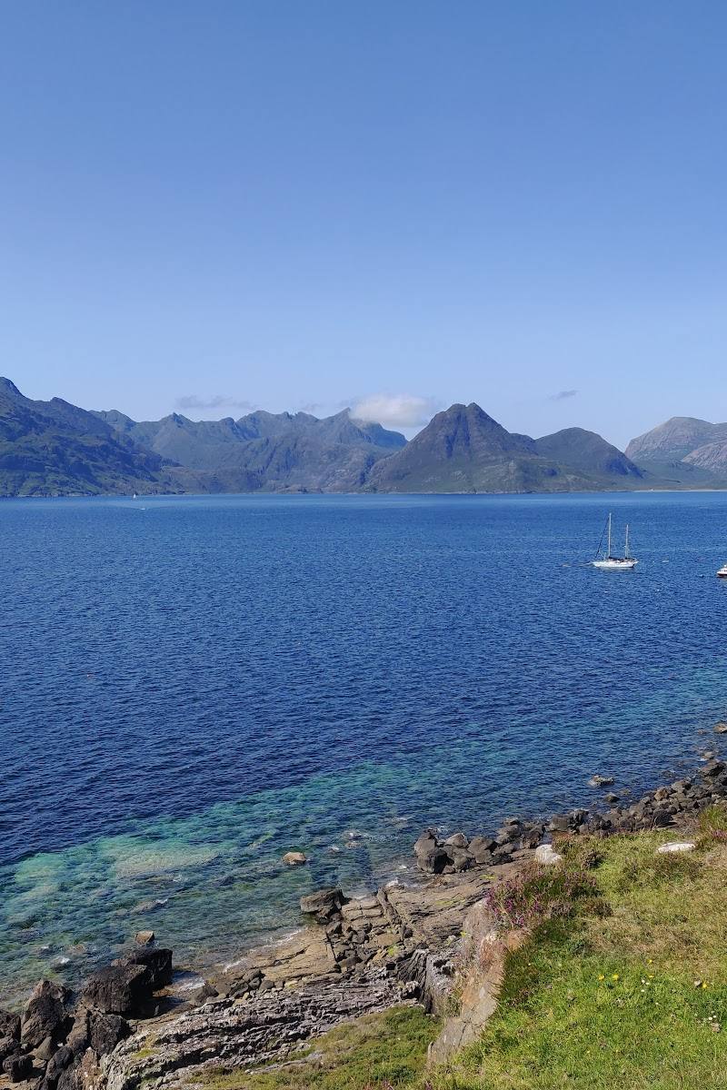
Pause at Camas Daraich to take in its white sand and bright water, then continue to the modern lighthouse at the southern point. On a clear day, look out towards Rum, Canna and Eigg.
The story
No specific history verified in the supplied sources.
Best time to go
Clear, settled days offer the best island views. Check tide times if visiting Camas Daraich; at very high tide the sand may disappear.
Choose a clear day for views towards the Small Isles. If stopping at Camas Daraich, check tide times: very high tides can leave little or no sand exposed. Arrive early on busy summer days, weekends and holidays.
How long to spend
Half day
Perfect for
Walkers · Photographers · Couples
Route at a glance
Duration
Half day
Terrain
Coastal, Remote countryside
Parking / start
Small parking area at the end of the lane near Aird; it can be busy on summer days, weekends and holidays. Do not obstruct farm gates.
Before you go
Address
Practical information
Opening & access
The route starts at a small parking area at the end of the single-track road near Aird and follows rough, sometimes boggy tracks and paths. Check current access and conditions before setting out.
Check before visiting
Parking
Small parking area at the end of the lane near Aird; it can be busy on summer days, weekends and holidays. Do not obstruct farm gates.
Toilets
Check before visiting
Check before visiting
Food & drink
Check before visiting; Cafe 1925 in Ardvasar is mentioned as a post-walk lunch stop in a supplied source, but current details are unverified.
Check before visiting
Dogs
One supplied source says dogs are welcome but should be kept on leads because loose farm animals, including cows with calves, are present. Check current local guidance.
Check before visiting
Accessibility
Not described as accessible: the route includes rough, sometimes boggy ground and repeated climbs and descents. Check conditions before visiting.
Check before visiting
Cost
Check before visiting
Check before visiting
Water
Sea
Gallery
Place photographsKeep exploring
Around Point of Sleat Walk
Within 50 km · approximate straight-line distances