Eryri (Snowdonia), Gwynedd
Llyn Llydaw
Lake
Place photograph
7.8
Wildland
Half day
Time
Check
Cost
Dramatic
Feel
Why it's Wildland
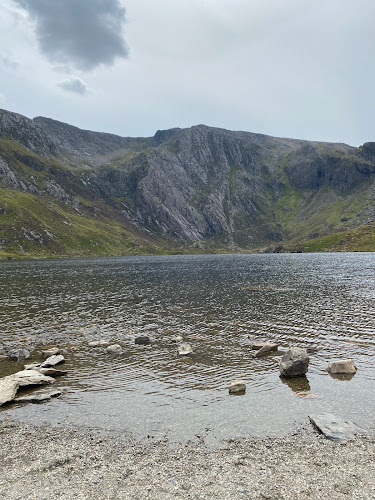
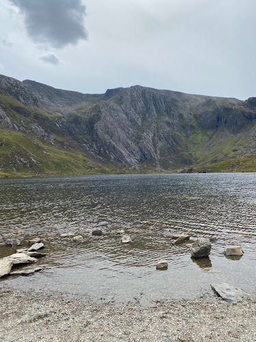
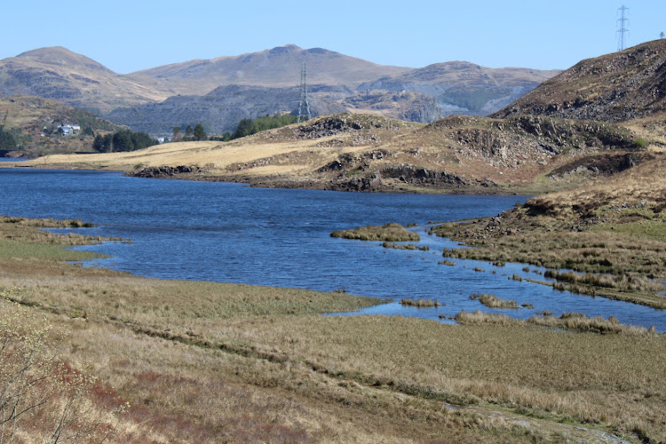
7.8A high mountain lake reached by a track built to serve the Britannia Copper Mines. From its shore, the route presses on towards Glaslyn and the upper mountain landscape.
Llyn Llydaw earns its place through the combination of a substantial mountain setting and a path with a clear industrial past. It is more than a viewpoint stop: the Miners’ Track brings you to the water, while the rougher lakeside continuation rewards walkers who are prepared for uneven ground.
Dramatic · Wild · Atmospheric
Find your way
Open mapEryri (Snowdonia), Gwynedd
Opening map…
The experience
Walk in from Pen-y-Pass on the Miners’ Track to reach the lake. Choose a shorter out-and-back along the main track, or continue around the shore if you are equipped for unclear, boggy and uneven ground. Do not treat the lake as a confirmed swimming venue: the supplied research does not establish permission.
Things to do
Follow the Miners’ Track to the lake
Walk from Pen-y-Pass to Llyn Llydaw on the track built to serve the Britannia Copper Mines. The track is described as broad in places, though eroded sections may occur.
The source row estimates about 1.5 hours on foot to reach the lake; AllTrails gives 2.5–3 hours for its 6.6-mile route.
Walk the rougher lakeside continuation
The route can continue around the lake, but the path away from the main track may be unclear, boggy and uneven. Suitable footwear and careful judgement are needed.
Part of the 6.6-mile, 2.5–3-hour route listed by AllTrails; the source does not give a separate duration.
Look towards the route to Glaslyn
The Miners’ Track continues along the lake’s northern bank before climbing towards the smaller lake, Glaslyn. Use this as a landmark and route decision point.
Make a day of it
Quick escape · About 2.5–3 hours for the AllTrails route described; a shorter out-and-back is possible, but no verified duration is supplied for it.
Lake-side out-and-back
- 01
Start at Pen-y-Pass and follow the Miners’ Track towards Llyn Llydaw.
- 02
Reach the lake shore and pause to take in the mountain setting.
- 03
Retrace your steps to Pen-y-Pass rather than continuing onto the rougher lakeside path.
Half day · About 2.5–3 hours for the full route listed by AllTrails; allow extra time if conditions are difficult.
Continue around Llyn Llydaw
- 01
Begin at Pen-y-Pass and follow the Miners’ Track to Llyn Llydaw.
- 02
Continue along the lakeside route rather than climbing towards Glaslyn.
- 03
Be prepared for a path that can be unclear, boggy and uneven; turn back if conditions or navigation are unsuitable.
- 04
Return to Pen-y-Pass.
Verified history
AllTrails states that the Miners’ Track was built in the 19th century to serve the Britannia Copper Mines, which were abandoned in 1917. The supplied source does not substantiate the source-row claims about the lake’s Ice Age origins or the proposed Breton derivation of its name, so those claims are not presented as verified history.
Hidden details
The track had a working purpose — The Miners’ Track was built in the 19th century to serve the Britannia Copper Mines, which were abandoned in 1917. That industrial connection gives the approach a story beyond its mountain scenery.
When to go
May · June · July · August · September · Early morning or late afternoon may be quieter and bring changing light, according to the source row; check conditions and transport before setting out.
The source row recommends May to September for milder weather and more accessible paths. This is a mountain environment, so season alone does not guarantee safe conditions.
Mountain weather can be unpredictable. Check the forecast and current route conditions before setting out; winter snow and ice can make the walk challenging.
The route
- ascent
- 456 ft, according to AllTrails
- surface
- The main track is described as road-like in places and eroded in others; the lakeside path can be boggy and uneven.
- distance
- 6.6 miles for the AllTrails route
- duration
- 2.5–3 hours, according to AllTrails
- difficulty
- Moderate, according to AllTrails
- route shape
- Out and back, according to AllTrails
- start point
- Pen-y-Pass
- parking start
- Pen-y-Pass parking is very limited and may require pre-booking in busier seasons. Check availability before travelling. AllTrails describes alternative parking near Llyn Pen-y-Gwyrd and a footpath to Pen-y-Pass; verify current arrangements.
- shorter alternative
- Walk from Pen-y-Pass to the lake on the main Miners’ Track and retrace your steps; a separate distance or duration is not supplied.
- Llyn Llydaw
- Miners’ Track and its copper-mining history
- Lakeside continuation towards the route to Glaslyn
What to look for
- 01
Notice how the Miners’ Track meets the lake and continues towards Glaslyn
- 02
look for the contrast between the broad main track and the rougher, less distinct path beside the water. The supplied research describes the track’s connection to the Britannia Copper Mines, but does not identify specific surviving mine remains at the lake.
The story
19th-century copper mining; the Miners’ Track was built to serve the Britannia Copper Mines, which closed in 1917.
Best time to go
Late spring to early autumn for generally milder conditions and more accessible paths; mountain weather can change quickly.
Late spring to early autumn is suggested for milder weather and more accessible paths. Early morning or late afternoon may offer quieter conditions and changing light, but this timing advice comes from the source row and should not be treated as a guarantee.
How long to spend
Half day
Perfect for
Walkers · Photographers · Wildlife lovers
Practical information
Opening & access
Reach the lake on foot from Pen-y-Pass via the Miners’ Track. The path continues along the lake’s northern shore; a full circuit leaves the main path, where the route can become unclear, boggy and uneven. Check current parking and transport arrangements before travelling.
Check before visiting
Parking
Pen-y-Pass is the stated route start. Parking is very limited and may require pre-booking in busier seasons; check availability before travelling. AllTrails also describes alternative parking near Llyn Pen-y-Gwyrd and a footpath to Pen-y-Pass.
Check before visiting
Toilets
No toilets at the lake are evidenced. The source row reports toilets at Pen-y-Pass; check current facilities before travelling.
Check before visiting
Food & drink
No café at the lake is evidenced. The source row reports a small café at Pen-y-Pass; check current facilities before travelling.
Check before visiting
Dogs
Check current access guidance and local signage before visiting; dog rules are not verified by the supplied sources.
Check before visiting
Accessibility
Not wheelchair accessible according to the source row. The lake route involves uneven terrain and inclines; the lakeside continuation can be boggy and uneven.
Cost
Check before visiting
Check before visiting
Water
Lake
Gallery
Place photographsKeep exploring
Around Llyn Llydaw
Within 50 km · approximate straight-line distances