Alwen Reservoir, near Denbigh, North Wales
Alwen Reservoir (Llyn Alwen)
Reservoir
Place photograph
6.2
Wildland
Half day
Time
Check
Cost
Peaceful
Feel
Why it's Wildland
6.2Built in the early 20th century to supply water to the port of Birkenhead, Alwen Reservoir is now a starting point for trails through forest, moorland and upland waterside scenery.
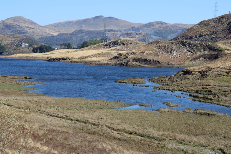
The appeal is the combination of a substantial reservoir, forest and open moorland, explored on a waymarked trail rather than from a single viewpoint. Its strongest sourced experience is a moderate, nearly 11-mile circuit; current bridge and forestry works may change how it can be walked.
Peaceful · Big-sky · Wild
Find your way
Open mapAlwen Reservoir, near Denbigh, North Wales
Opening map…
The experience
Use the car park as a trailhead for walking or cycling. The official Alwen Trail is a moderate 6.8-mile route, with forest, moorland and waterside sections; trail notices currently report a closed footbridge and forestry work, so confirm the available route before setting out.
Things to do
Follow the Alwen Trail
A shared-use, moderate trail through forest, moorland and along the reservoir edge, with views towards the mountains in Eryri National Park. Check the footbridge closure and forestry notices before starting.
Walkers: 2½–3½ hours; cyclists: 1½–2 hours for 6.8 miles/10.9 km, subject to current closures.
Take in the dam and reservoir views
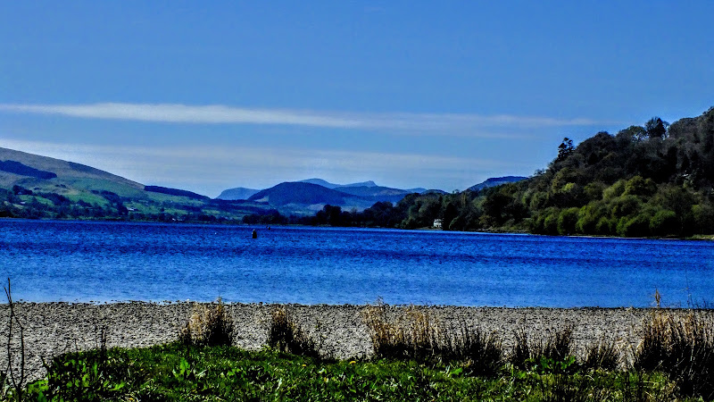
The reservoir and its large dam are the defining features of the landscape. The official source identifies the car park as the starting point for nearby trails; check signage for current access and conditions.
Look for the trail interpretation panels
Illustrated panels along the Alwen Trail explore wildlife, culture and folk tales associated with this historic upland landscape.
Continue to the Llyn Brenig visitor centre
Natural Resources Wales says the visitor centre at Llyn Brenig is one mile from the entrance to the Alwen Reservoir car park. Check its current opening and facilities before making it part of your plans.
Make a day of it
Quick escape · Check current trail notices; a shorter out-and-back distance is not specified by the supplied official sources.
A short reservoir-side outing
- 01
Start at the Alwen Reservoir car park and check the information panel and current closure notices.
- 02
Choose an open section of the signed trail for a walk or cycle, turning back before any closed section.
- 03
Pause at a permitted picnic bench and take in the reservoir and surrounding upland landscape.
Half day · Walkers: 2½–3½ hours; cyclists: 1½–2 hours, for the full published route when available.
Walk the Alwen Trail
- 01
Begin at the reservoir car park and read the trail information panel.
- 02
Follow the Alwen Trail waymarkers: clockwise on foot or anti-clockwise by bike.
- 03
Take in the forest, moorland and waterside sections, and pause at the picnic benches.
- 04
Check the reported footbridge closure first: the official notice says the trail currently operates as a linear out-and-back until a diversion is available.
Verified history
Alwen Reservoir and its dam were built in the early 20th century to provide water for the port of Birkenhead. The supplied official source does not give a construction date or further details about the project.
Folklore & legend
Natural Resources Wales says illustrated panels along the trail explore folk tales from the upland landscape. No specific legend is identified in the supplied sources, so none is retold here as fact.
Hidden details
A trail that links two landscapes — The Alwen Trail crosses forest, moorland and the reservoir edge, with changing views towards the mountains in Eryri National Park.
Interpretation of the upland landscape — Look out for illustrated trail panels about the area's wildlife, culture and folk tales.
When to go
May · June · July · August · September · No specific time of day is verified; check weather and current trail notices before setting out.
The source row recommends May to September, but the supplied official source does not specify seasonal conditions. Treat this as a general planning suggestion rather than a verified seasonal highlight.
The source row warns that winter can be chilly and paths may be muddy or inaccessible. Current forestry work and trail restrictions are reported by Natural Resources Wales; check notices and follow on-site safety instructions.
The route
- ascent
- 361 feet/110 metres
- surface
- Surfaced paths and forestry tracks
- distance
- 6.8 miles/10.9 km for the Alwen Trail
- duration
- Walkers: 2½–3½ hours; cyclists: 1½–2 hours
- difficulty
- Moderate
- waymarking
- Follow the waymarkers. Most trails are walked clockwise and cycled anti-clockwise; check signs and current closure notices.
- route shape
- Normally a trail around the reservoir; currently reported as a linear out-and-back because the connecting footbridge is closed.
- start point
- Alwen Reservoir car park; check the information panel at the trail start.
- parking start
- Natural Resources Wales lists charged parking, including parking for Blue Badge holders. Confirm current arrangements.
- Forest, moorland and waterside sections
- Views across the reservoir towards mountains in Eryri National Park
- Illustrated panels about local wildlife, culture and folk tales
- Picnic benches along the route
Worth pairing with
Llyn Brenig visitor centre
A visitor centre is reported at Llyn Brenig, one mile from the entrance to the Alwen Reservoir car park. Verify current opening and facilities before visiting.
What to look for
- 01
Notice how the trail moves between forest, open moorland and the reservoir edge
- 02
look for the dam and the illustrated panels about the upland landscape. Follow current signs and waymarkers, especially where closures affect the route.
The story
Early 20th-century water supply for the port of Birkenhead.
Best time to go
Late spring to early autumn for milder walking conditions; check current trail notices in any season.
Late spring through early autumn is a sensible choice for a longer outdoor outing, but the supplied official source gives no specific seasonal wildlife or light advice. Check the current trail and forestry notices before travel.
How long to spend
Half day
Perfect for
Walkers · Cyclists · Photographers · Families
Practical information
Opening & access
Natural Resources Wales lists walking and mountain-bike trails and a car park. Parking is charged; check current trail notices before setting out. The footbridge on the Alwen Trail is reported closed, making the route an out-and-back until a diversion is provided.
Check before visiting
Parking
Natural Resources Wales lists charged parking, including parking for Blue Badge holders. Check current details before travelling.
Check before visiting
Toilets
Check before visiting; the supplied official reservoir source does not confirm toilets at Alwen.
Check before visiting
Food & drink
No café or pub at the reservoir is verified by the supplied official source. A visitor centre at Llyn Brenig is about one mile from the entrance to Alwen Reservoir car park.
Dogs
Check before visiting; dog rules for the Alwen Reservoir trails are not confirmed by the supplied official source.
Check before visiting
Accessibility
Natural Resources Wales lists parking for Blue Badge holders. It does not confirm that the trails are wheelchair accessible; check current conditions before visiting.
Check before visiting
Cost
Paid parking; check current details
Check before visiting
Water
Reservoir
Gallery
Place photographsKeep exploring
Around Alwen Reservoir (Llyn Alwen)
Within 50 km · approximate straight-line distances