Hartland, near Bideford, Devon EX39 6AX
Hartland Point
Viewpoint
Place photograph
7.4
Wildland
1–2 hours for a short visit
Time
Check
Cost
Dramatic
Feel
Why it's Wildland
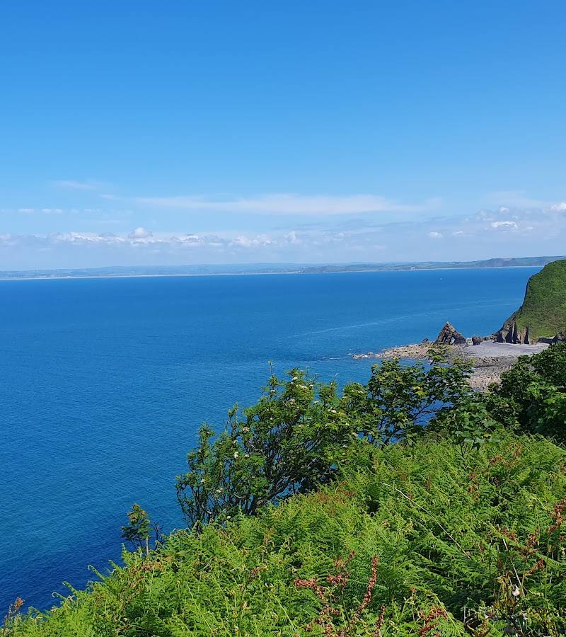
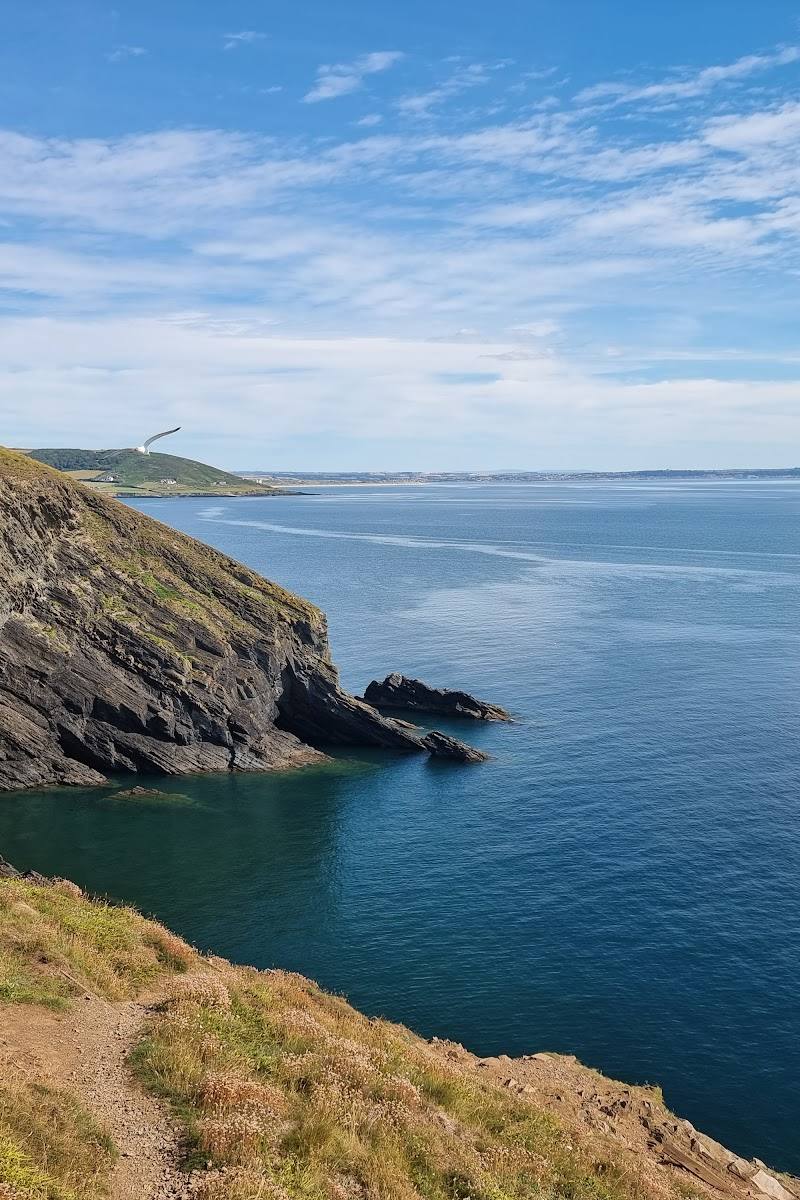
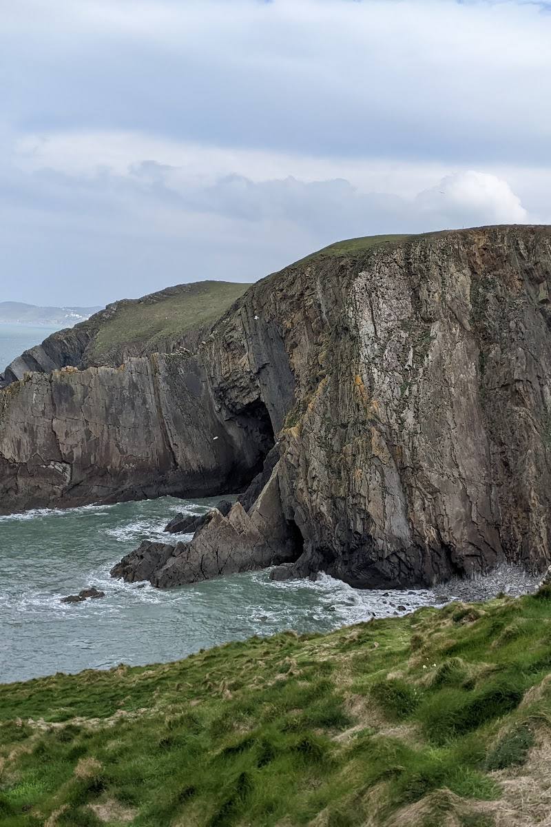
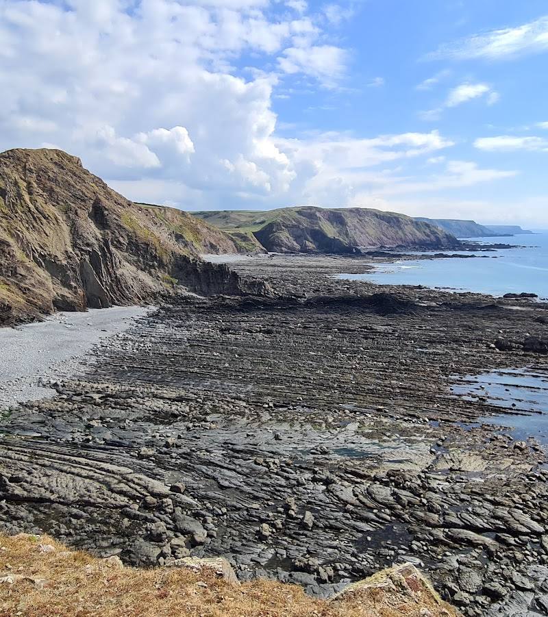
7.4At Devon’s north-western corner, the coast turns from the Bristol Channel towards the Atlantic. On clear days, the view reaches Lundy; below, the cliffs expose strikingly twisted rock strata.
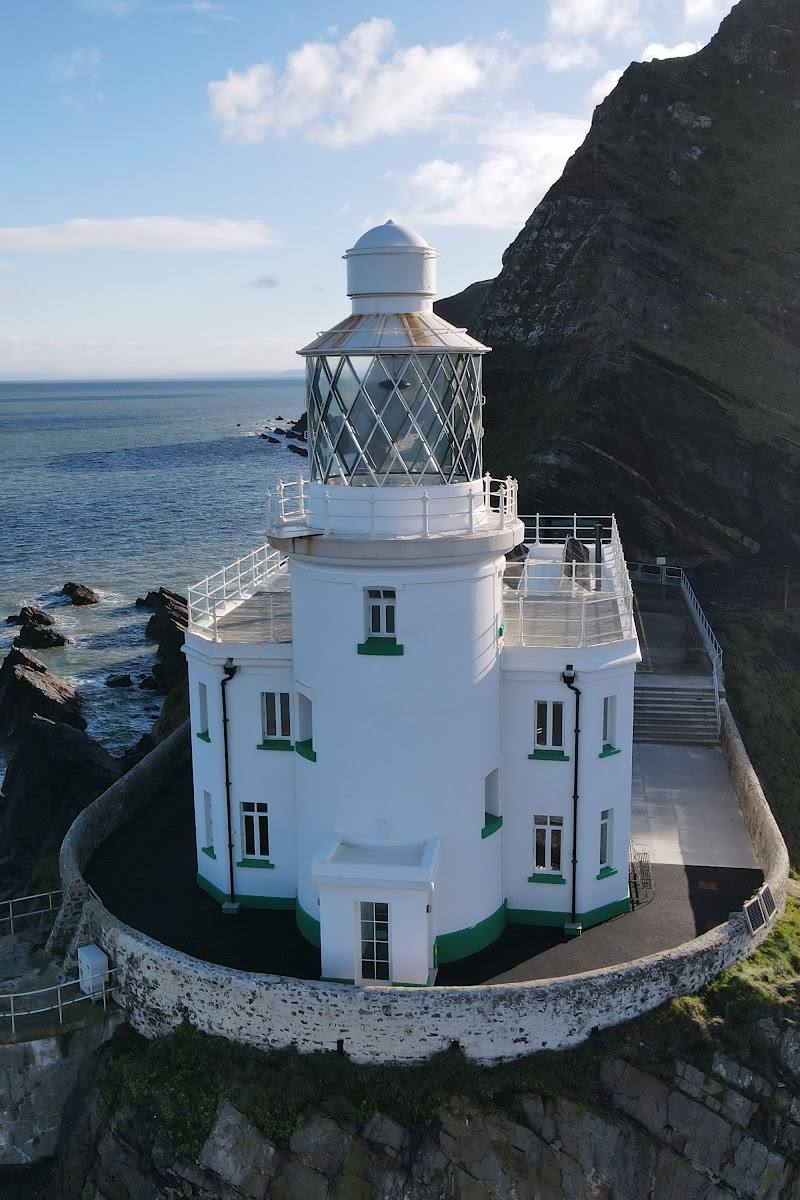
The appeal is the sense of reaching a rugged edge of the land: exposed cliff paths, far-reaching sea views and a lighthouse with a long maritime history. It is best experienced on foot, but steep terrain and stiles make this a demanding outing rather than an easy viewpoint stop.
Dramatic · Wild · Remote
Find your way
Open mapHartland, near Bideford, Devon EX39 6AX
Opening map…
Know this place a little better?
The experience
Come for the exposed coastal views and the feeling of reaching the far western edge of the Hartland peninsula. A short visit can focus on the viewpoint and lighthouse from an appropriate public path; for a fuller outing, take a sourced circular walk, allowing for steep ground and stiles.
Things to do
Take in the Hartland Point views
Use a confirmed public path to view the headland and lighthouse; Lundy may be visible in clear conditions.
Walk the Hartland Quay–Point–Stoke loop
A coastal and farmland loop with viewpoints, steep ground, steps and stiles. AllTrails describes the route as moderate and reports a Glenart Castle memorial on the way.
3–3.5 hours
Look for Lundy from the coast path
On a clear day, look offshore for Lundy, described by the supplied lighthouse source as visible from cliff-top viewpoints.
Notice the twisted cliffs at Shipload Bay
Explore Devon highlights the unusually twisted rock strata at Shipload Bay on its Hartland walk account.
Make a day of it
Quick escape · Check before visiting; no short-route duration is verified in the supplied sources.
A short look at the headland
- 01
Use a confirmed public path or access point and check current access before setting out.
- 02
Take in the headland and lighthouse views from the path.
- 03
Look towards the horizon for Lundy in clear conditions; return by the same confirmed route.
Half day · 3–3.5 hours
Hartland Point, Hartland Quay and Stoke circular
- 01
Start near Warren Beach, as described by AllTrails, after checking the current start point and access.
- 02
Follow the coastal route towards Hartland Point, taking care on steep sections, steps and stiles.
- 03
Pause at the viewpoints and look for the Glenart Castle memorial on the route.
- 04
Use the reported café near Hartland Point only if it is open; continue through farmland towards Stoke and return to the trailhead.
Verified history
The supplied Tripadvisor description identifies Hartland Point Lighthouse as a Grade II listed lighthouse designed by Sir James Douglass under Trinity House. It says the tower was first lit in 1874, automated in 1984, and that its navigational light moved to a modern beacon in 2012, leaving the white tower as a daymark. Treat these details as source-reported pending confirmation from an authoritative heritage or lighthouse record.
Hidden details
The lighthouse’s changing role — The supplied lighthouse description says the tower’s navigational light was moved to a modern beacon in 2012, while the tower remains a daymark.
The Glenart Castle memorial on the walk — AllTrails says its Hartland Quay–Point–Stoke circular passes the HMHS Glenart Castle memorial. The supplied source does not provide further memorial history.
When to go
· A clear day offers the best chance of seeing Lundy; no specific time of day is established by the supplied sources.
The supplied sources do not establish a best season. Coastal weather and route conditions can affect exposed, steep paths, so check forecasts and current conditions.
Exposed coastal walking; check the forecast and path conditions. The sourced circular includes steep sections and steps.
The route
- ascent
- 1,351 ft
- stiles
- Includes stiles; count not specified in the AllTrails route source.
- surface
- Check before visiting; not specified in the supplied route source.
- distance
- 6.2 miles
- duration
- 3–3.5 hours
- difficulty
- Moderate; steep sections require care
- waymarking
- Check before visiting.
- route shape
- Loop
- start point
- Near Warren Beach, according to AllTrails; confirm the exact trailhead before travel.
- parking start
- Check before visiting; the supplied AllTrails excerpt does not specify parking at the trailhead.
- Hartland Point viewpoint
- Coastal lookouts
- HMHS Glenart Castle memorial
- Reported café near Hartland Point
- Farmland section towards Stoke
Worth pairing with
Hartland Quay
Included with Hartland Point in the sourced AllTrails circular route; use as a pairing only if the route and access suit your plans.
Stoke
The AllTrails circular continues through farmland towards Stoke. Explore Devon notes the parish church tower is a prominent landmark in the area.
What to look for
Look for the lighthouse on the headland, Lundy on the horizon in clear conditions, and the twisted rock strata at Shipload Bay described by Explore Devon.
The story
Hartland Point Lighthouse and the maritime coast
Best time to go
Check conditions before visiting; the supplied sources do not identify a best season.
Choose a clear, settled day for the best chance of seeing Lundy and the wider coastline. Check weather and path conditions before setting out.
How long to spend
1–2 hours for a short visit; allow 3–3.5 hours for the sourced Hartland Quay–Hartland Point–Stoke loop
Perfect for
Walkers · Photographers · History lovers
Before you go
Address
Listed hours
- Monday: Open 24 hours
- Tuesday: Open 24 hours
- Wednesday: Open 24 hours
- Thursday: Open 24 hours
- Friday: Open 24 hours
- Saturday: Open 24 hours
- Sunday: Open 24 hours
Check before visiting.
Google rating
Practical information
Opening & access
Hartland Point is reached by coastal footpaths; routes described by the supplied sources include steep sections, steps and stiles. Check current access and conditions before setting out.
Check before visiting
Parking
Check before visiting. The supplied sources mention car parks in Hartland village and a National Trust car park near Exmansworthy, but do not establish parking at Hartland Point itself.
Check before visiting
Toilets
Check before visiting.
Check before visiting
Food & drink
A café is reported near Hartland Point in the AllTrails route description; availability and opening times should be checked before visiting.
Check before visiting
Dogs
Check before visiting and follow current path signage and livestock guidance.
Check before visiting
Accessibility
The sourced routes include steep sections, steps and stiles. The source row reports that the entrance is not wheelchair accessible; check current access details before travel.
Check before visiting
Cost
Check before visiting
Check before visiting
Water
Sea
Gallery
Place photographs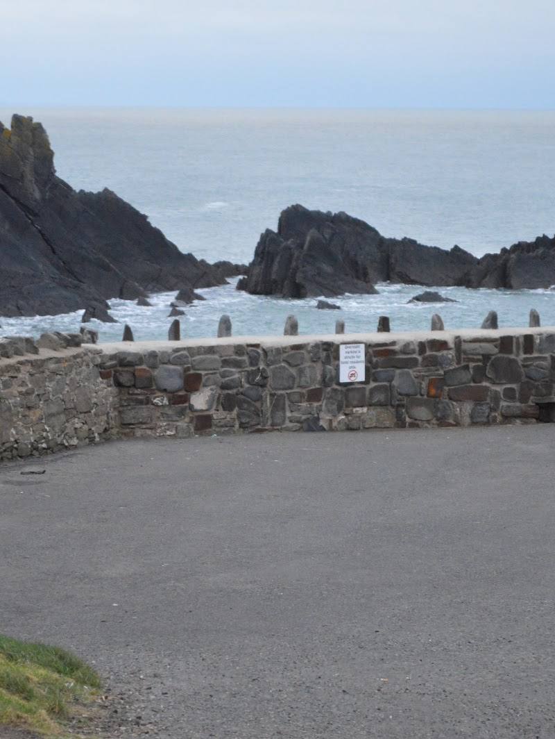
Keep exploring
Around Hartland Point
Within 50 km · approximate straight-line distances