6.8
Wildland
1–2 hours
Time
Check
Cost
Peaceful
Feel
Why it's Wildland
6.8Built in the 1820s by the Bude Canal Company, Lower Tamar Lake was made by damming the River Tamar to supply water to the canal. Today, it is managed as a bird and wildlife resource, with a bird hide beside the path.
Lower Tamar Lake has a clear purpose beyond a pleasant waterside stroll: it is a former canal reservoir now maintained for birds and wildlife. A level lakeside path, bird hide and the story of the old Bude Canal make it a quietly distinctive stop on the Devon–Cornwall border.
Peaceful · Secluded
Find your way
Open mapDevon–Cornwall border, near Kilkhampton
Opening map…
Know this place a little better?
The experience
Allow around 1–2 hours for a lakeside visit. Walk the level path, pause at the bird hide and look for wildlife around the lake edge. For a longer outing, connect with the wider Tamar Lakes paths; check route details and current facilities before setting off.
Things to do
Walk beside Lower Tamar Lake
Explore the lakeside path from the car park. The supplied route source describes the walks as level and without stiles; check local conditions and route options before setting out.
Pause at the bird hide
Look for the bird hide just off the path and watch quietly for birds. Sightings are not guaranteed.
Explore the Upper Tamar Lake circuit
If extending the visit, South West Lakes Trust describes a circular route around Upper Tamar Lake of approximately 2.8 miles (4.5 km), with a level path. Check the current route and access information before walking.
Allow time for a 2.8-mile (4.5 km) walk; exact duration not stated.
Make a day of it
Quick escape · Around 1–2 hours; exact time depends on the route taken.
Quick Escape: lakeside path and bird hide
- 01
Start from the Lower Tamar Lake car park.
- 02
Follow the lakeside path at an easy pace.
- 03
Pause at the bird hide and watch for wildlife.
- 04
Return to the car park; check local information for the best current path option.
Half day · Half day; allow extra time for the connecting paths and stops.
Make a Half Day of It: Lower and Upper Tamar Lakes
- 01
Begin at Lower Tamar Lake and explore its lakeside path and bird hide.
- 02
Follow the off-road woodland trail towards Upper Tamar Lake; South West Lakes Trust describes the distance from Upper Tamar to Lower Tamar as about half a mile.
- 03
At Upper Tamar Lake, consider the circular shoreline walk, reported as approximately 2.8 miles (4.5 km).
- 04
Check current parking, café, route and facility information before travelling.
Verified history
Lower Tamar Lake was constructed in the 1820s by damming the River Tamar. Explore Devon says it was built by the Bude Canal Company to supply the Bude Canal with water. The same source describes the spillway carrying water from the lake back into the Tamar, whose original course lay where the dam now stands. South West Lakes Trust says the lakes are now managed by the Trust.
Hidden details
The lake is part of the Bude Canal’s water story — The reservoir was built to supply the Bude Canal. Notice how the spillway returns water to the Tamar; Explore Devon says the river’s original course lay beneath the dam.
Look for the bird hide just off the path — The route description specifically notes a bird hide beside the path, a useful place to pause without assuming wildlife will be present.
When to go
April · May · June · July · August · September · A clear, quiet morning is a sensible choice for walking and watching for birds; no specific peak time is verified.
The source row recommends May to September for longer daylight and mild conditions, while also noting autumn colour and the quieter feel of winter. Treat wildlife activity and seasonal conditions as variable.
Check the forecast and path conditions before travelling. The supplied sources do not provide detailed weather or flood guidance.
Worth pairing with
Upper Tamar Lake
A worthwhile extension to the visit: South West Lakes Trust describes a circular shoreline path of approximately 2.8 miles (4.5 km), as well as woodland trails and a café with opening times to check.
Bude Aqueduct Trail
A longer, separate outing described by South West Lakes Trust as a roughly 10-mile (16 km), five-hour circular walk passing Dunsdon Nature Reserve and Bude. Check the route information before setting out.
What to look for
Look for the bird hide just off the path, the lake’s spillway and the landscape formed by damming the River Tamar for the Bude Canal.
The story
Bude Canal water supply; 19th-century reservoir engineering.
Best time to go
Spring and summer for longer daylight and greener surroundings; autumn and winter for a quieter visit. Wildlife sightings vary with season.
Choose a clear, quiet morning for a walk and wildlife watching. Spring and summer bring longer daylight; autumn and winter can be quieter.
How long to spend
1–2 hours
Perfect for
Walkers · Wildlife lovers · Photographers · Families
Practical information
Opening & access
A public lakeside destination with a car park and level, stonied path reported at the lake. Check current access and facilities before travelling.
Check before visiting
Parking
Car park at Lower Tamar Lake. Parking charges are listed by South West Lakes Trust; check current tariffs before visiting.
Check before visiting
Toilets
Seasonal toilets are reported at Lower Tamar Lake; check availability before travelling.
Check before visiting
Food & drink
A seasonal café is listed for Upper Tamar Lake. Check current opening times before visiting.
Check before visiting
Dogs
The source row reports dogs on leads; verify current rules and signage before visiting.
Check before visiting
Accessibility
Explore Devon describes the walks as level and without stiles. South West Lakes Trust reports a stoned path from the Lower Tamar car park, suitable for pushchairs and wheelchairs. Check current surface and conditions before setting out.
Check before visiting
Cost
Paid parking; check current charges.
Check before visiting
Water
Lake / reservoir. No swimming or paddling permission is established by the supplied evidence.
Gallery
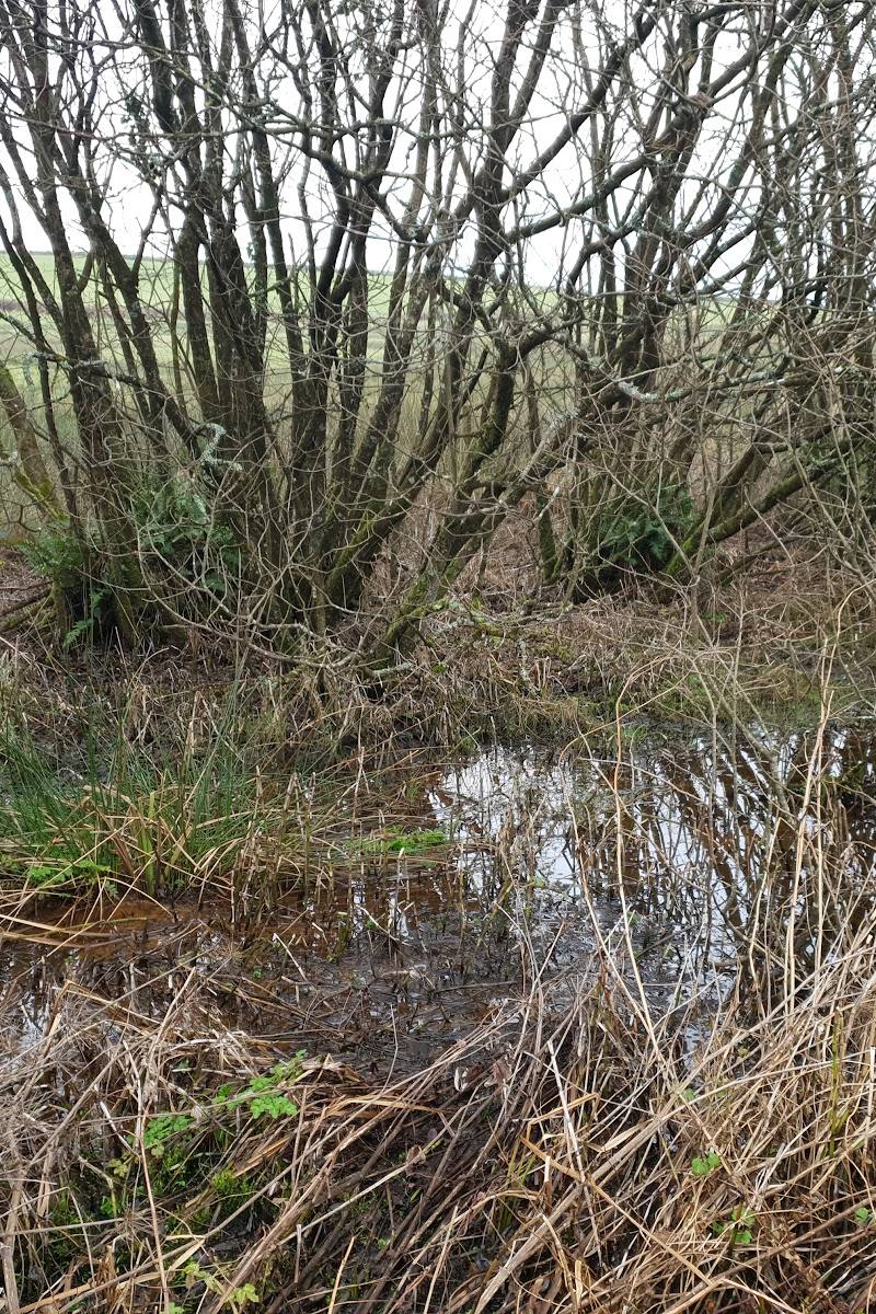
Place photographs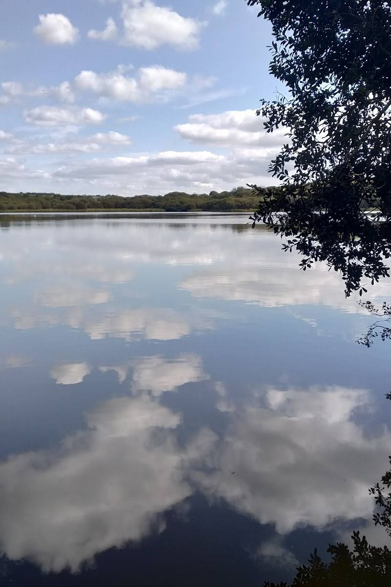
Keep exploring
Around Lower Tamar Lake
Within 50 km · approximate straight-line distances
 Place photograph6.2
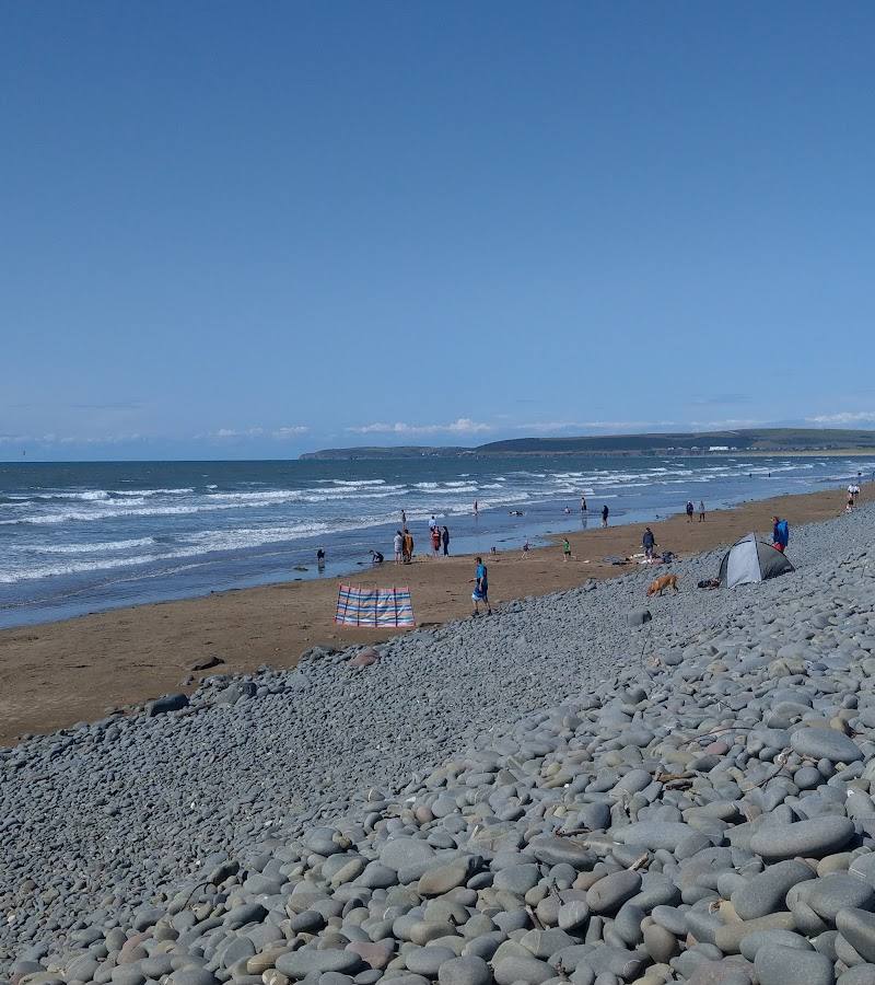
Sandymere Beach
Northam Burrows Country Park, near Westward Ho!, Bideford EX39 1XS
24.4 km away
 Place photograph6.7
Davidstow Airfield and Cornwall at War Museum
Nottles Park, Davidstow, Camelford PL32 9YF
29.2 km away