4.3
Wildland
Under 1 hour
Time
Check
Cost
Atmospheric
Feel
Why it's Wildland
4.3A small, weathered stone shaft on Batcombe Down carries a name that promises a carved hand. Historic England records that the hand said to have been carved on it can no longer be traced.
This is a brief, rewarding stop for anyone who enjoys Dorset’s less obvious historic details: a medieval monolith, an uncertain pre-Conquest possibility and a literary afterlife in Thomas Hardy’s Tess of the d’Urbervilles. It is a tiny monument, not a full-day destination on its own.
Atmospheric · Ancient-feeling
Find your way
Open mapBatcombe Down, near Dorchester, Dorset
Opening map…
Know this place a little better?
The experience
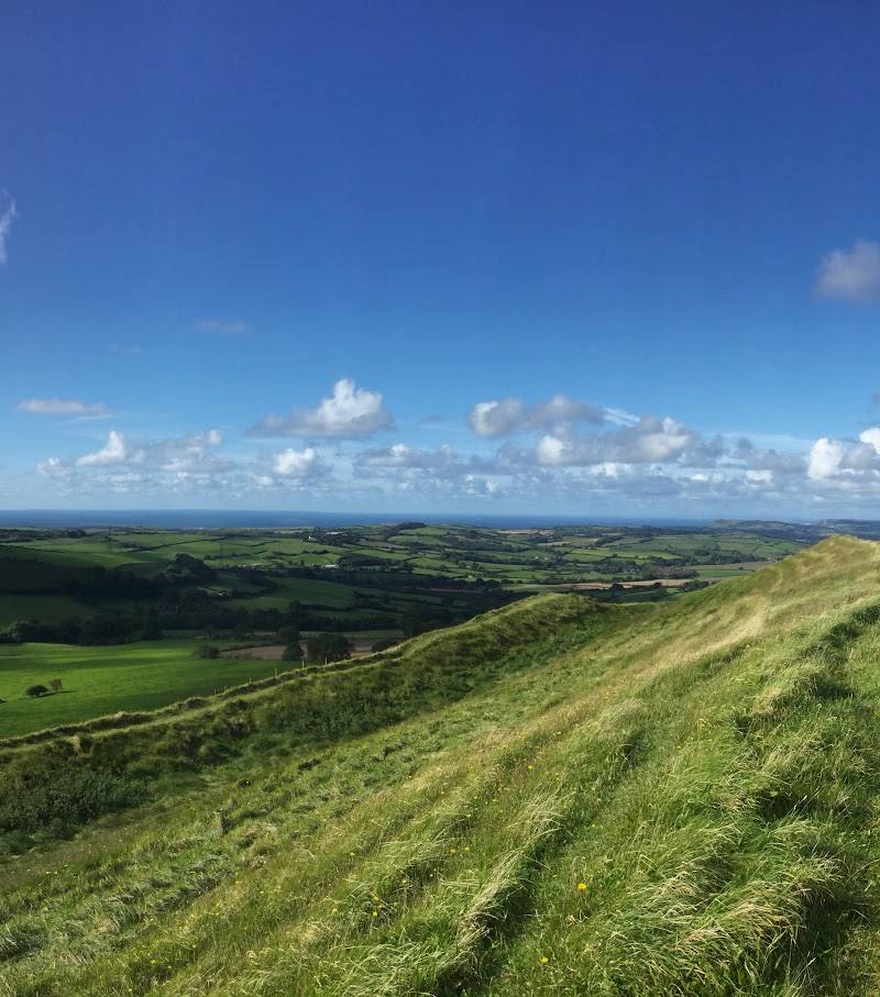
A short visit centred on the wayside stone shaft. Its modest scale rewards close looking rather than a long stop. For a longer outing, a published 4.5-mile Batcombe walk passes the monument; check route and access details before setting out.
Things to do
Inspect the stone shaft
Notice its oval form, tapering shape, necking and capital. Historic England describes it as a medieval wayside monolith.
10–20 minutes
Look for the reported hand carving
The name refers to a hand said to have been carved on one face, but Historic England records that it is no longer traceable.
A few minutes
Follow the Batcombe circular walk
A published 4.5-mile route describes tracks, paths, roads and fields, including the Cross and Hand and Batcombe church. Its start and parking advice are in the route source; check current conditions and access before relying on them.
2–3 hours
Make a day of it
Quick escape · Under 1 hour
A close look at the Cross and Hand
- 01
Check access and the approach before travelling; the map pin is not an entrance or parking point.
- 02
If access is available, examine the monolithic shaft, its necking and capital.
- 03
Look for the reported hand carving, bearing in mind Historic England says it is no longer traceable.
Half day · 2–3 hours
Batcombe Down and its historic lanes
- 01
Use the published Batcombe circular walk only after checking the route and current access.
- 02
The route description gives a 4.5-mile circuit over tracks, paths, roads and fields, with some steep climbs.
- 03
It describes passing the Cross and Hand, Batcombe church and the site of a 16th-century manor house.
Verified history
Historic England lists the Cross and Hand as a Grade II listed medieval wayside monolithic shaft, first listed on 11 July 1951. The entry describes an oval, crudely tapering stone about 107 cm high, with necking and a capital. It says the shaft may belong to a group of pre-Conquest shafts, but presents this as a possibility, not a settled date. The hand said to have been carved on one face is not traceable.
Folklore & legend
Local lore described in a modern account links the stone with the Devil and a supposed malefactor. Thomas Hardy used the stone, under the name Cross-in-Hand, in Tess of the d’Urbervilles; the story’s claims about the stone’s meaning should be understood as fiction and legend, not verified history.
Hidden details
The hand that cannot now be found — The monument’s name preserves a report of a carved hand, but Historic England says it is no longer traceable.
A possible pre-Conquest connection — Historic England notes that the shaft may belong to a group of pre-Conquest monuments. The entry explicitly treats this as a possibility.
When to go
· No specific time is supported by the available sources.
No season-specific wildlife, landscape or access information is available.
Check local conditions before travelling. The longer published walk includes tracks, paths, roads and fields, with some steep climbs.
The route
- ascent
- 450 ft total climb, according to the route source
- surface
- Track, path, road and field
- distance
- 4.5 miles for the published Batcombe circular walk
- duration
- 2–3 hours
- difficulty
- Easy, with some steep climbs, according to the route source
- route shape
- Circular
- start point
- Wriggle Road, Pleck, according to the route source
- parking start
- The route source advises parking considerately at the bottom of Wriggle Road, mindful of traffic and access. Check before travelling.
- The Cross and Hand
- Batcombe church
- The site of the 16th-century manor house
What to look for
Look for the oval, tapering stone shaft, its necking and capital, and the surface where a hand was reportedly carved but is no longer traceable. A local account also notes an Ordnance Survey benchmark on the south side.
The story
Medieval archaeology; possible pre-Conquest origins; literary connection to Tess of the d’Urbervilles
Best time to go
Check before visiting; no season-specific information is available.
No best time is established by the available sources. Check conditions and access before travelling.
How long to spend
Under 1 hour
Perfect for
History lovers · Walkers · Photographers
Before you go
Address
Google rating
Practical information
Opening & access
The monument is described as standing beside the road, but public access and the precise approach are not confirmed. Check before visiting; the Google Maps pin marks the place, not an entrance or parking. Access arrangements are unconfirmed. Check before visiting; do not enter private land or restricted structures.
Check before visiting
Parking
Check before visiting. The supplied map pin is not a parking location.
Check before visiting
Toilets
Check before visiting
Check before visiting
Food & drink
Check before visiting
Check before visiting
Dogs
Check before visiting
Check before visiting
Accessibility
Check before visiting. Access route, surface and step-free access are not confirmed.
Check before visiting
Cost
Check before visiting
Check before visiting
Gallery
Place photographs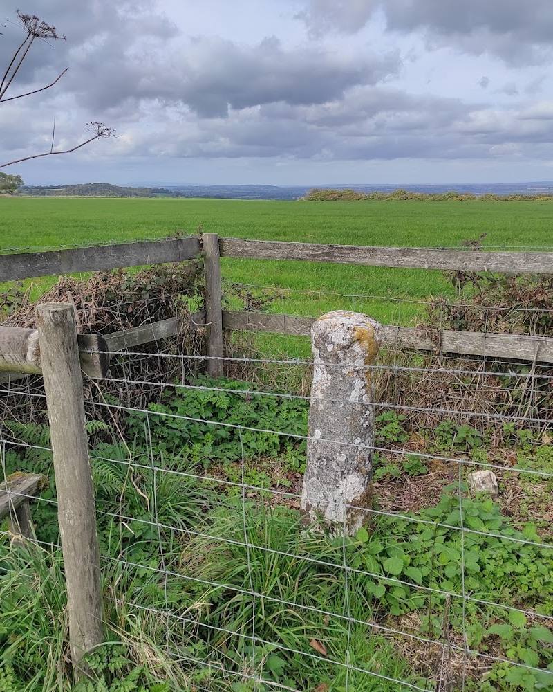
Keep exploring
Around The Cross and Hand
Within 50 km · approximate straight-line distances