7.5
Wildland
1–2 hours
Time
Check
Cost
Wild
Feel
Why it's Wildland
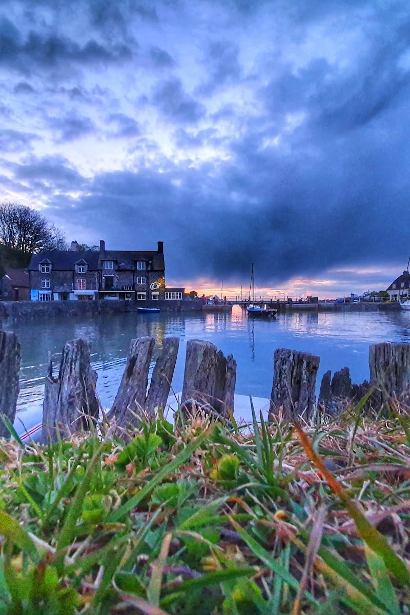
7.5A broad shingle shore where the River Horner can disappear beneath the stones before reaching the Bristol Channel. Behind it, marshland, farmland and Exmoor’s coastal hills make the beach part of a much larger landscape.
Bossington is more than a pebble beach: a steep shingle bank, an intermittently hidden river, marshland wildlife and visible traces of coastal and agricultural history give it a distinctive sense of place. Come to walk and explore the shore, not to swim: strong currents make swimming inadvisable.
Wild · Atmospheric · Peaceful
Find your way
Open mapBossington, near Minehead, Somerset
Opening map…
Know this place a little better?
The experience
Walk down from Bossington village to the wide pebble shore, look for the lime kilns and wartime pillboxes, and notice how the shingle bank separates the Bristol Channel from the low-lying land behind it. Allow time for the half-mile approach each way. Swimming is not advised because currents are strong.
Things to do
Explore the shingle shore
Walk the broad pebble beach and notice how the steeply shelving bank separates the Bristol Channel from the low-lying land behind it.
Check before visiting
Find the lime kilns and pillboxes
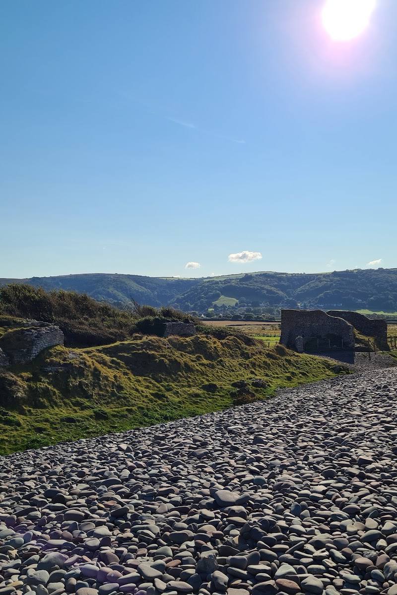
Look for the remains of lime kilns used in agriculture and World War II pillboxes along the beach.
Check before visiting
Notice where the River Horner meets the shore
The river can seep through the shingle rather than form a visible outlet; occasionally it breaks through the bank.
Check before visiting
Walk a section of the coastal path
A described 2.5-mile stroll on the South West Coast Path gives views over the marsh and farmland of Porlock Vale. Confirm route details and conditions before starting.
Check route details before visiting
Make a day of it
Quick escape · About 1–2 hours; allow for the half-mile walk each way from the village car park.
Quick Escape: shore and shingle
- 01
Park at the National Trust car park in Bossington village, checking current arrangements.
- 02
Walk about half a mile to the beach.
- 03
Explore the pebble shore and look for the lime kilns and wartime pillboxes.
- 04
Return to the village by the same approach. Do not swim: strong currents are reported.
Half day · Half day; the supplied sources do not give a duration for this combined outing.
Make a half day of it: beach and coastal landscape
- 01
Start from Bossington village and walk to the beach via the National Trust car park approach.
- 02
Explore the shingle shore, lime kilns and pillboxes.
- 03
Continue on a sourced South West Coast Path walk for views over Porlock Vale and the coast; choose a route appropriate to your ability and check its current details before setting out.
- 04
Return to Bossington. The supplied sources do not verify a particular café or other stop to include.
Verified history
The supplied beach guide identifies lime kilns used in agriculture and World War II pillboxes on the beach. It also describes Bossington Beach as part of the National Trust’s Holnicote Estate. The sources supplied do not provide dates or further historical detail for these remains.
Hidden details
The river beneath the beach — The River Horner runs down from the village of Bossington but may seep through the shingle without appearing to reach the sea; the outlet can sometimes break through visibly.
Pebbles sorted by the sea — The beach guide notes that strong currents sort the pebbles by size, with smaller stones towards the crest of the beach.
When to go
· No evidence-based time-of-day recommendation supplied; check weather and coastal conditions before visiting.
The supplied sources do not identify a best season. Marshland is described as habitat for rare birds and insects, but no seasonal wildlife timings are given.
Check local weather and coastal conditions before setting out. The beach has strong currents and no lifeguard service; swimming is not advised.
The route
- surface
- Pebble beach; path surface not specified for the 2.5-mile stroll.
- distance
- The approach from the National Trust car park in Bossington village is about half a mile to the beach. A separate South West Coast Path walk is described as 2.5 miles.
- duration
- Not supplied for the beach approach or 2.5-mile path walk; check before visiting.
- difficulty
- Not supplied for these beach and path sections; check route conditions before setting out.
- route shape
- Out and back to the beach from the village car park; 2.5-mile coastal path stroll separately described by the source.
- start point
- National Trust car park in Bossington village for the beach approach.
- parking start
- The National Trust car park in Bossington village is described as about half a mile from the beach. Check current arrangements.
- Broad shingle beach and steeply shelving pebble bank
- Lime kilns and World War II pillboxes
- River Horner’s sometimes-hidden passage beneath the shingle
- Views over Porlock Vale on the described coastal-path stroll
Worth pairing with
Bossington village
The village is the starting point for the walk to the beach and is described as having thatched cottages, tall chimneys and gardens.
Bossington Hill circular walk
A sourced 6.5-mile circular route from Bossington village includes the South West Coast Path, Selworthy Woods, an Iron Age hillfort and Selworthy Beacon. The route source describes it as moderate and taking around 3–4 hours; check its detailed directions and current conditions before setting out.
Three Picturesque Villages walk
The South West Coast Path source describes a 4.6-mile walk from Bossington car park through three villages, with coastal views, Selworthy Beacon and woodland paths. It is labelled challenging, with one long, very steep climb.
What to look for
Look for the old lime kilns and World War II pillboxes, the size-sorting of pebbles along the steep shingle bank, and the point where the River Horner seeps beneath the beach or breaks through it.
The story
Coastal defence and agricultural lime kilns
Best time to go
Check local conditions before setting out; no specific peak season is established by the supplied sources.
No specific time of day is identified in the supplied sources. Check weather and coastal conditions before setting out; avoid entering the water because currents are strong and there is no lifeguard service.
How long to spend
1–2 hours
Perfect for
Walkers · Photographers · Wildlife lovers · Dogs · History lovers
Before you go
Practical information
Opening & access
Public beach. The National Trust car park in Bossington village is about half a mile from the beach; check current access and parking arrangements before travelling.
Check before visiting
Parking
The National Trust car park in Bossington village is about half a mile from the beach. Check current arrangements before visiting.
Check before visiting
Toilets
Check before visiting
Check before visiting
Food & drink
Check before visiting
Check before visiting
Dogs
Dogs are allowed, according to the supplied beach guide. Check current local guidance and signage.
Check before visiting
Accessibility
The beach is reached on foot from the village car park. The shore is a steeply shelving pebble beach; check current path and access conditions before visiting.
Check before visiting
Cost
Check before visiting
Check before visiting
Water
Sea; the River Horner runs beneath or through the shingle at its mouth. Strong coastal currents; swimming is not advised.
Gallery
Place photographs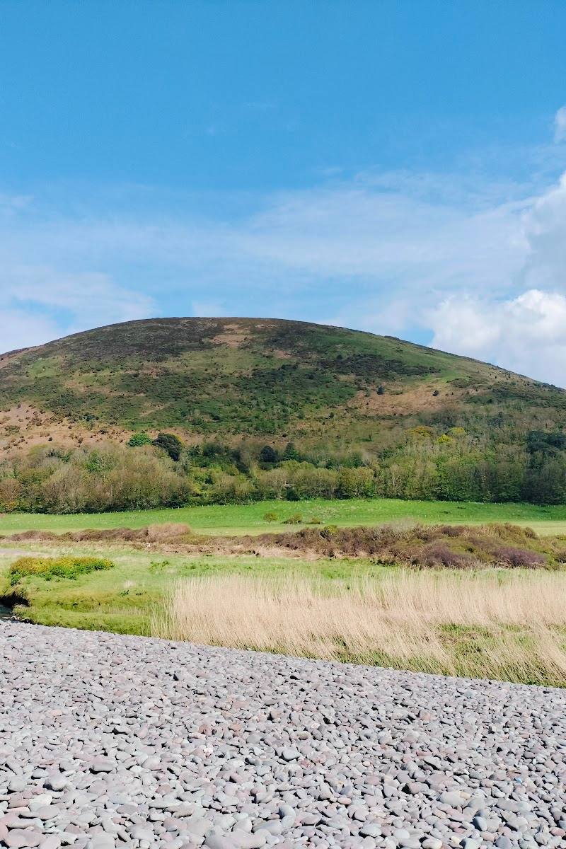

Keep exploring
Around Bossington Beach
Within 50 km · approximate straight-line distances