Porlock Weir, about 1.5 miles west of Porlock, Somerset
Porlock Weir
Historic village
Place photograph
6.2
Wildland
1–2 hours
Time
Check
Cost
Peaceful
Feel
Why it's Wildland
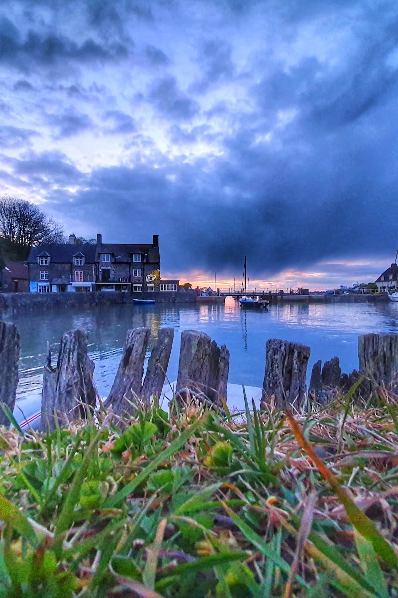
6.2Porlock Weir’s name recalls salmon stakes and traps once set along the shore. Its harbour still shows the pull of the Bristol Channel’s tides: boats that appear stranded on the mud are refloated as the water rises.
The appeal is the meeting of a working-looking little harbour, a powerful tidal landscape and the marsh and shingle beyond. It offers more to notice than a quick harbour photograph, though current practical details should be checked before setting out.
Peaceful · Atmospheric · Big-sky
Find your way
Open mapPorlock Weir, about 1.5 miles west of Porlock, Somerset
Opening map…
Know this place a little better?
The experience
Allow around 1–2 hours to look around the harbour and, if access and conditions permit, continue towards the marsh and shingle ridge. The supplied sources do not verify a complete route, facilities or current opening details.
Things to do
Watch the harbour change with the tide
Look at the boats sitting on the mud and how their position changes as the Bristol Channel tide rises. Tide times and conditions are not supplied; check locally.
15–30 minutes
Inspect the dock-gates and Turkey Island bridge
See the harbour gates used to retain tidal water and release it to flush stones from the inner harbour, then cross the bridge for a different harbour perspective. Confirm access on arrival.
15–30 minutes
Continue towards the marsh and shingle ridge
A visitor guide describes an amble from the harbour towards the marsh, shingle ridge and stony beach. Check conditions, access and the route before setting out.
About 1 hour
Look for birdlife on Porlock Marsh
A visitor account describes seeing birdlife on the marsh. Watch from accessible paths without disturbing wildlife; no particular species are verified by the supplied sources.
30–60 minutes
Make a day of it
Quick escape · About 1 hour
Quick harbour amble
- 01
Start by the harbour and take time to look at the boats and the Bristol Channel tide.
- 02
Cross the dock-gate bridge towards Turkey Island for another view of the inner harbour.
- 03
If conditions and access allow, continue towards the shingle ridge and stony beach, then return.
Half day · Half day
Harbour, marsh and Porlock village
- 01
Explore the harbour and dock-gates at Porlock Weir.
- 02
Walk towards Porlock Marsh and look for birds; check the route and conditions before setting out.
- 03
Continue to Porlock village for its thatched cottages and local shops, then check locally for refreshments.
- 04
Use a current map or local advice to plan the return; the supplied sources do not verify a complete circular route.
Verified history
The supplied visitor guide describes Porlock Weir as a historic coastal trading place. In the 18th and 19th centuries, cargoes included corn, flour, bark for tanning, bricks and oysters bound for Bristol. The guide also says oyster farming was revived by a community project launched in 2013. The source row explains that the name refers to salmon stakes and traps once set along the shore. These details are reported by the supplied sources; no further historical records were supplied for independent verification.
Hidden details
The gates that help keep the inner harbour clear — The harbour dock-gates hold back tidal water and release it in a rush to flush stones carried in by the tide. Look for the gates and the bridge to Turkey Island; do not enter restricted areas.
A golf course lost to flooding — A video account says the marsh was used as a golf course for one season in the early 20th century, before regular flooding ended it. The source does not give the exact year or further detail.
When to go
· Early morning or late afternoon for light and fewer people on popular walks, according to a local guide.
No season-specific recommendation is supported by the supplied sources.
A local guide cautions that Exmoor weather can change quickly and recommends waterproofs and warm layers. Paths may be muddy or uneven; check current conditions.
The route
- surface
- Check before visiting; path surfaces are not specified for the route between Porlock Weir and Porlock.
- duration
- A video account says its woodland walk from Porlock Weir to Porlock took about an hour at an unhurried pace; route distance and return details are not supplied.
- start point
- Porlock Weir; exact start point and route are not specified.
- parking start
- A visitor guide mentions a handy car park at Porlock Weir; current location, availability and terms are not supplied.
- Porlock Weir harbour and tidal boats
- Woodland trail towards Porlock, as described by a visitor account
- Porlock Marsh and reported birdlife
Worth pairing with
Porlock village
Combine the harbour with a visit to Porlock, described in a visitor account as having thatched cottages, local shops and a gallery. A woodland trail between the village and the weir is also described, but check its current route and condition.
Porlock Marsh
A nearby marsh walk offers a change from the harbour; a visitor account reports seeing birdlife there. Check current access and route conditions.
Hurlstone Point
A local accommodation guide describes this coastal headland as about two miles away, with panoramic sea views. Route, access and timings should be checked before setting out.
What to look for
- 01
Watch the harbour boats against the changing tide
- 02
find the dock-gates and bridge to Turkey Island, and notice the shingle ridge and marsh beyond the harbour.
The story
Coastal trade, harbour history and historic salmon fishing.
Best time to go
Check local conditions before visiting; the supplied sources do not establish a best season.
A local guide recommends early morning or late afternoon for light and fewer people on popular walks; this is general advice, not a guarantee of quiet conditions.
How long to spend
1–2 hours
Perfect for
Walkers · Photographers · History lovers
Before you go
Address
Practical information
Opening & access
A harbour settlement to explore on foot. A visitor guide describes a car park and an amble around the boats, marsh, shingle ridge and stony beach; confirm current access and parking arrangements before travelling.
Parking
A visitor guide mentions a handy car park; location, charges and current availability are not specified. Check before visiting.
Check before visiting
Toilets
Check before visiting
Check before visiting
Food & drink
A video source describes a meal at Locanda on the Weir and refreshments in Porlock, but current opening and availability are unverified. Check before visiting.
Check before visiting
Dogs
A visitor guide describes marshland as a place for dogs, but does not establish current rules. Check local signage and restrictions before visiting.
Check before visiting
Accessibility
Check before visiting; path surfaces and step-free access are not established by the supplied sources.
Check before visiting
Cost
Check before visiting
Check before visiting
Water
Harbour, Bristol Channel coast and nearby marsh; no swimming or paddling permission established.
Gallery
Place photographs

Keep exploring
Around Porlock Weir
Within 50 km · approximate straight-line distances