7XFJ+VX, Caterham, Surrey CR3 7AN, United Kingdom
Woldingham Viewpoint
Viewpoint
Place photograph
5.5
Wildland
1–2 hours, Half day
Time
Check
Cost
Peaceful
Feel
Why it's Wildland
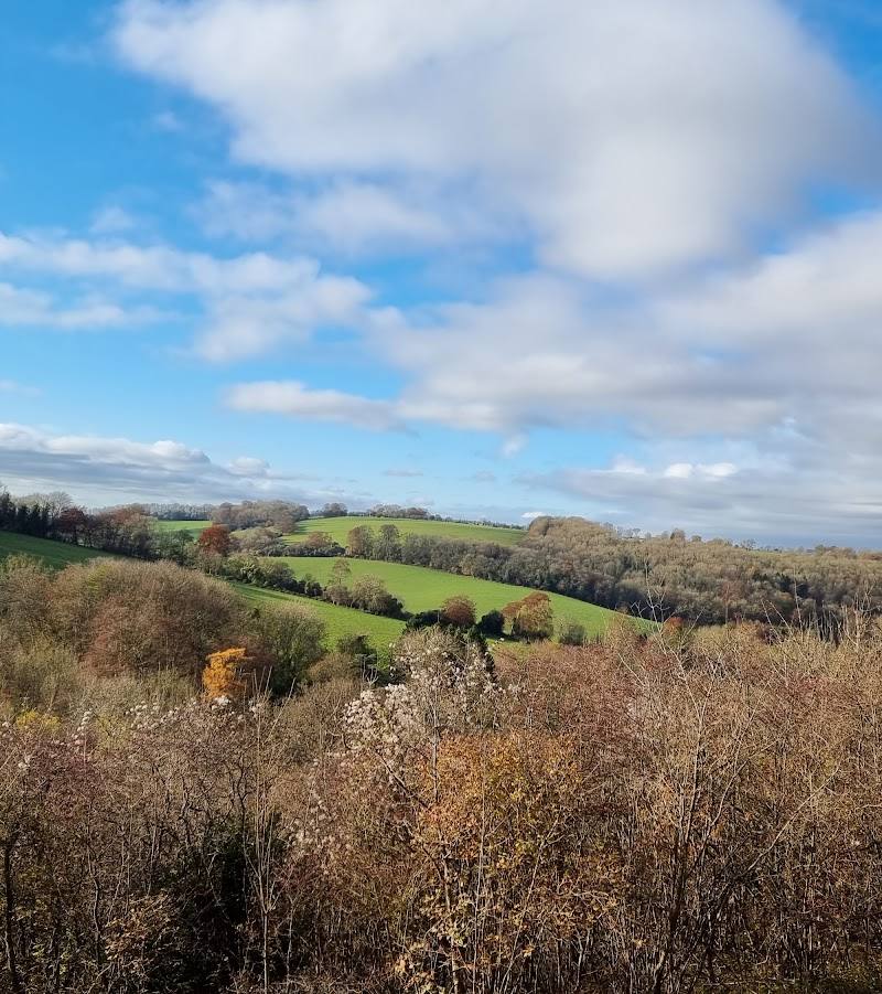
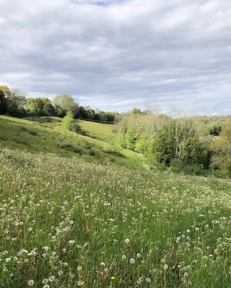
5.5Woldingham’s views are part of a wider North Downs landscape of steep hills and sweeping valleys. On the documented circular walk from Woldingham station, a section of Madeira Walk opens to views towards London across Caterham Valley; the route also passes chalk grassland, woodland and historic village sites.
The appeal is the contrast between open North Downs views and a walk that threads through woodland, remnant chalk grassland and Woldingham’s layered village history. It is best approached as part of a documented walk, rather than as a confirmed standalone viewpoint at the map pin.
Peaceful · Big-sky
Find your way
Open map7XFJ+VX, Caterham, Surrey CR3 7AN, United Kingdom
Opening map…
Know this place a little better?
The experience
Use the documented Woldingham circular walk from the station to combine valley views with woodland, chalk grassland and village landmarks. The map pin itself is not confirmed as a visitor entrance.
Things to do
Walk to the Caterham Valley view
On the Surrey County Council circular walk, follow Madeira Walk through houses and woodland to an open area with remnant chalk grassland and views towards London across Caterham Valley.
Part of a 3.5-mile circular walk, approximately 1.5 hours overall
Follow the Woldingham Heritage Walk
Take the parish council’s circular route between nine heritage information boards, including stops at St Agatha’s Church, The Green, The Crescent and St Paul’s Church.
Approximately 1 hour 45 minutes
Look for the chalk-grassland plants
The Surrey County Council walk identifies a remnant area of chalk grassland beside Madeira Walk, noted for its rich variety of plants. No particular species or flowering dates are specified.
Find the historic horse trough on The Green
The parish council’s Heritage Walk account describes a granite horse trough installed in 1907, removed in 1939 and reinstated in 1979. Look for it at The Green.
Make a day of it
Quick escape · About 1.5 hours
Quick escape: valley views and woodland
- 01
Start and finish at Woldingham station.
- 02
Follow the Surrey County Council circular walk, using its directions to reach the Madeira Walk section.
- 03
Pause at the open view towards London across Caterham Valley, then continue the signed circular route back to the station.
Half day · About 2–3 hours, depending on stops
Make a half day of it: walk and village heritage
- 01
Walk the circular route from Woldingham station, allowing time for the woodland and chalk-grassland sections.
- 02
Add the parish council’s Heritage Walk stops at St Agatha’s Church, The Green, The Crescent and St Paul’s Church; use its published route instructions and map.
- 03
Consider a refreshment stop at one of the venues listed by the parish council; check opening before setting out.
Verified history
Woldingham’s heritage spans village development, wartime use and estate history. Surrey County Council says Woldingham Garden Village began as accommodation for the Public Schools Battalion of the Middlesex Regiment during the First World War and was later converted into a convalescent camp; some buildings remain as bungalows. The Marden Park estate was established in the mid-17th century by Sir Robert Clayton. The parish council’s Heritage Walk also records the opening of the railway line in 1884 after completion of the Oxted Tunnel, and notes that Great Church Wood still shows bomb craters from the Second World War.
Hidden details
A wartime story in the village landscape — The parish council says Woldingham Garden Village began as a camp for the Public Schools Battalion during the First World War. Surrey County Council notes that some of the camp’s buildings were converted into bungalows after the war and remain standing.
Bomb craters in Great Church Wood — The parish council identifies Great Church Wood as designated Ancient Woodland and reports that bomb craters from the Second World War can still be seen there.
The granite trough’s unusual wartime disappearance — The parish council records that the horse trough on The Green was removed in 1939 to confuse the enemy, rediscovered in a council works yard in 1977 and reinstated in 1979.
When to go
April · May · September · October · A clear morning or afternoon for the valley views; check weather and route conditions before travelling.
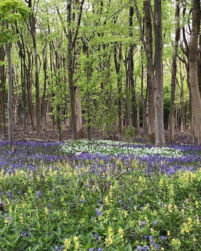
The walk description notes plant-rich chalk grassland and the Surrey Hills route highlights spring wildflowers; autumn colour is mentioned in the supplied walk account. The sources do not specify exact peak dates.
Some route sections can become muddy after wet weather, and the walk includes hills, steps and quiet-road sections. Check conditions and wear suitable footwear.
Worth pairing with
Woldingham Heritage Walk
A circular village walk with nine heritage information boards at sites including St Agatha’s Church, The Green, The Crescent and St Paul’s Church.
The Dene at Knights Garden Centre
Listed by the parish council as a refreshment option along the Heritage Walk. Check opening before visiting.
Woldingham Village Club
Listed by the parish council as a refreshment option along the Heritage Walk. Check access and opening before visiting.
What to look for
- 01
Look out for the open views towards London across Caterham Valley from the Madeira Walk section
- 02
the remnant chalk grassland
- 03
the many-trunked beech tree on the route described by Surrey Hills
- 04
and the nine heritage information boards on the parish council’s circular Heritage Walk.
The story
Archaeology
Best time to go
Spring and autumn are suggested by the sources for wildflowers and woodland colour respectively; views and route conditions vary with weather.
Choose a clear day for the valley views. Spring is a good time to look for the wildflower interest noted on the walk; autumn brings woodland colour. Check the forecast and path conditions, as sections can become muddy.
How long to spend
1–2 hours, Half day
Perfect for
Walkers · Photographers · History lovers
Before you go
Address
Listed hours
- Monday: Open 24 hours
- Tuesday: Open 24 hours
- Wednesday: Open 24 hours
- Thursday: Open 24 hours
- Friday: Open 24 hours
- Saturday: Open 24 hours
- Sunday: Open 24 hours
Check before visiting.
Google rating
Practical information
Opening & access
The supplied pin is a Google Maps main-place pin, not a confirmed entrance or parking point. Surrey County Council describes public footpaths and bridleways on its Woldingham circular walk; check the route and current conditions before setting out, and do not assume the pin itself is an access point.
Check before visiting
Parking
Surrey County Council lists pay-and-display parking at Woldingham station and another district council car park on Woldingham Road near the station; limited parking is also noted along Church Road. Check current arrangements and charges before travel.
Check before visiting
Toilets
Surrey County Council lists toilets at Woldingham station. Check availability before visiting.
Check before visiting
Food & drink
Village shops are noted along Station Road; the parish council lists refreshments at Woldingham Village Club and The Dene at Knights Garden Centre. Check opening and access before visiting.
Check before visiting
Dogs
The supplied sources advise keeping dogs under control on public footpaths and bridleways. Check local signs and current restrictions.
Check before visiting
Accessibility
The documented circular walk includes steps, hills, climbs and quiet-road walking; some path surfaces can become muddy. It is not described as wheelchair accessible. Check conditions and route details before setting out.
Check before visiting
Cost
Check before visiting
Check before visiting
Gallery
Place photographsKeep exploring
Around Woldingham Viewpoint
Within 50 km · approximate straight-line distances