Waun Mawn, near Crymych, Pembrokeshire, SA41 3TU
Waun Mawn Standing Stones
Prehistoric
Source image
7.4
Wildland
1–2 hours
Time
Check
Cost
Atmospheric
Feel
Why it's Wildland
7.4Waun Mawn is the remnant of a vast prehistoric stone circle: excavation identified a former circle around 110 m across, with evidence for stones removed in antiquity. Its relationship to Stonehenge has been investigated, but the evidence does not establish a simple, settled story of the stones’ origins.
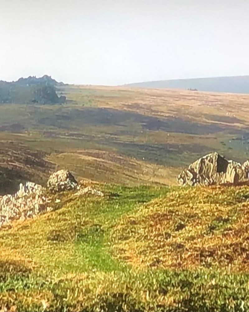
A short, rough walk leads to a site whose scale is mostly invisible in the surviving stones. The combination of four remaining monoliths and excavated stoneholes makes Waun Mawn compelling precisely because visitors must imagine the much larger circle that once occupied this moorland.
Atmospheric · Wild · Ancient-feeling
Find your way
Open mapWaun Mawn, near Crymych, Pembrokeshire, SA41 3TU
Opening map…
Know this place a little better?
The experience
Allow around an hour for the 1 km walk and time at the stones, plus whatever time you need to reach and return from the site. Expect natural, uneven, boggy ground rather than a surfaced visitor path. The National Park’s short walk is the only sourced itinerary here; no unsourced nearby stops are added.
Things to do
Find the surviving stones
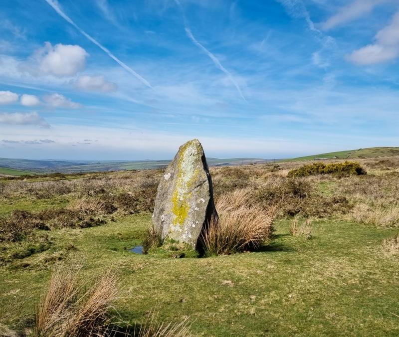
Follow the National Park’s described route from the B4329 to the stone group. Coflein records one erect monolith and three nearby prostrate stones.
About 30 minutes for the 1 km walk according to the National Park; the excerpt does not clarify whether this is one way or the full walk.
Picture the former circle
The 2018 excavation identified a circle around 110 m in diameter and stoneholes for stones removed in antiquity. The surviving stones are only part of the archaeological evidence for the site.
Notice the moorland route underfoot
The National Park describes the approach as uneven and boggy, with natural surfaces and reasonably gentle gradients. Take care on the ground and do not assume the route is suitable for every visitor.
Make a day of it
Quick escape · About 30 minutes each way is not stated; the National Park gives 30 minutes for the 1 km walk, with no return-time clarification. Allow extra time to explore and check the route details before setting out.
The short walk to the stones
- 01
Use the Pembrokeshire Coast National Park walk information to locate the two permitted laybys; parking is limited.
- 02
From the B4329, follow the bridleway/farm lane for about 50 m, then continue up the slope along the track and across moorland to the stones.
- 03
Look at the surviving stones and consider the larger circle identified through excavation.
- 04
Return by the same route; the supplied walk information describes a 1 km walk and 30-minute duration but does not clearly state whether that duration is one way or for the full walk.
Verified history
Coflein records an erect monolith 1.6 m high and three nearby stones lying prone. A 2018 evaluation excavation identified additional stoneholes and interpreted the remains as a former circle around 110 m in diameter, including stones removed in antiquity. The record describes the circle as the third largest known in Britain. Dating was still in progress in the account supplied by Coflein, and the researchers noted that the evidence could not determine whether the circle was completed. The site has been investigated in connection with the Welsh origins of Stonehenge; the supplied evidence supports that research context, not a definitive account of the stones’ journey or purpose.
Hidden details
The stones that are no longer there — Excavation identified holes or stone packing for stones removed in antiquity. These buried traces help explain why the surviving stones do not show the full scale of the proposed circle.
An unresolved question about the circle — Coflein’s account says gaps in the excavated arc may suggest the circle was never completed, but also notes that the evidence cannot settle that question. Treat completion as unresolved, not as established fact.
When to go
· No verified recommendation; choose a time when you can safely manage the moorland approach and check current access conditions.
The supplied research gives no reliable seasonal guidance. The route is described as uneven and boggy, so weather and ground conditions may affect the walk.
Expect natural, uneven ground described by the National Park as boggy. Check current weather and access conditions before visiting.
The route
- surface
- Natural surfaces; bridleway/farm lane followed by track and moorland
- distance
- 1 km
- duration
- 30 minutes; the supplied excerpt does not clarify whether this is one way or the full walk
- difficulty
- Reasonably gentle gradients; uneven and boggy ground
- start point
- B4329, following the bridleway/farm lane described by the National Park
- parking start
- Limited parking at two laybys shown on the National Park map; do not park in gateways or passing places.
- Surviving standing and recumbent stones
- Landscape of the possible former 110 m stone circle
- Moorland approach
What to look for
- 01
The standing monolith, about 1.6 m high in Coflein’s record
- 02
three nearby stones lying prone
- 03
and the wider setting of the proposed circle. The 2018 excavation identified additional stoneholes, including holes for stones removed in antiquity—features that are not necessarily visible on the ground.
The story
Prehistoric archaeology; possible Neolithic stone circle
Best time to go
No source-supported seasonal recommendation; check ground and weather conditions before visiting.
No verified best season or time of day is available. Choose conditions suitable for walking over uneven, potentially boggy moorland and check access before departure.
How long to spend
1–2 hours
Perfect for
Walkers · History lovers · Photographers
Before you go
Address
Website
Listed hours
- Monday: Open 24 hours
- Tuesday: Open 24 hours
- Wednesday: Open 24 hours
- Thursday: Open 24 hours
- Friday: Open 24 hours
- Saturday: Open 24 hours
- Sunday: Open 24 hours
Check before visiting.
Google rating
Practical information
Opening & access
The Pembrokeshire Coast National Park describes a 1 km walk from the B4329 along a bridleway/farm lane and across moorland to the stones. Ground is uneven and boggy. Parking is limited to two laybys; do not park in gateways or passing places. Check current access conditions before setting out.
Check before visiting
Parking
Parking is limited to two laybys shown on the Pembrokeshire Coast National Park walk map. Do not park in gateways or passing places.
Toilets
Check before visiting
Check before visiting
Food & drink
Check before visiting
Check before visiting
Dogs
Check before visiting
Check before visiting
Accessibility
The National Park describes an uneven, boggy route with natural surfaces and a reasonably gentle gradient. Google source information says the car park and entrance are not wheelchair accessible. Check current conditions and suitability before travelling.
Check before visiting
Cost
Check before visiting
Check before visiting
Gallery
Place photographsKeep exploring
Around Waun Mawn Standing Stones
Within 50 km · approximate straight-line distances