Vatersay, Isle of Barra, Outer Hebrides, Scotland
Traigh Shiar
Beach
Place photograph
5.9
Wildland
1–2 hours
Time
Check
Cost
Wild
Feel
Why it's Wildland
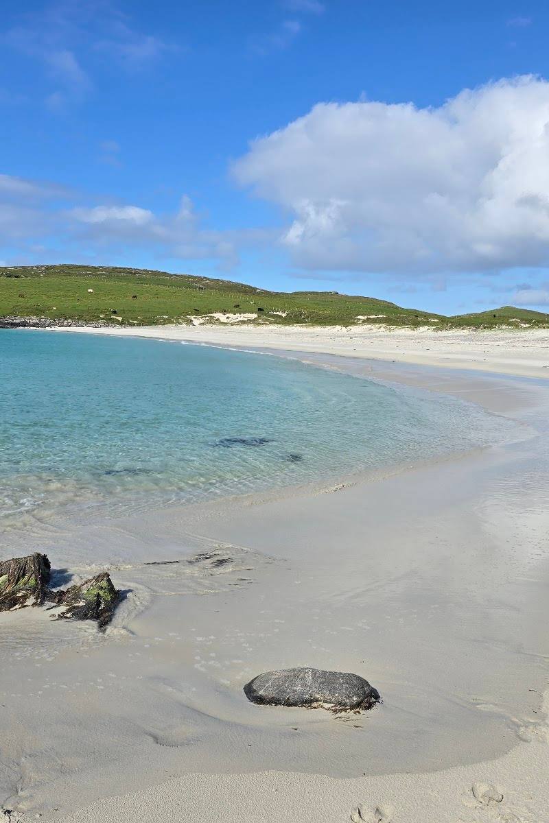
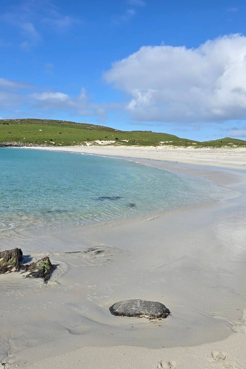
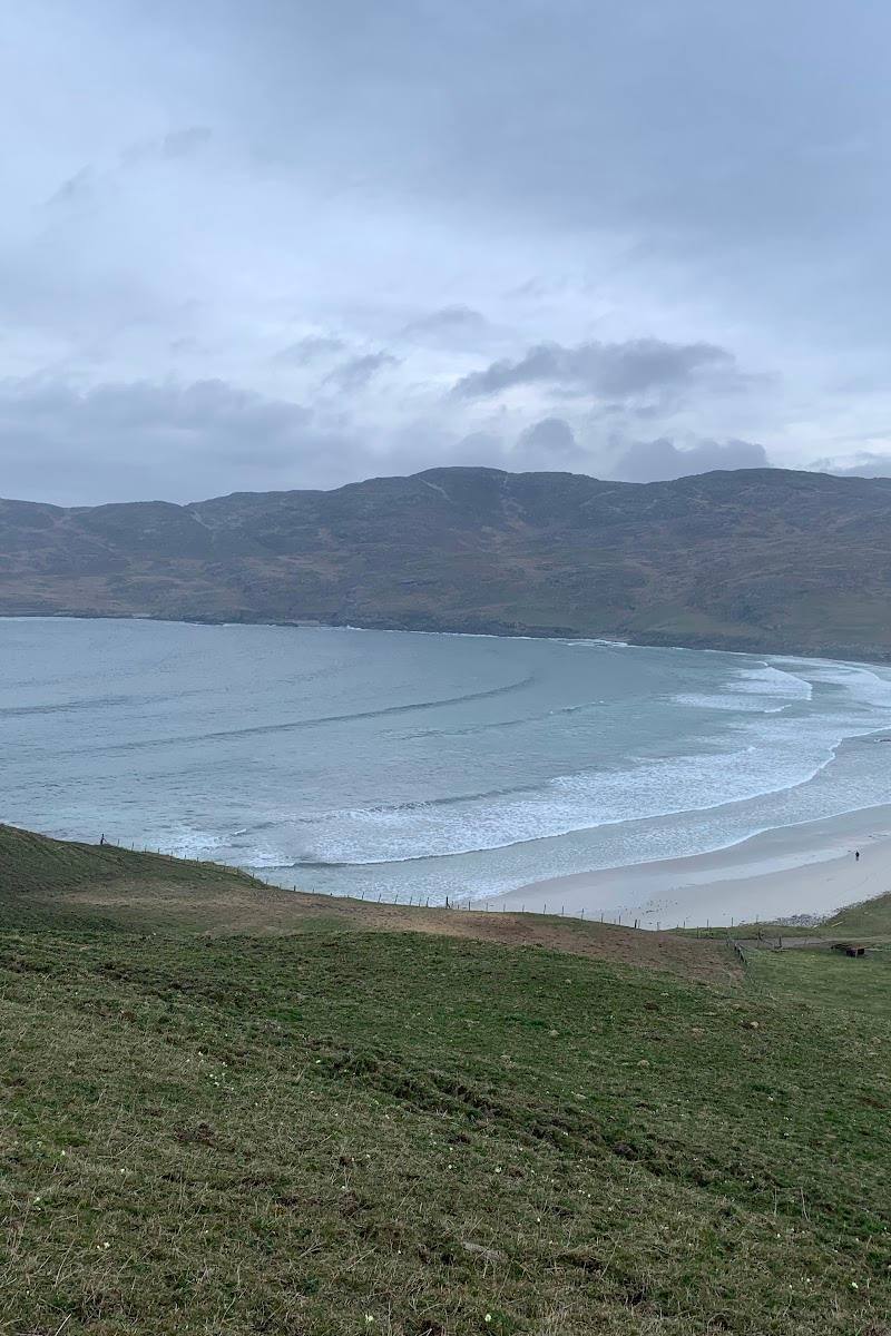
5.9A wave-facing beach on Vatersay, where the Atlantic side of the island feels markedly different from its more sheltered eastern shore.
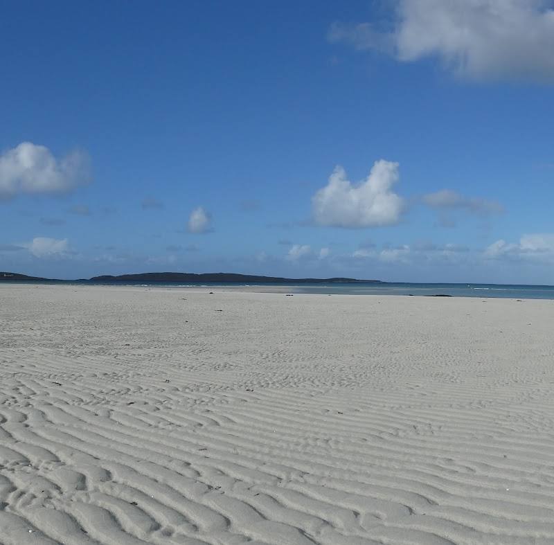
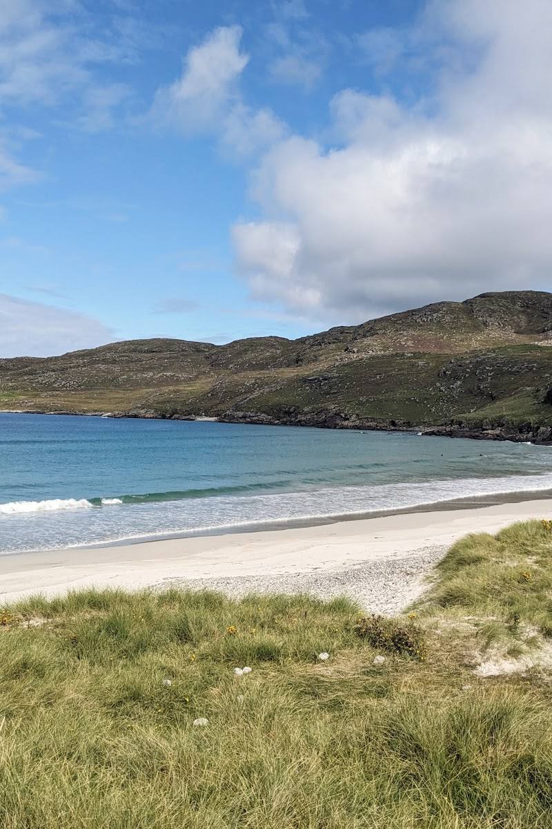
Traigh Shiar stands out for its Atlantic-facing character: the route source describes it as a beach shaped by waves, in contrast to the opposite side of Vatersay. It offers a coastal stop within a remote-island landscape, though detailed facilities and access information are not available in the supplied sources.
Wild · Dramatic
Find your way
Open mapVatersay, Isle of Barra, Outer Hebrides, Scotland
Opening map…
Know this place a little better?
The experience
Visit for the Atlantic-facing coastal setting and, if conditions and access allow, include Traigh Shiar as a stop on the Vatersay beaches loop. The supplied sources do not verify swimming permission, facilities or a specific beach access route.
Things to do
Notice the wave-facing shore
Take in Traigh Shiar’s waves and compare its character with Traigh a Bhaigh on the opposite side of Vatersay.
Include the beach on a Vatersay loop
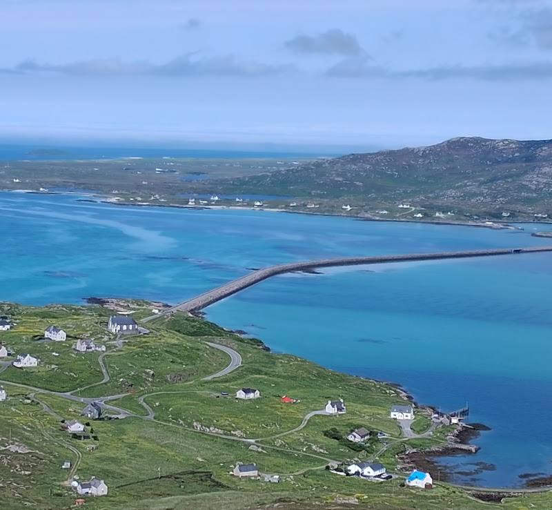
Traigh Shiar is listed as a waypoint on a 4.89 km Vatersay beaches hiking loop. The route source estimates 1 hour 15 minutes and 43 m of ascent, and warns of off-grid segments and limited navigation instructions.
About 1 hour 15 minutes for the loop
Make a day of it
Quick escape · Allow 1–2 hours; this is a suggested visit duration, not a sourced estimate.
A coastal stop at Traigh Shiar
- 01
Check local access and weather before setting out.
- 02
Visit Traigh Shiar and take in its wave-facing coastal character.
- 03
Compare its Atlantic-facing feel with the more sheltered Traigh a Bhaigh on the other side of Vatersay.
Half day · About 1 hour 15 minutes for the sourced loop; allow extra time for beach stops.
Make a half day of Vatersay’s beaches
- 01
Start at the parking waypoint identified for the Vatersay beaches loop, after checking its location and current access.
- 02
Follow the 4.89 km loop, which takes about 1 hour 15 minutes and includes Traigh Shiar as a waypoint.
- 03
Pause at Traigh Shiar and take in its wave-facing shore.
- 04
Continue the loop only if navigation and conditions are suitable; the route source notes off-grid segments and potentially limited navigation instructions.
Hidden details
A contrast between Vatersay’s shores — The route’s beach description contrasts wave-facing Traigh Shiar with Traigh a Bhaigh on the other side of the island.
When to go
· Not established by the supplied sources.
The supplied sources do not provide seasonal advice for Traigh Shiar.
Check local weather and coastal conditions before visiting. The supplied route source notes off-grid sections and potentially limited navigation instructions.
The route
- ascent
- 43 m
- distance
- 4.89 km for the Vatersay beaches loop
- duration
- About 1 hour 15 minutes
- difficulty
- Komoot labels the route moderate; its general difficulty descriptions also mention easy routes for all skill levels.
- waymarking
- Navigation instructions may be limited.
- route shape
- Loop
- start point
- The route source marks a start point and parking waypoint but does not provide a textual location.
- parking start
- Parking is marked at the route start waypoint; check its precise location and current availability.
- Traigh Shiar Beach waypoint
- Contrasting beach character on the opposite side of Vatersay
Worth pairing with
Traigh a Bhaigh
The route source contrasts this beach on the other side of Vatersay with wave-facing Traigh Shiar.
What to look for
Notice the wave-facing character described for Traigh Shiar, and how it contrasts with Traigh a Bhaigh on the other side of Vatersay.
Best time to go
Not established by the supplied sources; check local conditions before travelling.
The supplied sources do not identify a best season or time of day. Check weather and local conditions before setting out.
How long to spend
1–2 hours
Perfect for
Walkers · Photographers
Before you go
Address
Google rating
Practical information
Opening & access
Located on Vatersay. The supplied sources identify a beach waypoint on a Vatersay beaches walking loop, but do not establish detailed access arrangements. Check locally before visiting. Access arrangements are unconfirmed. Check before visiting; do not enter private land or restricted structures.
Check before visiting
Parking
A Vatersay beaches loop source marks parking at its start, but does not confirm parking specifically for Traigh Shiar. Check locally.
Check before visiting
Toilets
Check before visiting
Check before visiting
Food & drink
Check before visiting
Check before visiting
Dogs
Check before visiting
Check before visiting
Accessibility
The supplied route is described as an easy-to-moderate 4.89 km loop with 43 m of ascent, but includes off-grid segments and may have limited navigation instructions. It is not confirmed to be an accessible route to or along the beach.
Cost
Check before visiting
Check before visiting
Water
Sea
Gallery
Place photographsKeep exploring
Around Traigh Shiar
Within 50 km · approximate straight-line distances