8.0
Wildland
Half day
Time
Check
Cost
Peaceful
Feel
Why it's Wildland
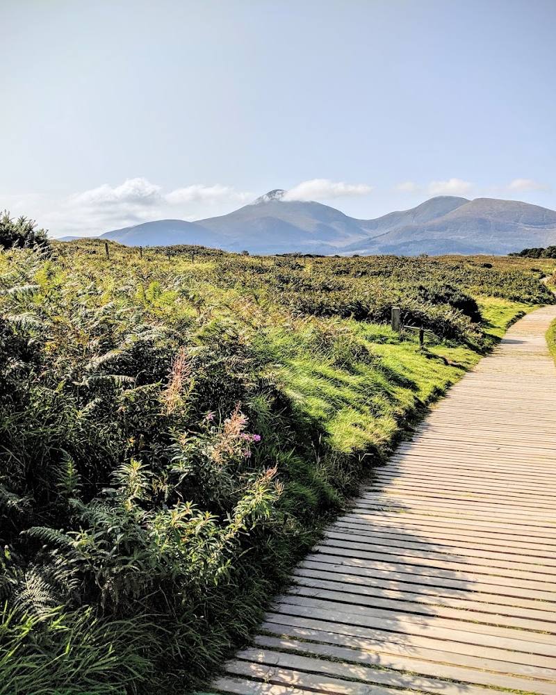
8.0Strangford Lough is an island-studded sea inlet whose shores bring together wildlife-rich water, drowned drumlin hills and a long human history. Its scale is best appreciated slowly: on a coastal path, from a shoreline village or on a locally operated water-based tour.
This is a landscape with real scale and variety: an island-studded sea lough, dramatic drumlin-lined shores and a strong combination of wildlife and human history. The experience is spread across the shoreline rather than concentrated at one viewpoint, so choosing a specific walk, village or verified tour makes for a better visit.
Peaceful · Dramatic · Wild · Big-sky
Find your way
Open mapCounty Down, Northern Ireland
Opening map…
Know this place a little better?
The experience
Choose one shoreline section rather than trying to cover the whole lough. A coastal walk is a grounded way to take in the views; for time on the water, use a locally operated tour and check its availability and conditions directly.
Things to do
Walk a section of the lough shore
Choose a coastal path and take time with the open-water views, islands and drowned drumlin scenery. Confirm the access point and route details before travelling.
Check route locally
Explore the shoreline at Kearney
The supplied tourism source describes a coastal walk from historic Kearney Village along the shore. Check the village car park and current access arrangements before visiting.
Check route locally
Look for wildlife from shore or on a guided tour
The supplied sources mention seals and a variety of birds around the lough. A water-based tour may offer a different perspective; sightings and tour availability are not guaranteed.
Make a day of it
Quick escape · 1–2 hours
A short shoreline escape
- 01
Choose one coastal path or shoreline access point rather than attempting to see the whole lough.
- 02
Walk a section with open views over the water and drumlin-lined shore.
- 03
Pause to scan the islands and water for wildlife; sightings are not guaranteed.
- 04
Check access, parking and current conditions for your chosen starting point before setting out.
Half day · Half day
Make a half day of the lough
- 01
Pick a shoreline walk suited to your plans; the supplied sources describe coastal routes at Kearney and other points around the lough.
- 02
Allow time to take in the island-studded water and the drowned drumlin landscape rather than rushing between stops.
- 03
If you want to go on the water, investigate a locally operated boat, kayak or paddleboard tour and confirm availability, conditions and permission directly.
- 04
Finish in a nearby town or village; the National Trust notes cafés, art galleries and antiques among local-town options, but check what is open.
Verified history
The supplied Tourism Ireland source describes a landscape shaped by Vikings, Normans and medieval monks, and identifies 12th-century Inch Abbey as a nearby historic site. It also describes Kearney as a historic village. These are regional connections, not a single continuous account of the lough’s history.
Hidden details
Drowned drumlin shoreline — Look for the rounded, partly submerged hill forms along the shore: the National Trust source describes the distinctive scenery as drowned drumlins.
The Narrows’ tidal currents — The supplied Tripadvisor description notes strong tidal currents where the Narrows funnels the water. Treat this as a reason to check local conditions and use qualified operators, not as an invitation to enter the water.
When to go
· No specific time is established by the supplied sources; check conditions and any activity operator’s schedule.
The supplied research does not establish a reliable best season for visiting the lough as a whole.
Check local weather, shoreline conditions and tidal information before choosing a walk or water-based activity.
Worth pairing with
Kearney Village and coastal path
A source-supported pairing for a shoreline visit: the tourism source describes a coastal walk from the historic village. Confirm local access and parking before setting out.
Inch Abbey
A nearby 12th-century monastic ruin mentioned by Tourism Ireland; check current visitor access and opening arrangements.
Strangford–Portaferry ferry crossing
Tourism Ireland describes the crossing as a short connection between the Ards and Lecale peninsulas, with views of villages, hills and water. Check current sailing information before relying on it.
What to look for
- 01
Look across the shoreline for the distinctive drowned drumlin hills and scattered islands. On a suitable walk or guided water tour, watch for seals and seabirds
- 02
sightings are not guaranteed.
The story
Vikings, Normans, medieval monastic sites and historic coastal settlements.
Best time to go
Check local conditions and activity availability before travelling; the supplied sources do not establish a best season.
No best time of day is established by the supplied sources. Check conditions and any operator schedules before travelling.
How long to spend
Half day
Perfect for
Walkers · Wildlife lovers · Photographers · History lovers
Before you go
Google rating
Practical information
Opening & access
A large sea lough with places to explore along its shoreline. Access, parking and facilities vary by location; check the relevant site before setting out.
Check before visiting
Parking
Parking information depends on the chosen shoreline access point; check before visiting.
Check before visiting
Toilets
Check before visiting.
Check before visiting
Food & drink
The source describes cafés in local towns and villages; check current options and opening times before visiting.
Check before visiting
Dogs
Check before visiting.
Check before visiting
Accessibility
Terrain and access vary around the lough. The supplied sources mention coastal paths, woodland paths and farmland walks, but do not establish step-free access or accessibility provision.
Cost
Check before visiting
Check before visiting
Water
Sea lough; sheltered waters and tidal currents in the Narrows are described in the supplied sources. Water activity permission and conditions must be checked with the relevant operator or access authority.
Check before visiting
Gallery
Place photographs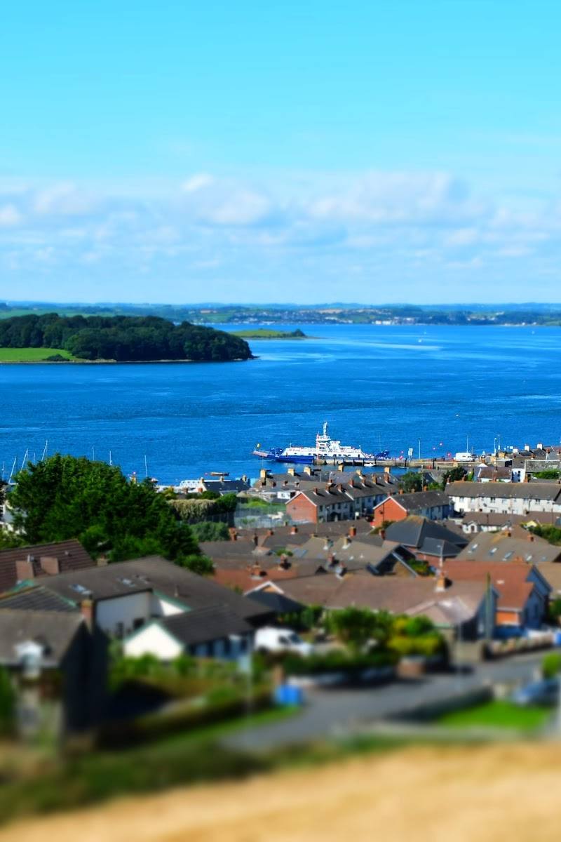


Keep exploring
Around Strangford Lough
Within 50 km · approximate straight-line distances