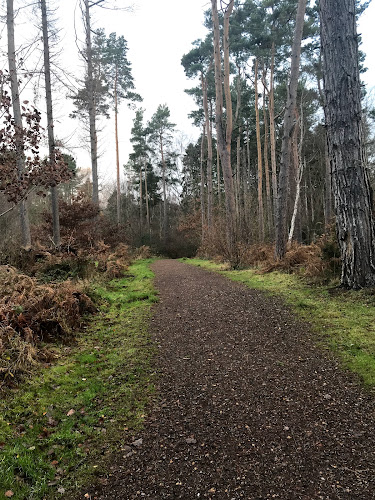
Smiddy Shaw Reservoir, Muggleswick Common, County Durham
Smiddy Shaw Reservoir Loop
route · Waterside walk
Source image
5.6
Wildland
1–2 hours
Time
Check
Cost
Peaceful
Feel
Why it's Wildland
5.6A quiet circuit beside a North Pennines reservoir, with open-water views and upland countryside. The reservoir was completed by 1872 and forms part of a group of three reservoirs on Muggleswick Common.
The appeal is a simple, open-water walk in a broad upland setting, with a specific reservoir history and a reported chance of seeing red grouse and red kites. It is a worthwhile short outing, but the available sources support a modest, practical listing rather than claims of unusual facilities or hidden features.
Peaceful · Big-sky
Find your way
Open mapSmiddy Shaw Reservoir, Muggleswick Common, County Durham
Opening map…
The experience
Follow a circular route beside Smiddy Shaw Reservoir, pausing for the water views and scanning the surrounding moorland for birds. The supplied route sources give different circuit lengths, so choose a route description before setting off rather than assuming the circuits are identical.
Things to do
Walk a circular route beside the reservoir
Follow a sourced loop around Smiddy Shaw Reservoir. AllTrails describes a 3.9-mile, 1–1.5-hour loop from Hawkburn Head car park; Ramblers Routes lists a separate 1.8-mile, 52-minute route. Check the route details and map before choosing.
52 minutes to 1.5 hours, depending on the route
Watch for upland birds
The Ramblers route description suggests looking for red grouse in the heather and red kites overhead.
Make a day of it
Quick escape · About 52 minutes for the Ramblers route; a separate AllTrails circuit is listed at 1–1.5 hours.
Quick reservoir circuit
- 01
Choose one of the sourced circular route descriptions before starting; they give different distances.
- 02
Walk the reservoir circuit and pause at open stretches for views across the water.
- 03
Scan the surrounding countryside for red grouse and red kites.
Verified history
Smiddy Shaw Reservoir was completed by 1872 and is owned and operated by Northumbrian Water. It is one of three reservoirs on Muggleswick Common; Smiddy Shaw and Waskerley feed water by gravity towards a treatment works at Honey Hill, while Hisehope feeds into Smiddy Shaw.
Hidden details
Part of a three-reservoir system — Smiddy Shaw is one of three reservoirs on Muggleswick Common. Hisehope feeds into Smiddy Shaw, while Smiddy Shaw and Waskerley feed water towards a treatment works at Honey Hill.
When to go
· Not specified in the supplied sources.
The supplied sources do not establish a best season.
Check the forecast and current ground conditions before walking; the supplied sources do not give specific weather or path-condition guidance.
The route
- ascent
- AllTrails: 190 ft.
- distance
- AllTrails: 3.9 miles; Ramblers Routes lists a separate 1.8-mile route.
- duration
- AllTrails: 1–1.5 hours; Ramblers Routes: 52 minutes.
- difficulty
- AllTrails: moderate; Ramblers Routes: easy.
- route shape
- Loop / circular
- start point
- Hawkburn Head car park is the start described by AllTrails; Ramblers Routes also identifies a car park at Smiddy Shaw Reservoir.
- parking start
- AllTrails identifies Hawkburn Head car park as the start. Check current availability and access before travelling.
- shorter alternative
- Ramblers Routes lists a separate 1.8-mile, 52-minute easy circular route. Check its route map; it may not be the same circuit as the 3.9-mile AllTrails route.
- Views across Smiddy Shaw Reservoir
- Open North Pennine countryside
- Reported chances to see red grouse and red kites
What to look for
Look across the reservoir and over the surrounding upland for red grouse and red kites, which the Ramblers route description identifies as wildlife to watch for.
The story
Reservoir engineering and water supply
Best time to go
Not specified in the supplied sources; check local conditions before visiting.
No specific season or time of day is established by the supplied sources. Check the forecast and ground conditions before setting out.
How long to spend
1–2 hours
Perfect for
Walkers · Wildlife lovers · Photographers
Route at a glance
Duration
1–2 hours
Terrain
Lakeside, Hills
Parking / start
The AllTrails route starts at Hawkburn Head car park. Check availability and current arrangements before travelling.
Practical information
Opening & access
A circular walk is described from Hawkburn Head car park. Check current access and parking arrangements before setting out.
Check before visiting
Parking
The AllTrails route starts at Hawkburn Head car park. Check availability and current arrangements before travelling.
Check before visiting
Toilets
Check before visiting
Check before visiting
Food & drink
Check before visiting
Check before visiting
Dogs
Check current access rules and signage before visiting.
Check before visiting
Accessibility
A separate Ramblers route is described as easy; this does not establish step-free or wheelchair access. Check route conditions before visiting.
Check before visiting
Cost
Check before visiting
Check before visiting
Water
Reservoir
Gallery
Place photographsKeep exploring
Around Smiddy Shaw Reservoir Loop
Within 50 km · approximate straight-line distances