Porth Penmon, Anglesey, Wales, LL58 8RW
Porth Penmon Quarry Loading Pier
Industrial heritage
Place photograph
3.8
Wildland
Under 1 hour
Time
Check
Cost
Atmospheric
Feel
Why it's Wildland
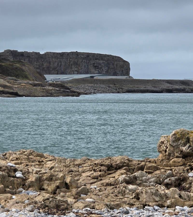
3.8A surviving piece of Penmon’s quarrying past: this loading pier once connected the quarry to its workings by tramway and was marked on historic mapping with a travelling crane.
The interest here is a tangible fragment of a coastal industrial landscape rather than a developed visitor attraction. The documented remains of the quarry’s loading pier offer a focused, place-specific glimpse into how stone was moved from Penmon.
Atmospheric
Find your way
Open mapPorth Penmon, Anglesey, Wales, LL58 8RW
Opening map…
Know this place a little better?
The experience
A short, history-led visit centred on the recorded remains of Penmon Quarry’s loading pier. Current access and on-site interpretation are not confirmed.
Things to do
Trace the quarry’s route to the shore
Use the recorded site history to understand the loading pier’s former connection to Penmon Quarry: historic mapping shows it linked by tramway to the quarry’s incline. The present condition of that route is not confirmed.
Under 1 hour
Look for the loading pier remains
Coflein records the pier as extant. Check access before visiting and avoid entering any restricted structure or land.
Under 1 hour
Make a day of it
Quick escape · Under 1 hour
A short look at the quarry loading pier
- 01
Check current access arrangements before visiting.
- 02
If access is available, view the recorded remains of the loading pier from a permitted route.
- 03
Look for evidence of the structure’s former role as a quarry wharf; do not assume the historic tramway or crane survives on site.
Verified history
The site record identifies the structure as the loading pier for Penmon Quarry and describes it as extant. First-edition Ordnance Survey mapping shows it linked by tramway to the quarry’s incline; a map annotation also records a travelling crane. The record cites aerial photography from 2006–09 and historic mapping. It does not establish whether the tramway or crane survives on the ground.
Hidden details
A tramway connection on the historic map — The first-edition 25-inch Ordnance Survey mapping shows the loading pier linked to the quarry’s incline by tramway. This is a documented historical detail; the route’s surviving traces are not confirmed.
The travelling crane annotation — A historic map annotation records a travelling crane at the loading pier. The source does not confirm that any crane remains survive.
When to go
· No evidence-backed best time is available; check access and conditions before visiting.
The supplied site record gives no seasonal guidance.
Coastal weather and ground conditions may affect a visit. Check conditions and access before setting out.
What to look for
Look for the surviving pier structure and consider its former role as the quarry’s loading point. The historic mapping records a tramway connection and a travelling crane, but their remains on site are not confirmed.
The story
Industry
Best time to go
No season-specific information is confirmed; check local conditions before visiting.
No particular time of day is documented as best. Check conditions and access before setting out.
How long to spend
Under 1 hour
Perfect for
History lovers · Walkers · Photographers
Before you go
Practical information
Opening & access
The historic loading pier is recorded as extant, but current access arrangements are not confirmed. Check before visiting and do not enter restricted areas. Access arrangements are unconfirmed. Check before visiting; do not enter private land or restricted structures.
Check before visiting
Parking
Parking information for the pier is not confirmed. Check before visiting.
Check before visiting
Toilets
Check before visiting.
Check before visiting
Food & drink
Check before visiting.
Check before visiting
Dogs
Check before visiting.
Check before visiting
Accessibility
Surface conditions, step-free access and the route to the pier are not confirmed. Check before visiting.
Check before visiting
Cost
Check before visiting
Check before visiting
Water
Sea
Gallery
Place photographsKeep exploring
Around Porth Penmon Quarry Loading Pier
Within 50 km · approximate straight-line distances