8.3
Wildland
1–2 hours to Full day
Time
Check
Cost
Dramatic
Feel
Why it's Wildland
8.3A former Midland Railway line now carries a level, traffic-free route through limestone dales, beneath railway tunnels and across the landmark Headstone Viaduct.
This is more than a flat former railway track: its tunnels, viaduct and changing views across the White Peak make the journey itself the attraction. Choose a short out-and-back for the signature scenery, or use the full 8.5 miles for a substantial day on the trail.
Dramatic · Big-sky · Atmospheric
Find your way
Open mapPeak District, Derbyshire
Opening map…
Know this place a little better?
The experience
Take a short out-and-back from a convenient access point to experience the trail’s railway character and dale scenery, or spend longer linking tunnels, the Headstone Viaduct and former station access points. The whole route is 8.5 miles between Blackwell Mill and Coombs Road in Bakewell.
Things to do
Walk or cycle a section of the trail
Follow the traffic-free former railway line through the White Peak’s limestone dales. The full trail is 8.5 miles; choose a shorter out-and-back to suit your time.
1–2 hours to Full day
See the Headstone Viaduct
Pause at the trail’s landmark viaduct and look across the limestone-dale landscape.
Pass through the railway tunnels
Experience the route’s former railway engineering as the trail passes through its tunnels. Check current conditions and guidance before setting out.
Make a day of it
Quick escape · 1–2 hours
Quick Escape: a tunnel-and-dale out-and-back
- 01
Start from a suitable trail access point and follow the level route towards a tunnel or dale viewpoint.
- 02
Walk as far as time allows, taking in the former railway corridor and limestone scenery.
- 03
Turn back along the same route; check current trail and access information before setting out.
Half day · Half day
Make a Half Day of It: follow the trail to the viaduct
- 01
Choose an access point at Bakewell, Hassop or Millers Dale and check parking and current conditions.
- 02
Follow the traffic-free trail towards the Headstone Viaduct, enjoying the views across the limestone dales.
- 03
Continue through a section of the former railway tunnels, then return to your starting point or plan a suitable onward connection.
Full Wildland day · Full day
Full Wildland Day: take on the full trail
- 01
Plan the 8.5-mile trail between Blackwell Mill and Coombs Road in Bakewell, checking transport, parking and current access arrangements in advance.
- 02
Allow time for the Headstone Viaduct, the railway tunnels and stops to take in the limestone-dale scenery.
- 03
Use one of the trail’s access points to plan breaks; verify refreshment availability before travelling.
Verified history
The Monsal Trail follows the former Manchester to London Midland Railway line, which closed in the late 1960s. Its route now connects the former railway landscape with a traffic-free trail through the limestone dales. The supplied Peak District National Park source gives the closure period but does not provide a more precise date.
Hidden details
Read the landscape as a railway route — Notice how the trail follows the former railway line through tunnels and across the Headstone Viaduct; these are visible clues to the route’s past use.
When to go
· No specific time of day is established by the supplied sources. Choose a clear spell for the dale views and check conditions before travelling.
The supplied sources describe the route as a year-round trail but do not identify a particular season as best. Weather and current trail conditions should guide plans.
Check the forecast and current trail conditions before setting out. The supplied sources do not specify weather-related closures or surface conditions.
The route
- surface
- Described as flat; the supplied source does not specify the full surface construction.
- distance
- 8.5 miles
- difficulty
- Easy, based on the described flat route; check current conditions.
- route shape
- Linear between Blackwell Mill and Coombs Road in Bakewell; shorter out-and-back walks are possible.
- start point
- Access points include Bakewell, Hassop and Millers Dale; the trail’s furthest points are Blackwell Mill and Coombs Road in Bakewell.
- parking start
- Pay-and-display car parks are available at the former stations at Bakewell, Hassop and Millers Dale. Check current parking details.
- shorter alternative
- Choose a short out-and-back from one of the trail access points; the supplied source does not specify a particular shorter route distance.
- Headstone Viaduct
- Railway tunnels
- Views through limestone dales
- Former railway corridor
What to look for
Look for the Headstone Viaduct, the trail’s former railway tunnels and the changing limestone-dale views. The route follows the former Manchester to London Midland Railway line.
The story
Railway; Industrial heritage
Best time to go
Year-round, subject to weather and current trail conditions.
Choose a clear day for the strongest views across the dales. Check conditions before travelling, particularly after wet or unsettled weather.
How long to spend
1–2 hours to Full day
Perfect for
Walkers · Cyclists · Families · Young children · Photographers
Route at a glance
Duration
1–2 hours to Full day
Terrain
Valley, Hills
Parking / start
Pay-and-display car parks are available at the former stations at Bakewell, Hassop and Millers Dale. Check current parking information before travelling.
Before you go
Practical information
Opening & access
The Peak District National Park describes the Monsal Trail as a traffic-free route open to walkers, cyclists, horse riders and wheelchair users. Check current conditions and access information before setting out.
Check before visiting
Parking
Pay-and-display car parks are available at the former stations at Bakewell, Hassop and Millers Dale. Check current parking information before travelling.
Check before visiting
Toilets
Check before visiting.
Check before visiting
Food & drink
The Peak District National Park notes refreshment stops along the trail; check current availability before setting out.
Check before visiting
Dogs
Check current trail guidance and signage before visiting.
Check before visiting
Accessibility
The route is described by the Peak District National Park as flat and suitable for wheelchair users, families with pushchairs and strollers. Surface and conditions may vary; check current access information.
Check before visiting
Cost
Check before visiting
Check before visiting
Water
River
Gallery
Place photographs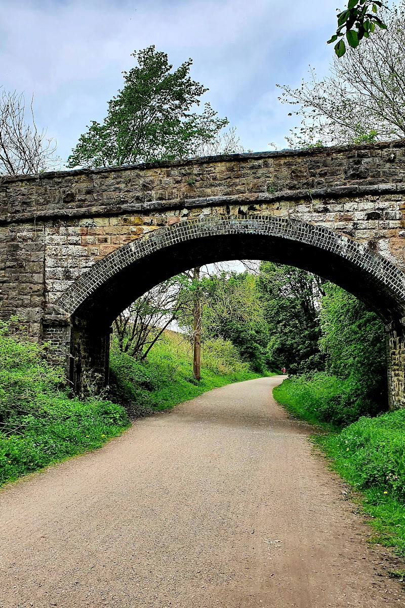
Keep exploring
Around Monsal Trail
Within 50 km · approximate straight-line distances