8.2
Wildland
1–2 hours
Time
Check
Cost
Dramatic
Feel
Why it's Wildland
8.2A sharply ridged limestone hill known as the Dragon’s Back, formed from an ancient reef and rising above the Upper Dove Valley.
Chrome Hill’s serrated ridge is unusually distinctive: a rugged limestone reef knoll whose steep, rocky ascent leads to broad views over the Peak District. It offers a more demanding and memorable outing than a simple viewpoint stop.
Dramatic · Wild · Big-sky
Find your way
Open mapNear Buxton, Derbyshire
Opening map…
Know this place a little better?
The experience
A hill walk with a steep, rocky climb and expansive Peak District views. Allow time for the ascent and take care in wet conditions; the terrain may not suit every walker.
Things to do
Climb the Dragon’s Back
Walk the steep, rocky route towards Chrome Hill’s distinctive ridge. The supplied guide rates its route hard and warns that wet conditions can make the terrain hazardous.
2.5–3.5 hours for the guide’s 4.9-mile return route
Take in the views from the ridge
Look out across the rolling hills and Upper Dove Valley from the elevated ground. Visibility and conditions will affect the experience.
Compare Chrome Hill with Parkhouse Hill
Notice the two recognisable limestone hills together in the Upper Dove Valley; their rugged outlines are part of the landscape known as the Dragon’s Back.
Look for limestone flora
The hills are designated a Site of Special Scientific Interest for their limestone flora. Visit Peak District specifically notes the rare Jacob’s Ladder plant; do not assume it will be in flower or visible on every visit.
Make a day of it
Quick escape · Allow around 2.5–3.5 hours for the sourced route; it is described as a hard walk.
Quick Escape: climb Chrome Hill
- 01
Set out on a route to Chrome Hill only after checking current access, weather and conditions.
- 02
Climb the steep, rocky sections with suitable footwear and care, particularly if the ground is wet.
- 03
Pause for views across the surrounding Peak District hills and the Upper Dove Valley.
- 04
Return by your chosen route; the supplied route guide describes a 4.9-mile return walk, but check its map and directions before relying on it.
Half day · Check route and timings before setting out.
Make a half day of it: Chrome Hill and Parkhouse Hill
- 01
Plan a walk that takes in Chrome Hill and Parkhouse Hill; the two hills are linked by several routes, according to Visit Peak District.
- 02
Use the supplied route guide to check the line, distance and conditions rather than improvising across steep or rocky ground.
- 03
Take time to view the Dragon’s Back ridge and the surrounding limestone landscape.
- 04
The Quiet Woman pub in Earl Sterndale is named as a nearby starting point for walks; verify current access, opening and parking arrangements before making plans.
Verified history
Chrome Hill and neighbouring Parkhouse Hill are limestone reef knolls. Visit Peak District says they formed as former coral reefs around 340 million years ago. The hills are designated a Site of Special Scientific Interest for their limestone flora, including the rare Jacob’s Ladder plant.
Folklore & legend
The name Dragon’s Back refers to the resemblance of Chrome Hill’s rugged, curved ridge to the plates along a stegosaurus’s spine. This is a descriptive nickname, not a historical legend.
Hidden details
A reef in the hills — The striking hill shape has a geological story: the neighbouring knolls are described as former coral reefs formed around 340 million years ago.
Jacob’s Ladder — The SSSI is noted for limestone flora, including rare Jacob’s Ladder. Treat it as a possibility to look for, not a guaranteed sighting.
When to go
· Choose a clear period for views; check the forecast and ground conditions before setting out.
The supplied sources do not establish a best season. Wet conditions can make steep, rocky sections hazardous; the limestone flora is a reason to take time over the landscape, but no flowering dates are provided.
The route guide warns that steep rocky stretches can be hazardous in wet weather. Check forecast and ground conditions before walking.
The route
- ascent
- 1,427 ft
- surface
- Steep and rocky in places; may be hazardous when wet
- distance
- 4.9 mi return for the route in the supplied guide
- duration
- 2.5–3.5 hours
- difficulty
- Hard
- route shape
- Return route, according to the supplied guide
- start point
- The supplied route guide gives trailhead coordinates 53.200157, -1.866527. Visit Peak District also names the Quiet Woman pub in Earl Sterndale as a possible starting point for walks near Chrome Hill.
- parking start
- Check before visiting; the supplied sources do not confirm parking arrangements.
- Chrome Hill’s distinctive Dragon’s Back ridge
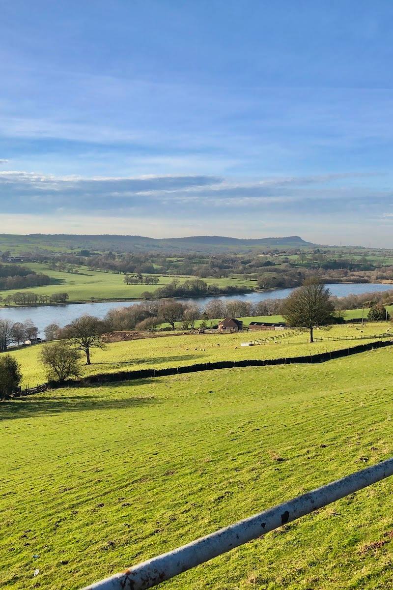
- Views across the rolling hills and surrounding Peak District countryside
- Limestone landscape and flora
Worth pairing with
Parkhouse Hill
A neighbouring, smaller limestone reef knoll that can be included in a walk around the Dragon’s Back landscape. Check route details and conditions before linking the hills.
The Quiet Woman, Earl Sterndale
Visit Peak District identifies this pub as one of the best places to start a walk near Chrome Hill. Confirm current opening, access and parking before planning a visit.
What to look for
- 01
From below, look for the serrated ridge that gives Chrome Hill its Dragon’s Back nickname. On the hill, notice the rugged limestone and the changing views across the Upper Dove Valley
- 02
the area is also noted for limestone flora, including rare Jacob’s Ladder.
The story
Ancient limestone reef; geological history
Best time to go
Check conditions before visiting; wet weather can make the steep, rocky sections hazardous.
Choose a clear, settled period for views from the ridge. Avoid or take extra care on wet ground, when steep rocky sections can be hazardous.
How long to spend
1–2 hours
Perfect for
Walkers · Photographers · History lovers
Before you go
Address
Google rating
Practical information
Opening & access
The hill is reached on footpaths. The supplied route guide describes steep, rocky sections that can be hazardous when wet. Check current access and conditions before setting out.
Check before visiting
Parking
Check before visiting
Check before visiting
Toilets
Check before visiting
Check before visiting
Food & drink
Check before visiting
Check before visiting
Dogs
Check before visiting
Check before visiting
Accessibility
The steep, rocky ascent is not suitable for all walkers. Check conditions and route suitability before setting out.
Check before visiting
Cost
Check before visiting
Check before visiting
Gallery
Place photographs


Keep exploring
Around Chrome Hill
Within 50 km · approximate straight-line distances