6.5
Wildland
1–2 hours
Time
Check
Cost
Atmospheric
Feel
Why it's Wildland
6.5A holed granite stone stands between two upright stones on the moor: the distinctive remains of a prehistoric stone circle, with its precise original purpose still uncertain.
Mên-an-Tol is a small but unusually memorable encounter with Penwith’s prehistoric landscape: a rare holed stone, open moorland and a longer circular walk linking several ancient sites and mining remains.
Atmospheric · Ancient-feeling
Find your way
Open mapNear Madron, west of Penzance, Cornwall
Opening map…
Know this place a little better?
The experience
Visit the holed stone on the moor, then, if you have time and suitable footwear, follow the documented circular route through a wider landscape of prehistoric monuments and mining remains.
Things to do
Study the holed stone
Look closely at the large round opening, the two upright stones beside it and the fallen stones. The surviving arrangement is described as the remains of a stone circle; the stone’s precise position and function are uncertain.
15–30 minutes
Walk the Mên-an-Tol circular
Follow the documented 3-mile / 4.8 km core loop linking Mên-an-Tol with Lanyon Quoit, the Nine Maidens Stone Circle, Ding Dong mine, Bosiliack Entrance Grave and the Bosiliack round house settlement.
At least 3 hours
Look for Mên Scryfa
On the longer route, the landscape guide directs walkers to look through a field opening for Mên Scryfa, a standing stone with a later inscription on its northern face.
Make a day of it
Quick escape · About 1 hour return, as reported by visitors; allow extra time for the approach and conditions.
Quick escape: see the holed stone
- 01
Use the small roadside parking area near the route start, checking availability and access before travelling.
- 02
Follow the lane and signposted approach; the final access includes a stile.
- 03
Spend time looking at the holed stone, the two upright stones and the fallen stones around them.
- 04
Return by the same approach.
Half day · At least 3 hours; 3 miles / 4.8 km for the core loop.
Make a half day of it: the Mên-an-Tol circular
- 01
Start at the route’s small parking area near Bosullow.
- 02
Visit Mên-an-Tol, then continue on the documented circular route to Lanyon Quoit, the Nine Maidens Stone Circle, Ding Dong mine, Bosiliack Entrance Grave and the Bosiliack round house settlement.
- 03
Allow time to pause at the monuments and read the landscape; expect granite stiles, a gradual climb with one steep section and a short stretch on a public road.
- 04
Check route guidance and conditions before setting out; the guide notes cattle in the Mên-an-Tol area and nearby mine shafts.
Verified history
The visible stones are described as the remains of a stone circle, probably dating to the late Neolithic or early Bronze Age, approximately 2500–1500 BC. A holed stone about 1.2 metres across sits between two upright stones; the original arrangement and purpose are uncertain. The wider landscape includes other prehistoric monuments and evidence of later mining activity.
Folklore & legend
Local healing and divination traditions are associated with the holed stone. One account says people crawled through it anti-clockwise to seek cures, while children were passed through the opening. These are recorded as beliefs and legends, not verified medical or historical facts.
Hidden details
The circle may once have held more stones — The Cornish Ancient Sites Protection Network suggests the circle may originally have comprised 19 stones, while noting that only remains are visible today.
A stone with an uncertain orientation — The site account notes that the holed stone may have been moved and may once have faced at right angles to its present position. This remains a possibility, not a confirmed reconstruction.
When to go
· No particular time of day is established by the supplied sources.
The supplied sources describe the site and route as an outdoor visit but do not identify a best season. The route crosses exposed moorland, so choose a suitable weather window and check conditions.
The circular route can be boggy, and the moorland is exposed. Wear sturdy waterproof footwear and check current route conditions. The route guide also notes cattle in the Mên-an-Tol area and nearby mine shafts.
The route
- stiles
- Granite stiles
- surface
- Moorland paths and tracks; route may be boggy.
- distance
- 3 miles / 4.8 km core loop
- duration
- Allow at least 3 hours
- difficulty
- Not specified by the route guide; includes one steep section.
- waymarking
- Follow the Penwith Landscape Partnership route guide; waymarking status not specified.
- route shape
- Circular loop
- start point
- Roadside parking area by Bosullow; grid reference SW 418 344.
- parking start
- A small parking area at the route start is described. When busy, the guide says the verge downhill may accommodate cars, with caution for tractors and hidden ditches.
- shorter alternative
- Visit Mên-an-Tol by the out-and-back approach from the roadside parking area; the exact distance is not stated in the supplied source.
- Mên-an-Tol
- Lanyon Quoit
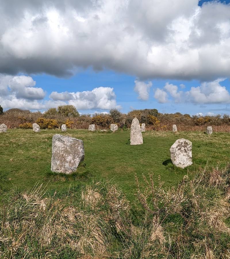
- Nine Maidens Stone Circle
- Ding Dong mine
- Bosiliack Entrance Grave
- Bosiliack round house settlement
- Mên Scryfa
Worth pairing with
Lanyon Quoit
A prehistoric monument included with Mên-an-Tol on the documented circular route.
Nine Maidens Stone Circle
A prehistoric site on the documented circular route through the surrounding landscape.
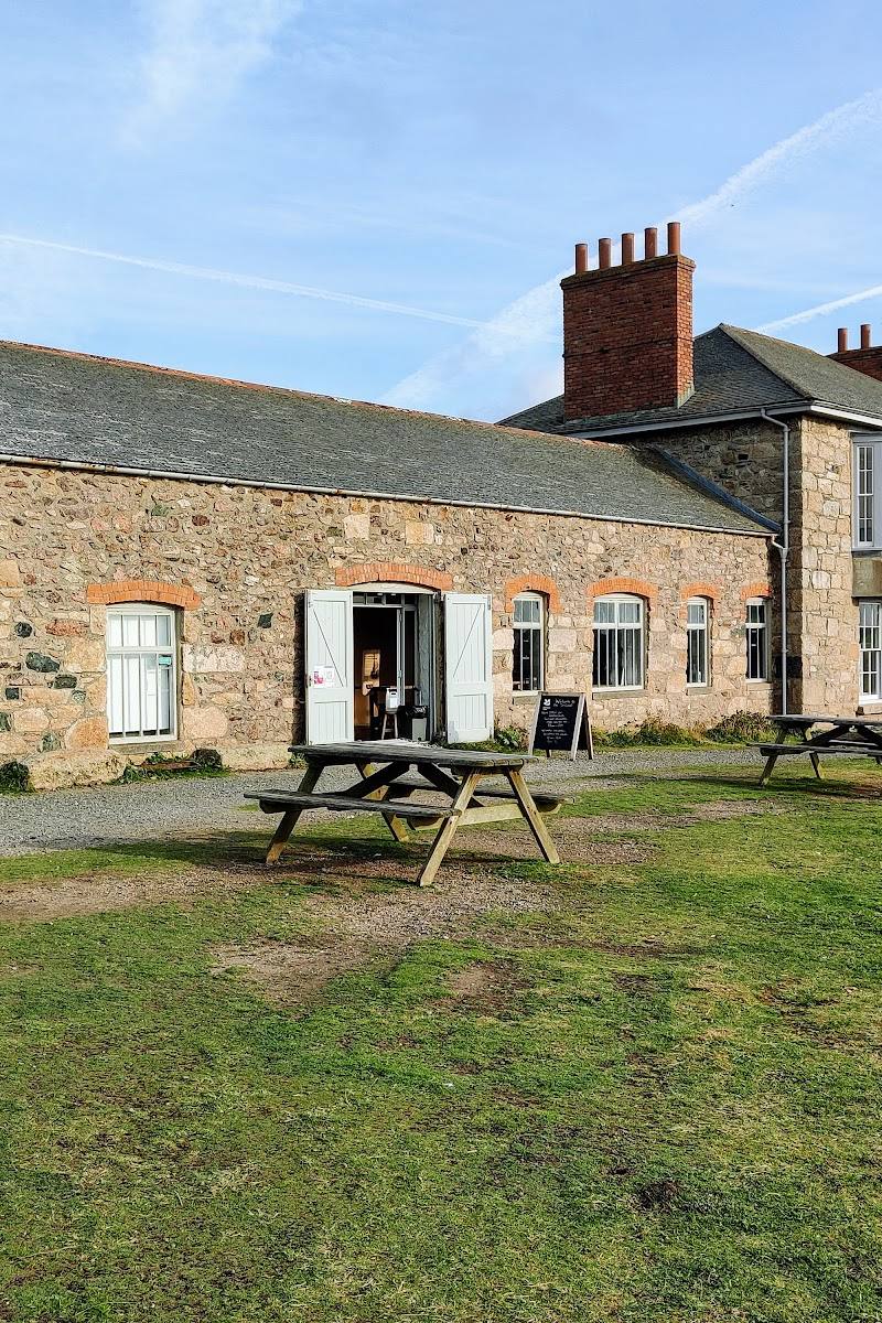
The Morvah Schoolhouse and Cafe
Listed by the Tin Coast site as the nearest facilities; check opening before visiting.
What to look for
The roughly 1.2-metre-wide holed stone, its circular opening, the two upright stones beside it, and fallen stones that mark the remains of a possible stone circle. The landscape guide also identifies Mên Scryfa, an inscribed standing stone, as a feature to look for on the longer route.
The story
Prehistoric archaeology; local healing and divination folklore.
Best time to go
Year-round; check weather and path conditions before walking.
No specific seasonal peak is established in the supplied sources. Choose a clear, settled day for the exposed moorland walk and check conditions first.
How long to spend
1–2 hours; allow at least 3 hours for the documented circular route.
Perfect for
Walkers · History lovers · Photographers
Before you go
Address
Listed hours
- Monday: Open 24 hours
- Tuesday: Open 24 hours
- Wednesday: Open 24 hours
- Thursday: Open 24 hours
- Friday: Open 24 hours
- Saturday: Open 24 hours
- Sunday: Open 24 hours
Check before visiting.
Google rating
Practical information
Opening & access
A small roadside parking area is followed by a walk of about half a mile up a lane and a stile into the site. The stile makes the site unsuitable for disabled access. Check conditions and access before setting out.
Check before visiting
Parking
A small parking area is reported beside the road near the route start. Check current conditions; do not assume space is available.
Check before visiting
Toilets
Check before visiting.
Check before visiting
Food & drink
The Morvah Schoolhouse and Cafe is listed as the nearest facility, about 1.5 miles from the route. Check opening before visiting.
Check before visiting
Dogs
Check before visiting.
Check before visiting
Accessibility
The approach includes a stile and the site is described as unsuitable for disabled access. The wider circular walk includes granite stiles, a gradual climb with one steep section, and a short stretch of public road.
Cost
Check before visiting
Check before visiting
Gallery
Place photographs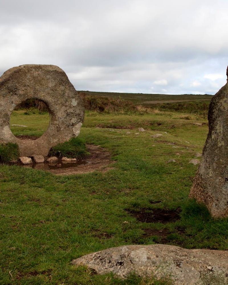
Keep exploring
Around Mên-an-Tol
Within 50 km · approximate straight-line distances