Between Beer and Branscombe, Devon
Hooken Cliffs
route · Coastal walk
Source image
8.1
Wildland
Half day
Time
Check
Cost
Dramatic
Feel
Why it's Wildland
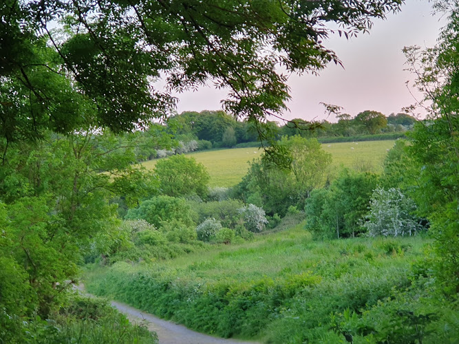
8.1A 1790 landslip left a tumbled undercliff of thick vegetation, white cliffs and pinnacles. The route descends through it before returning along the clifftops, with views towards the red cliffs beyond.
The Hooken Undercliff gives this coastal walk a distinctive change of scene: a landslip-shaped, densely vegetated landscape beneath white cliffs, followed by an exposed clifftop return. The steep steps and proximity to the cliff edge make it a proper coastal ramble, not an easy stroll.
Dramatic · Wild
Find your way
Open mapBetween Beer and Branscombe, Devon
Opening map…
The experience
Allow for a moderate 4.1-mile walk between Beer and Branscombe through the Hooken Undercliff, then back along the clifftops. Expect steep sections and steps, and take care where the path runs close to the edge.
Things to do
Walk through Hooken Undercliff
Follow the route through the tumbled landscape left by the 1790 landslip, beneath thick vegetation, white cliffs and pinnacles.
Part of the 4.1-mile walk
Return along the clifftops
Take the route back above the undercliff for views in either direction across the coast. The path includes steep sections and runs close to the cliff edge in places.
Part of the 4.1-mile walk
Look for coastal wildlife
The route source describes the undercliff as a haven for wildlife and lists wildlife among the walk’s features. No particular species are verified by the supplied sources.
Make a day of it
Quick escape · About 4.1 miles; allow a half day for the moderate walk and stops.
Through the Hooken Undercliff
- 01
Start at Fore Street, Beer, EX12 3ET, as listed by the South West Coast Path.
- 02
Follow the route through the Hooken Undercliff and notice the vegetation, white cliffs and pinnacles formed around the landslip landscape.
- 03
Return along the clifftops above, taking care on steep sections, steps and path close to the cliff edge.
- 04
Check current route conditions before setting out; a supplied source reports a closure due to subsidence, but does not establish its current status.
Verified history
A dramatic landslip in 1790 created the tumbled Hooken Undercliff landscape described by the South West Coast Path. The route page also mentions tales of smugglers, Romans and lacemakers along the walk, but the supplied material does not substantiate those histories in further detail.
Hidden details
The undercliff is the walk’s geological turning point — The route passes through terrain described as the result of the 1790 landslip. Look for the contrast between thick vegetation below and the white cliffs and pinnacles rising through it.
A changing cliff palette — The route description points to views of red cliffs soaring beyond the white. Watch for this colour contrast on the clifftop return.
When to go
April · May · September · October · No specific time of day is verified. Choose a settled-weather window and check current path conditions.
The source row recommends late spring or early autumn for generally mild weather and fewer visitors; it notes that summer can be busier and winter can be windy, with slippery paths.
The source row warns of windy winter conditions and potentially slippery paths. The route has steep ascents and descents and sections close to the cliff edge; check weather and path conditions before visiting.
The route
- distance
- 4.1 miles (6.6 km)
- difficulty
- Moderate; steep ascents and descents, including a long flight of steps. The path runs close to the cliff edge in places.
- route shape
- The South West Coast Path describes a walk through the undercliff and a return along the clifftops, linking Beer and Branscombe.
- start point
- Fore Street, Beer, EX12 3ET
- parking start
- The source row mentions a small parking area near Beer Head. Check current availability and suitability before visiting.
- The Hooken Undercliff landslip landscape
- Thick vegetation beneath white cliffs and pinnacles
- Clifftop views towards red cliffs
- The route links Beer and Branscombe
Worth pairing with
Beer
Beer is one end of the walk. The source row says cafés are available in the village; check current opening and availability.
Branscombe
The route links Beer and Branscombe. The supplied South West Coast Path page gives dog restrictions for parts of Branscombe beach; check current beach rules before visiting.
What to look for
Notice how the landslip has created a tumbled undercliff, where thick vegetation sits beneath white cliffs and pinnacles. On the return, look out for the contrast with the red cliffs beyond.
The story
Coastal geology; the Hooken landslip of 1790.
Best time to go
Late spring or early autumn, as suggested in the source row; check weather and path conditions before travelling.
Late spring or early autumn is suggested by the source row. Choose a settled-weather day and check path conditions, especially after wet or windy weather.
How long to spend
Half day
Perfect for
Walkers · Photographers · Wildlife lovers · Dogs
Route at a glance
Duration
Half day
Terrain
Coastal, Village
Parking / start
The source row mentions a small parking area near Beer Head; the South West Coast Path lists Fore Street, Beer, EX12 3ET as the walk start. Check current parking availability before visiting.
Practical information
Opening & access
A South West Coast Path walk linking Beer and Branscombe. The route is described as moderate, with steep ascents and descents, a long flight of steps and sections close to the cliff edge. Check current path conditions before setting out.
Check before visiting
Parking
The source row mentions a small parking area near Beer Head; the South West Coast Path lists Fore Street, Beer, EX12 3ET as the walk start. Check current parking availability before visiting.
Check before visiting
Toilets
Check before visiting.
Check before visiting
Food & drink
The source row says cafés are available in nearby Beer; check current opening and availability before visiting.
Check before visiting
Dogs
The South West Coast Path identifies East Beach, Beer, as dog friendly and gives seasonal/area restrictions for Branscombe beach. Check current beach rules and signage; cliff-path conditions may also affect dogs.
Check before visiting
Accessibility
The source row says the natural paths are not wheelchair accessible. The route source describes steep ascents and descents, a long flight of steps and paths close to the cliff edge.
Cost
Check before visiting
Check before visiting
Water
Sea
Gallery
Place photographsKeep exploring
Around Hooken Cliffs
Within 50 km · approximate straight-line distances