Above Giggleswick, near Settle, North Yorkshire, on the south-western edge of the Yorkshire Dales.
Giggleswick Scar
Escarpment
Place photograph
6.5
Wildland
Half day
Time
Check
Cost
Dramatic
Feel
Why it's Wildland
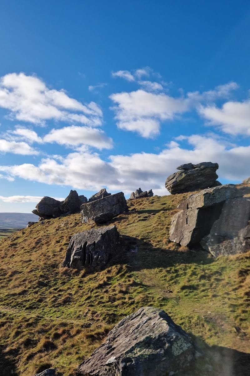
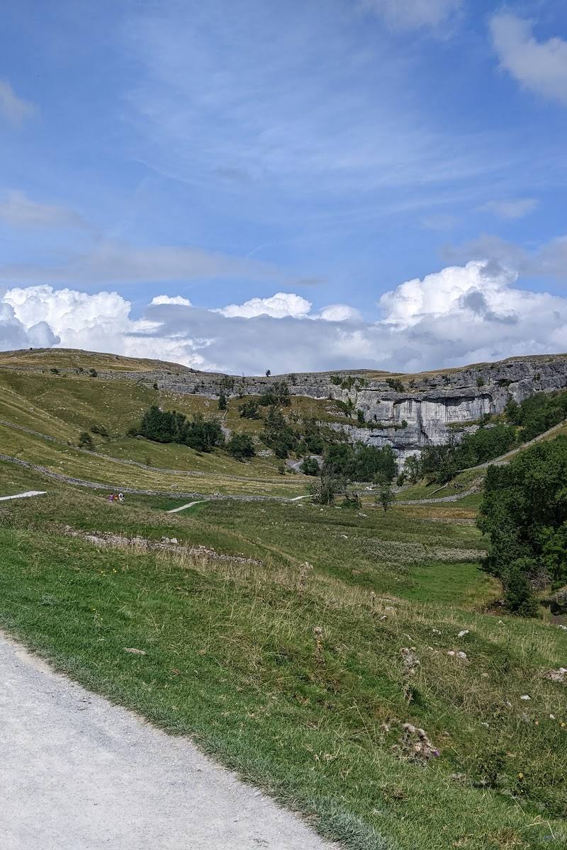
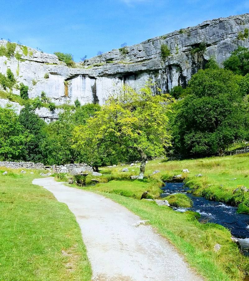
6.5Limestone cliffs rise above Giggleswick, with limestone pavement, caves and wide views across the surrounding countryside. A walk across the scar can also lead to Schoolboy’s Tower, a large cairn associated with a tradition at Giggleswick School.
The appeal here is the contrast between a dramatic limestone edge and the quieter walking country above a small village. Limestone pavement, caves and the distinctive Schoolboy’s Tower give the walk more to discover than the cliff face alone.
Dramatic · Peaceful · Ancient-feeling
Find your way
Open mapAbove Giggleswick, near Settle, North Yorkshire, on the south-western edge of the Yorkshire Dales.
Opening map…
Know this place a little better?
The experience
Walk to the limestone scar for views, explore its limestone features from safe paths, and look out for the Schoolboy’s Tower cairn. Longer routes can combine the scar with countryside walking towards Feizor and the River Ribble.
Things to do
Walk the limestone edge
Follow a mapped footpath to explore the scar’s limestone outcrops and open views. Paths may be steep or uneven, so check conditions and keep back from exposed edges.
Check route length before setting out
Find Schoolboy’s Tower
Look for the large cairn on the scar. The Yorkshire Dales village guide describes a tradition in which pupils added a stone to mark the end of the teaching day.
Take in the limestone pavement
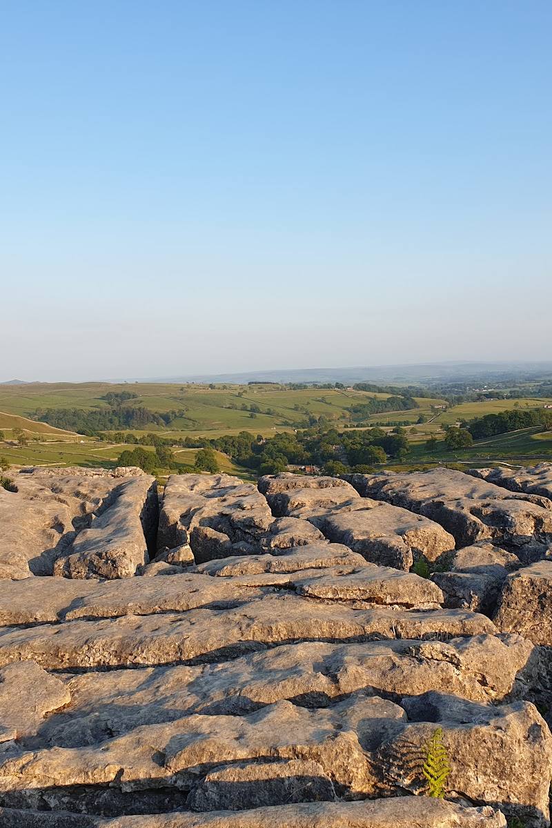
The documented walk crosses limestone pavement and outcrops on the scar. Watch your footing on uneven rock.
Extend the walk towards Feizor
A documented 8.3-mile circuit combines Giggleswick Scar with countryside walking, Feizor and a return through the Ribble Valley. Check the route description and conditions before setting out.
4–5 hours for the full circuit
Make a day of it
Quick escape · Allow 1–2 hours; check route length and conditions before setting out.
Quick escape: walk to the scar
- 01
Start from a suitable public footpath near Giggleswick and follow a mapped route towards the scar.
- 02
Enjoy the limestone scenery and views from safe paths, keeping well back from cliff edges.
- 03
Return by your chosen route; do not enter caves without appropriate expertise and equipment.
Half day · About 4–5 hours for the published 8.3-mile circuit; route conditions and pace affect timing.
Make a half day of it: scar, cairn and countryside
- 01
Begin at Giggleswick Church and follow the documented circuit towards Giggleswick Scar.
- 02
Walk the limestone terrain and look for Schoolboy’s Tower, the cairn associated with the school tradition.
- 03
Continue through the countryside towards Feizor, then follow the documented route back through the Ribble Valley.
- 04
Check current route conditions and access before departure.
Verified history
The cliffs above Giggleswick are limestone features associated with the Craven Fault. At the end of the scar is Schoolboy’s Tower, a cairn that the Yorkshire Dales village guide says was built up by pupils, traditionally with a stone laid at the end of each teaching day. The same guide reports prehistoric discoveries at Kinsey Cave; this does not establish that visitors can safely or freely enter the cave.
Hidden details
Schoolboy’s Tower is a cairn — Despite its name, Schoolboy’s Tower is described in the route account as a cairn. A village guide links it to a tradition of pupils adding a stone at the end of the teaching day.
Cave entrances are not an invitation to explore — Caves are reported along the scar, including Kinsey Cave. Some approaches are hazardous and require relevant caving expertise and equipment; check reliable current guidance and do not enter if unsure.
When to go
May · June · September · A clear, settled day is most useful for enjoying the views; check the forecast before setting out.
The source row recommends late spring and early autumn for milder weather and vibrant scenery. Winter visits may be possible, but paths can be slippery or icy.
Exposed, rugged terrain can be more challenging in poor weather. Check the forecast and current path conditions; take particular care around cliffs, caves and uneven limestone.
The route
- ascent
- 450 metres total climbing
- surface
- Good paths are reported; limestone terrain and pasture paths feature along the route.
- distance
- 8.3 miles (13.4 km) for the documented circuit
- duration
- 4–5 hours
- difficulty
- Moderate
- route shape
- Circuit from Giggleswick Church, taking in Giggleswick Scar, Feizor and the Ribble Valley
- start point
- Giggleswick Church
- parking start
- Check parking arrangements near Giggleswick Church before setting out.
- shorter alternative
- Walk to the scar and return by a suitable mapped path; a specific shorter route distance is not established by the supplied sources.
- Giggleswick Scar limestone cliffs and pavement
- Schoolboy’s Tower cairn
- Feizor
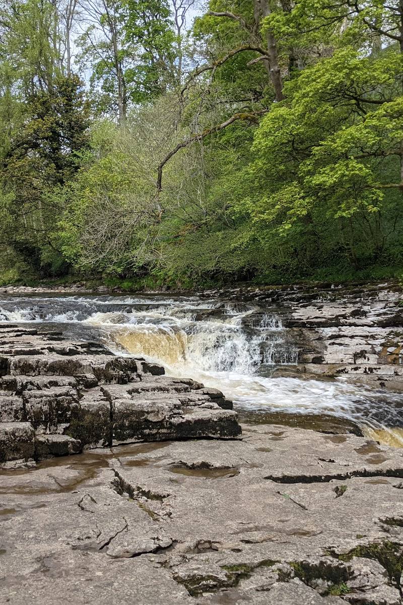
- Stainforth Force
- Ribble Valley
Worth pairing with
Settle
Pair the scar with a visit to nearby Settle for town amenities. The village guide also notes that Giggleswick is within walking distance of Settle.
Feizor
Feizor is included on the documented longer circuit from Giggleswick Scar. Check local facilities and opening details independently before planning a stop.
Stainforth Force
The documented longer circuit continues to Stainforth Force and the River Ribble; consider it only if you are undertaking the full route and have checked conditions.
What to look for
Limestone pavement and outcrops, the large Schoolboy’s Tower cairn, and the entrances to caves. Do not attempt dangerous or restricted cave approaches without suitable expertise and equipment.
The story
Archaeology
Best time to go
Late spring to early autumn for generally milder walking conditions; check the forecast before visiting. Winter paths can be slippery or icy.
Late spring to early autumn is suggested for milder conditions. Choose a clear day for the views and check the forecast; wet, icy or windy conditions make exposed, uneven ground more challenging.
How long to spend
Half day
Perfect for
Walkers · Photographers · History lovers
Practical information
Opening & access
Footpaths lead from Giggleswick towards the scar. The ground is rugged and some paths are steep; check current access and conditions before setting out, and keep away from unguarded edges. Some caves require specialist knowledge and equipment and can be dangerous. Access arrangements are unconfirmed. Check before visiting; do not enter private land or restricted structures.
Check before visiting
Parking
Parking is reported near walking starting points, including in Giggleswick village; confirm suitable parking before travelling. A separate scar walk starts at Giggleswick Church.
Toilets
No toilets directly on the scar are reported. Check facilities in Giggleswick or Settle before travelling.
Check before visiting
Food & drink
No café on the scar is reported. Giggleswick and nearby Settle have places to eat and drink; check opening details before visiting.
Check before visiting
Dogs
The source row describes the site as dog-friendly. Livestock is present on some walks; keep dogs under close control.
Accessibility
Rugged terrain and steep paths; not wheelchair accessible according to the source row. Some cave approaches involve steep, unguarded ground and are unsuitable without appropriate caving knowledge and equipment.
Cost
Check before visiting
Check before visiting
Gallery
Place photographsKeep exploring
Around Giggleswick Scar
Within 50 km · approximate straight-line distances