Near Cleator and Ennerdale Bridge, Cumbria, on the western edge of the Lake District National Park
Ennerdale Water
Lake
Place photograph
8.2
Wildland
Check before visiting
Time
Check
Cost
Peaceful
Feel
Why it's Wildland
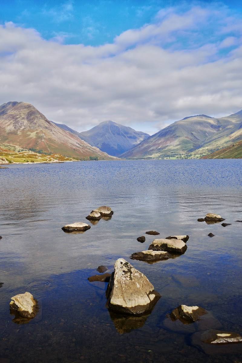
8.2A remote glacial lake at the western edge of the Lake District, set beneath high fells and crossed by the Coast to Coast route.
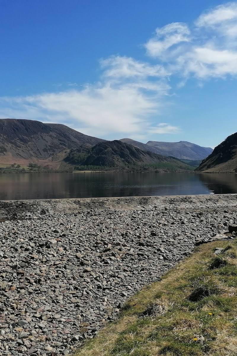
Ennerdale feels quieter and more secluded than many Lake District lake destinations. Its long, rugged shore, fell-backed valley and Coast to Coast connection make it a rewarding place to walk, rather than simply admire from the roadside.
Peaceful · Secluded · Wild
Find your way
Open mapNear Cleator and Ennerdale Bridge, Cumbria, on the western edge of the Lake District National Park
Opening map…
Know this place a little better?
The experience
Choose a lakeshore walk for a shorter visit or use the reported 11.5-mile circuit for a substantial day on foot. The Coast to Coast also passes through the valley. Check route conditions, access and parking before travelling.
Things to do
Walk a section of the lakeshore
Follow a lakeshore path for a closer look at the lake and its surrounding fells. Choose a section to suit your time and check current conditions.
Walk the Ennerdale Water circuit
A walking video source describes an 11.5-mile loop. Check a current map and conditions before relying on this route.
Follow the Coast to Coast through the valley
Ennerdale Water lies along the Coast to Coast Walk; use current route information to plan a suitable section.
Make a day of it
Quick escape · Check before visiting
Quick Escape: a lakeshore walk
- 01
Check current access and parking information for Bowness Knott or Bleach Green.
- 02
Walk a section of the lakeshore path and return the way you came.
- 03
Allow extra time for the terrain and conditions; no shorter route distance or duration is verified.
Half day · Check before visiting
Make a Half Day of It: explore the valley on foot
- 01
Use one of the named access points, after checking current parking and access arrangements.
- 02
Follow a lakeshore path and spend time taking in the fell-backed setting.
- 03
Choose a longer fell route only if prepared for its conditions; the supplied sources do not give a verified half-day route specification.
Full Wildland day · Check before visiting
A full circuit of Ennerdale Water
- 01
Plan the reported 11.5-mile loop, checking the route, weather and conditions before departure.
- 02
Allow for a substantial walk; the supplied source does not verify a walking duration or detailed route instructions.
- 03
Use the named access points only after checking current parking and access information.
When to go
· Check before visiting
The supplied sources do not establish a best season or seasonal wildlife highlights.
Check the forecast and local conditions before walking. The supplied sources do not provide specific weather guidance.
The route
- distance
- 11.5 miles for the loop described in the supplied walking video
- route shape
- Loop
- parking start
- Bowness Knott and Bleach Green are named as access points; the supplied sources do not confirm which is the start for the 11.5-mile loop.
- shorter alternative
- Walk a section of the lakeshore and return the same way; no verified distance is supplied.
- Ennerdale Water
- The surrounding fell landscape
- The Coast to Coast route through the valley
What to look for
Look across the lake to the surrounding high fells, and notice how the lakeshore path opens into the broader Ennerdale valley. The supplied sources do not verify specific wildlife or historic features to seek out.
Best time to go
Check local conditions before visiting; no specific seasonal recommendation is verified in the supplied sources.
No specific best time of day is verified in the supplied sources. Check weather and conditions before setting out.
How long to spend
Check before visiting
Perfect for
Walkers · Photographers
Before you go
Address
Google rating
Practical information
Opening & access
Lakeshore paths and longer fell routes are described, with access from Bowness Knott and Bleach Green car parks. Check current access and parking information before setting out.
Check before visiting
Parking
Bowness Knott and Bleach Green car parks are named as access points; current parking details are not supplied.
Toilets
Check before visiting
Check before visiting
Food & drink
Check before visiting
Check before visiting
Dogs
Check before visiting
Check before visiting
Accessibility
Check before visiting. The supplied sources mention lakeshore paths and fell routes but do not establish accessible routes or facilities.
Check before visiting
Cost
Check before visiting
Check before visiting
Water
Lake
Gallery
Place photographs

Keep exploring
Around Ennerdale Water
Within 50 km · approximate straight-line distances