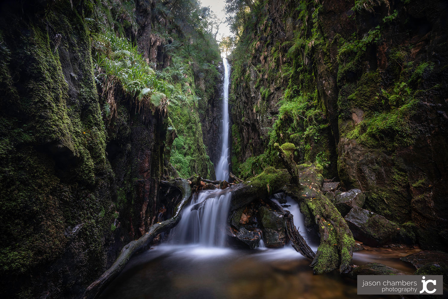
Above the south-western shore of Crummock Water, near Buttermere, Cumbria
Scale Force
Gorge waterfall
Source image
9.0
Wildland
AllTrails estimates 1.5–2 hours for its 4.4-mile out-and-back route. Britain Express describes a shorter 2.5-mile return
Time
Check
Cost
Enclosed
Feel
Why it's Wildland
9.0The Lake District’s tallest waterfall, with a 170-foot main drop tucked into a narrow rock chasm.
The contrast is the draw: an open lakeside approach gives way to a confined gorge and a slender fall of remarkable height. A distinctive destination in its own right, rather than simply a stop on a lakeside walk.
Enclosed · Dramatic · Hidden-feeling
Find your way
Open mapAbove the south-western shore of Crummock Water, near Buttermere, Cumbria
Opening map…
The experience
Approach from Buttermere along Crummock Water, then head uphill towards Scale Beck and the gorge. Look for the contrast between the thin upper plume and the broader lower cascade. There are no facilities or bins at the falls, so carry out everything you bring. The source row reports no mobile signal.
What to look for
The slender main fall framed by the narrow fissure, the wider lower cascade, and mist against the gorge walls. View from secure ground rather than scrambling up the slippery rock.
The story
Check before visiting
Best time to go
Spring for stronger flow; avoid flood conditions and icy weather.
Spring melt or recent rain can strengthen the flow, but wet weather also makes the approach boggy and slippery. Avoid floods. Late afternoon can bring pronounced shadows into the gorge.
How long to spend
AllTrails estimates 1.5–2 hours for its 4.4-mile out-and-back route. Britain Express describes a shorter 2.5-mile return; check your chosen route before setting out.
Perfect for
Walkers · Photographers · Waterfall lovers
Practical information
Opening & access
Walking approaches from Buttermere follow Crummock Water before climbing towards the falls. Expect rocky, boggy and slippery sections; waterproof footwear is needed. Avoid flood conditions and climbing the wet rocks beside the falls.
Parking
Parking areas in Buttermere include a National Trust car park west of the village. Spaces can be scarce in summer; arrive early. Check current charges before visiting.
Check before visiting
Toilets
None at the falls. The source row places the nearest facilities in Buttermere; check before visiting.
Check before visiting
Food & drink
Check before visiting
Check before visiting
Dogs
The source row lists dogs as welcome but warns that steep sections may be difficult for them. Check before visiting for current lead requirements.
Check before visiting
Accessibility
Not wheelchair accessible according to the source row. The approach includes rough, rocky and boggy ground, with slippery sections in wet weather.
Water
Freshwater waterfall and beck. The source row advises no swimming because the plunge pool is shallow and rocky.
Gallery
Place photographsKeep exploring
Around Scale Force
Within 50 km · approximate straight-line distances
RSPB St Bees Head
St Bees, Cumbria
21.3 km away