Eskdale, western Lake District, Cumbria, England
Stanley Ghyll Force
Waterside landscape
Place photograph
8.0
Wildland
1–2 hours
Time
Check
Cost
Dramatic
Feel
Why it's Wildland
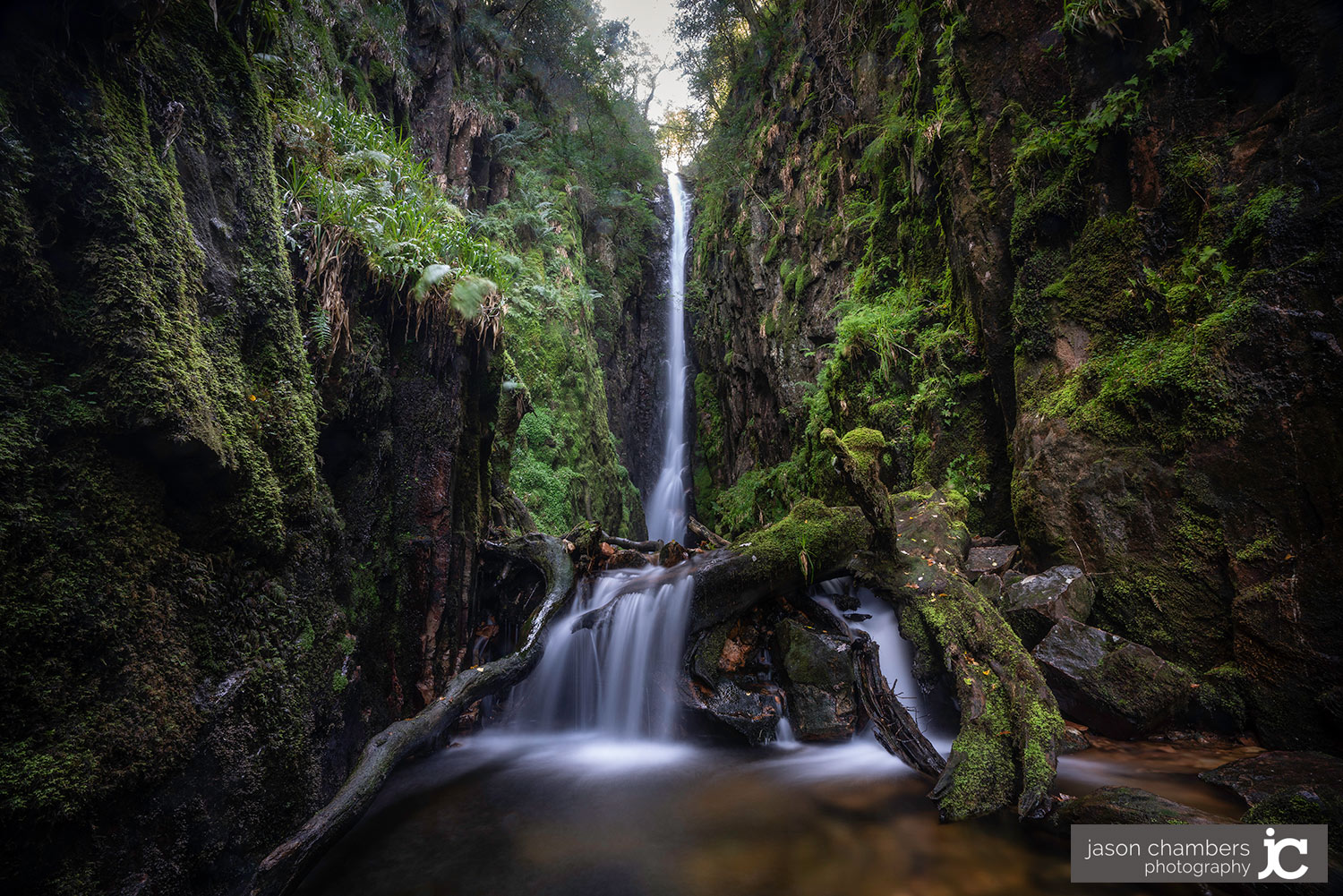
8.0A waterfall enclosed by a steep, fern-covered ravine, with a high viewing point above the gorge.
The ravine makes this more than a waterfall stop: enclosed woodland, sudden drops and the view into the chasm give a relatively short walk real drama. The terrain demands more care than its modest distance suggests.
Dramatic · Atmospheric · Wild
Find your way
Open mapEskdale, western Lake District, Cumbria, England
Opening map…
The experience
Walk from Dalegarth into the woodland, then follow the currently open signed approach to the waterfall viewpoint. Give the gorge time rather than rushing straight to the photograph. For a longer outing, the published circular walk returns through woodland past St Catherine’s Church, but its water crossings need careful planning.
Things to do
Walk from Dalegarth to the gorge viewpoint
Follow the woodland approach to the waterfall and upper viewing point. Visitor reports describe steep sections and a substantial drop below the viewpoint; use only open paths and protected viewing areas.
Follow the Dalegarth woodland circuit
The published 2.9-mile moderate loop links Stanley Force with woodland, riverside sections and St Catherine’s Church. It includes rough ground and unbridged crossings, so check the map and water conditions rather than treating it as an easy stroll.
1–1.5 hours walking, according to the route source
Make a day of it
Quick escape · Allow around 1–2 hours; timing depends on the open approach and your pace.
Quick escape — woodland and waterfall
- 01
Start at Dalegarth station, checking parking information and the current walking route before setting out.
- 02
Follow the signed, open approach through the woodland towards Stanley Ghyll Force.
- 03
Pause at the protected upper viewpoint to take in the waterfall and the depth of the gorge.
- 04
Return on an open, suitable path rather than following unsigned trails or attempting water crossings.
Half day · Allow a half day with photography and pauses; the published loop estimates 1–1.5 hours of walking.
A slower half day — the gorge and St Catherine’s
- 01
Use the published Dalegarth and Stanley Ghyll circular route as your planning reference: 2.9 miles with 383 feet of ascent.
- 02
Take your time through the woodland and at the waterfall viewpoint, staying behind barriers.
- 03
Continue on the mapped return past St Catherine’s Church; treat this as an exterior stop unless access is confirmed.
- 04
Avoid unbridged crossings when water is high or fast. The route source identifies a bridge further along the River Esk, south of Gill Force, as an alternative to the crossing by the church; locate it on your map before committing.
- 05
Return to Dalegarth, shortening or abandoning the circuit if conditions make the crossings or gorge paths unsafe.
When to go
May · June · Morning is suggested by the imported record for light through the canopy; safe weather and footing matter more than the hour.
Late spring suits the fern-covered woodland setting described in the imported record. This is a seasonal recommendation, not a verified botanical peak.
Wear footwear with grip. Narrow paths can become slippery in wet weather, with steep and sudden drops nearby. Avoid unbridged crossings in high or fast-flowing water. The imported record reports poor phone signal, so carry an offline map and do not depend on reception.
The route
- ascent
- 383 feet / approximately 117 metres
- surface
- Woodland and riverside paths with rocky, rough and narrow sections; slippery when wet
- distance
- 2.9 miles / approximately 4.7 km for the published Dalegarth and Stanley Ghyll circular
- duration
- 1–1.5 hours estimated walking time; allow longer for stops
- difficulty
- Moderate, as graded by AllTrails; steep drops and water crossings add hazards
- route shape
- Loop
- start point
- Dalegarth train station
- parking start
- Visitor reports describe parking at Dalegarth station; check current charges and availability.
- shorter alternative
- An out-and-back visit from Dalegarth to the waterfall viewpoint is described by visitors; exact distance and current path availability need checking.
- Stanley Ghyll Force
- Woodland gorge
- Waterfall viewpoint
- St Catherine’s Church on the return
Worth pairing with
St Catherine’s Church
A quiet exterior stop on the published circular return from Stanley Ghyll. Interior access and opening times are not established by the supplied evidence. Plan the river crossing carefully.
What to look for
Ferns and moss along the ravine, the contrast between enclosed woodland and the exposed upper viewpoint, and the depth of the gorge beneath the protected viewing area.
Best time to go
Late spring for fresh woodland greenery; choose settled conditions for safer footing.
Late spring is the imported record’s recommendation for lush greenery, with morning suggested for light through the canopy. Rain can increase the flow but also makes narrow paths slippery and river crossings hazardous; avoid high-water conditions.
How long to spend
1–2 hours
Perfect for
Walkers · Photographers · Couples
Practical information
Opening & access
Walking access from Dalegarth station is documented by route information and visitor reports. Expect steep, rocky and sometimes narrow paths beside sudden drops. Check current closures and follow on-site signs.
Check before visiting
Parking
Parking at Dalegarth station is reported by visitors. Check current charges and availability before travelling; do not rely on older reviews for prices.
Check before visiting
Toilets
The imported record mentions public toilets in Eskdale Green, not at the waterfall. Check before visiting.
Check before visiting
Food & drink
The imported record mentions small cafés in Eskdale Green. Specific venues and opening hours are unverified. Check before visiting.
Check before visiting
Dogs
The imported record lists dogs as welcome; the walking source warns of steep drops and deep water, especially with dogs. Check current restrictions and keep dogs under close control.
Check before visiting
Accessibility
Steep sections, steps, rocky ground and narrow paths make this unsuitable for wheelchair access on the described approach. Unbridged crossings occur on the published circular route.
Cost
Check before visiting
Check before visiting
Water
Waterfall, River
Gallery
Place photographsKeep exploring
Around Stanley Ghyll Force
Within 50 km · approximate straight-line distances
 Source image9.0
Scale Force
Above the south-western shore of Crummock Water, near Buttermere, Cumbria
17.8 km away
Windermere and Troutbeck
Troutbeck Valley and Windermere, Lake District
23.2 km away