Drizzlecombe, near Sheepstor, Dartmoor, Devon
Drizzlecombe Stone Rows
Prehistoric
Source image
7.2
Wildland
1–2 hours for a focused visit
Time
Check
Cost
Atmospheric
Feel
Why it's Wildland
7.2Three Bronze Age stone rows run across the slope at Drizzlecombe, among cairns, burial chambers and traces of settlement. At the eastern row, the Bone Stone—about 4.2 metres tall—was re-erected by archaeologists in 1893.
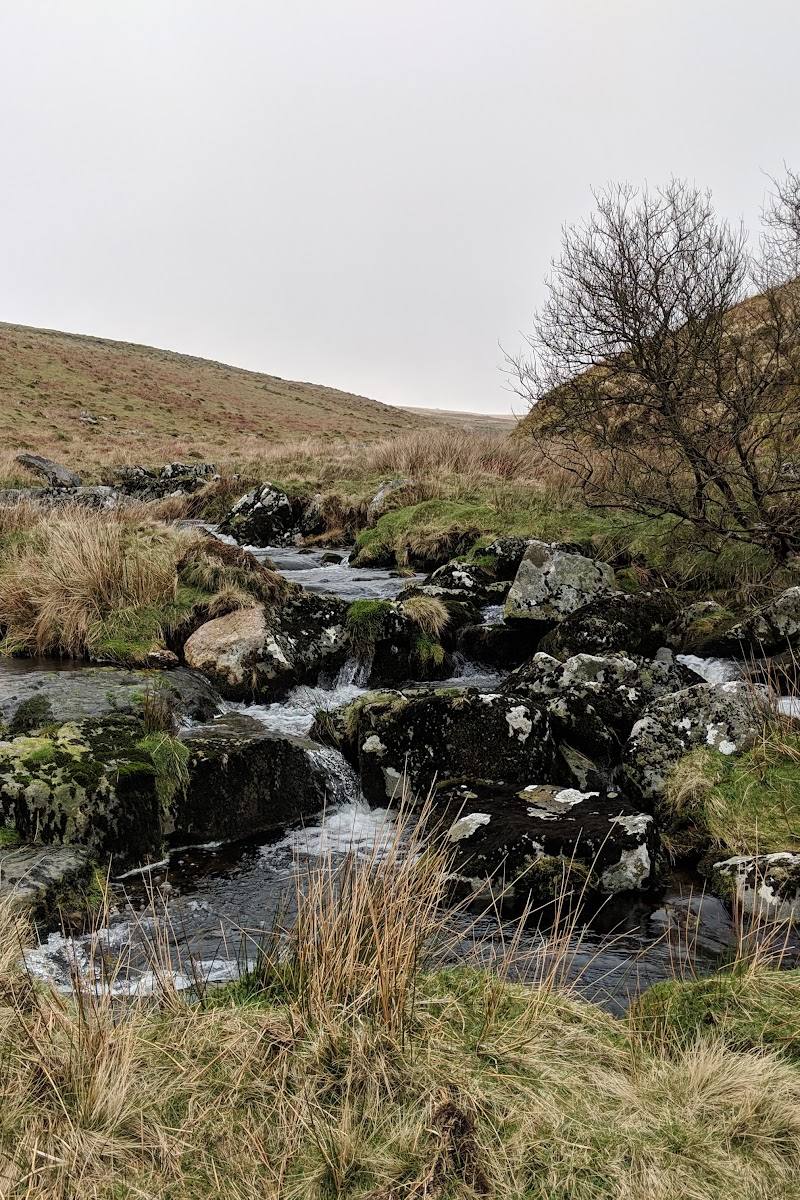
Drizzlecombe is more than a cluster of standing stones: its rows, cairns and settlement remains sit within open Dartmoor moorland, where the monuments make sense as part of a much larger prehistoric landscape. The remote, rough-footed approach is part of the experience, but calls for map-reading and preparation.
Atmospheric · Big-sky · Ancient-feeling · Remote
Find your way
Open mapDrizzlecombe, near Sheepstor, Dartmoor, Devon
Opening map…
Know this place a little better?
The experience
Follow the moorland paths to the stone rows and cairns, then look beyond the monuments to the River Plym valley and the wider prehistoric remains. Ground is rough and can be wet; carry a map and check conditions before setting out.
Things to do
Read the three stone rows
Compare their alignments and forms: the southern row changes from a single line to a double row and back; the northern row extends for about 150 metres.
30–60 minutes; estimate.
Find the Bone Stone
Look for the tall eastern-row menhir, about 4.2 metres high. It was re-erected by archaeologists in 1893.
Part of the site visit.
Look for the Giant’s Basin
Find the large cairn near the eastern and southern rows. The supplied sources describe it as roughly 22 metres across and about 3 metres high; its relationship to the rows is uncertain.
Part of the site visit.
Notice the wider archaeological landscape
Look beyond the rows for cairns, a stone-lined cist and remains of settlement and hut circles across the moor.
Allow extra time while exploring.
Make a day of it
Quick escape · 1–2 hours; estimate, not a verified route duration.
Quick escape: the stone rows
- 01
Use a confirmed approach and follow a footpath towards the stone rows; do not rely on the imported map pin as an entrance or parking location.
- 02
Explore the three rows and their terminal stones, then return by your chosen approach.
- 03
Allow for rough, uneven and potentially wet moorland ground; take an Ordnance Survey map.
Half day · Half day; estimate, not a verified route duration.
Make a half day of it: rows, cairns and moorland circuit
- 01
Plan a moorland circuit only after checking the route and selecting a confirmed start point.
- 02
Visit the stone rows, Bone Stone and Giant’s Basin; look out for settlement remains, hut circles and the stone-lined cist.
- 03
If following the route described by Britain Express, consider its return via the footpath and Ditsworthy Warren House; check map and conditions before setting out.
Verified history
Drizzlecombe is a substantial Bronze Age ceremonial and settlement landscape on Dartmoor. Its three principal stone rows are accompanied by cairns and terminal standing stones; sources also describe hut circles, settlement remains and a stone-lined cist. The Bone Stone, on the eastern row, was re-erected by archaeologists in 1893. The Giant’s Basin is a large cairn whose precise relationship to the rows remains uncertain.
Hidden details
A row that changes shape — The southern row is described as starting single, becoming double, then returning to a single line before its terminal stone.
The Bone Stone’s curious top — The tall eastern-row stone has a protrusion at its top, compared by the source to a banner on a flagpole.
A hollow in the Giant’s Basin — History Hit describes a crater in the cairn’s centre, reportedly created by early excavation; it says whether anything significant was found is unknown.
When to go
· A clear day is preferable on this exposed moor; no particular time of day is verified as best.
The supplied sources do not identify a seasonal highlight. Weather and ground conditions matter because the site is exposed and paths may be rough or wet.
Dartmoor weather can change quickly. Check the forecast and ground conditions, wear suitable footwear and carry a map. The terrain is uneven and can be wet.
The route
- surface
- Rough tracks, footpaths and moorland ground; can be wet underfoot.
- difficulty
- Rough, uneven moorland walking; paths may be wet. No graded difficulty verified.
- route shape
- Britain Express describes an out-and-back or a possible circular return via Ditsworthy Warren House. AA RatedTrips describes a triangular circuit, but its route starts near Gutter Tor; do not assume either route starts at the imported map pin.
- start point
- Britain Express identifies the lane east of Sheepstor and a parking area at its end. AA RatedTrips describes a separate start near Gutter Tor Scout Hut. Confirm the intended start before travel.
- parking start
- Parking descriptions differ by approach. Britain Express reports a parking area at the end of the lane east of Sheepstor; AA RatedTrips reports a rough parking area near Gutter Tor Scout Hut. Verify current access and parking.
- shorter alternative
- Visit the stone rows and Bone Stone by the approach you have confirmed, then retrace your steps rather than attempting a longer circuit.
- Three Bronze Age stone rows
- The Bone Stone
- Giant’s Basin cairn
- Settlement remains, hut circles and a stone-lined cist
- Open views across Dartmoor and the Plym valley
Worth pairing with
Sheepstor
Britain Express suggests taking time to explore Sheepstor village; it notes the area’s association with the filming of War Horse.
What to look for
- 01
Compare the three rows: the southern row changes from single to double and back again
- 02
the northern row stretches for about 150 metres
- 03
the eastern row ends at the Bone Stone. Look for the Giant’s Basin cairn, the stone-lined cist, hut circles and settlement remains. The Bone Stone’s unusual top projection is another detail to notice.
The story
Bronze Age archaeology
Best time to go
Check weather and ground conditions before visiting; no specific peak season is established by the supplied sources.
Choose a clear, settled day for visibility across the exposed moor. The supplied sources do not establish a particular seasonal highlight.
How long to spend
1–2 hours for a focused visit; allow longer for a moorland circuit.
Perfect for
Walkers · History lovers · Photographers
Before you go
Address
Listed hours
- Monday: Open 24 hours
- Tuesday: Open 24 hours
- Wednesday: Open 24 hours
- Thursday: Open 24 hours
- Friday: Open 24 hours
- Saturday: Open 24 hours
- Sunday: Open 24 hours
Check before visiting.
Google rating
Practical information
Opening & access
Footpaths cross the moor to the prehistoric monuments. The approach is remote and exposed, with rough, uneven and sometimes wet ground; check conditions and use an Ordnance Survey map. Confirm current access and route conditions before setting out. Access arrangements are unconfirmed. Check before visiting; do not enter private land or restricted structures.
Check before visiting
Parking
Britain Express describes a parking area at the end of the lane east of Sheepstor. AA RatedTrips describes a rough parking area near Gutter Tor Scout Hut. These are different approach descriptions; confirm your chosen start point and current parking arrangements before travelling.
Toilets
Check before visiting.
Check before visiting
Food & drink
Check before visiting.
Check before visiting
Dogs
One supplied route source advises keeping dogs under control and on a lead during the bird-nesting season (1 March–15 July). Check current local guidance and signage.
Check before visiting
Accessibility
The site is on open moorland with uneven, rough and potentially wet paths. No step-free access is verified; check suitability before visiting.
Check before visiting
Cost
Check before visiting
Check before visiting
Water
The site lies above the River Plym and Drizzle Combe; no water activity permission is evidenced.
Gallery
Place photographsKeep exploring
Around Drizzlecombe Stone Rows
Within 50 km · approximate straight-line distances