Hullbridge, Hockley, Essex, SS5 6QB, United Kingdom
Brandy Hole Saltmarsh
Saltmarsh
Source image
5.0
Wildland
1–2 hours, Half day
Time
Check
Cost
Big-sky
Feel
Why it's Wildland
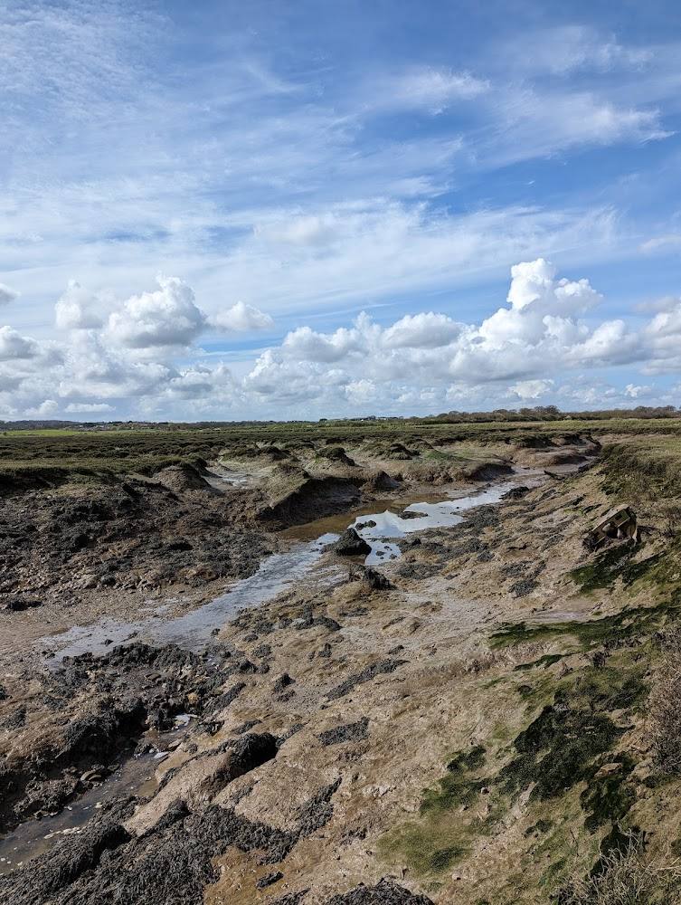
5.0At Brandy Hole, the footpath follows the edge of a patterned stretch of marsh beside the River Crouch. A local council walk guide links its landscape to historic salt beds and oyster farming, and describes the surrounding creeks as habitat for birds and marine life.
The appeal here is a working-edge landscape rather than a remote wilderness: a riverside footpath leads from Hullbridge towards saltmarsh, boatyard and open marsh views, with the route guide pointing out the area's distinctive tidal-creek setting and birdlife.
Big-sky · Atmospheric
Find your way
Open mapHullbridge, Hockley, Essex, SS5 6QB, United Kingdom
Opening map…
Know this place a little better?
The experience
Explore the Hullbridge riverside footpath towards Brandy Hole, then follow the route along the marsh edge and retrace your steps. The council’s walk description gives a longer option continuing through the village and towards Battlesbridge.
Things to do
Walk the Hullbridge riverside path to Brandy Hole
Follow Footpath 9 east from Hullbridge beside the River Crouch, passing slipways and the yacht club before reaching the Brandy Hole area. The council describes this as a walk of about 1 hour 15 minutes in Hullbridge and Brandy Hole; the supplied map pin is not an entrance point.
About 1 hour 15 minutes
Look across the marsh and creeks for birds
The local walk guide says visitors may see sea birds, waders, farmland birds and birds of prey along the route. Seals are sometimes seen resting in the creeks, but sightings are not guaranteed.
Notice the saltmarsh patterns
The council guide describes the Brandy Hole marsh as a curiously patterned area associated with its historic use for salt beds and oyster farming.
Make a day of it
Quick escape · About 1 hour 15 minutes for the Hullbridge and Brandy Hole walk described by the council
Quick escape: Hullbridge to Brandy Hole
- 01
Start in Hullbridge village or at the Recreation Ground in Pooles Lane.
- 02
Follow Footpath 9 east beside the River Crouch, past the yacht club and towards Brandy Hole.
- 03
Continue along the described path beside the sea wall and saltmarsh, then retrace your steps.
Half day · About 2 hours 30 minutes for the longer walk via Battlesbridge described by the council
Make a half day of it: extend the riverside walk
- 01
Begin with the Hullbridge-to-Brandy-Hole riverside section.
- 02
Continue along Footpath 9 towards Battlesbridge, as described in the council guide.
- 03
Return to Hullbridge using the guide’s route; check current route conditions and transport options before setting out.
Verified history
A local council walk guide describes Brandy Hole as a curiously patterned area of marsh associated with the historic use of the area for salt beds and oyster farming. It also identifies the nearby creeks as spawning grounds and habitat for marine species and birds.
Hidden details
A landscape shaped by former salt beds and oyster farming — The council walk guide connects the marsh’s distinctive patterning with its past use for salt beds and oyster farming.
When to go
· Not verified; check tides and conditions before visiting.
The supplied sources do not establish a best season for this place.
Check the forecast and local route conditions before setting out. Tide-related conditions may affect riverside routes; confirm current advice before visiting.
Worth pairing with
Battlesbridge
The council describes an option to extend the Hullbridge walk towards Battlesbridge, where the route guide mentions antique centres, pubs, cafés and a hotel. Check current opening and access details before travelling.
What to look for
- 01
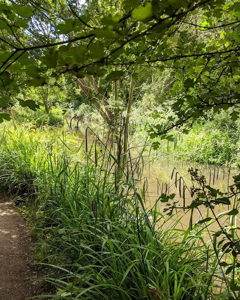
Look for the patterned marsh landscape described in the local walk guide, the riverside boatyard and the contrast between marsh and farmland. The guide also notes sea birds, waders, farmland birds and birds of prey
- 02
seals may sometimes be seen resting in the creeks.
The story
Industry
Best time to go
No season-specific visit information is verified. Check conditions before setting out.
No best time of day is verified. Check tides, weather and route conditions before setting out.
How long to spend
1–2 hours, Half day
Perfect for
Walkers · Wildlife lovers · Photographers
Before you go
Address
Listed hours
- Monday: Open 24 hours
- Tuesday: Open 24 hours
- Wednesday: Open 24 hours
- Thursday: Open 24 hours
- Friday: Open 24 hours
- Saturday: Open 24 hours
- Sunday: Open 24 hours
Check before visiting.
Google rating
Practical information
Opening & access
A public footpath route is described along the edge of the saltmarsh. The supplied map pin marks the main place, not an entrance or parking point. Check local access and tidal conditions before setting out; do not assume access to the marsh itself.
Check before visiting
Parking
Parking at Brandy Hole is not verified. The Hullbridge walk guide describes starting in the village or at the Recreation Ground in Pooles Lane; confirm current parking arrangements before travelling.
Toilets
Check before visiting
Check before visiting
Food & drink
The council guide mentions a restaurant near the route, but current details are not verified. Check before visiting.
Check before visiting
Dogs
Check before visiting
Check before visiting
Accessibility
A footpath route is described, but surface, gradients, step-free access and suitability for mobility aids are not verified. Check conditions before visiting.
Check before visiting
Cost
Unknown
Check before visiting
Water
Estuary
Gallery
Place photographsKeep exploring
Around Brandy Hole Saltmarsh
Within 50 km · approximate straight-line distances