Shellness Road, Leysdown-on-Sea, Isle of Sheppey, Sheerness ME12, Kent
The Swale National Nature Reserve
Mixed-habitat reserve
Source image
7.0
Wildland
About 1 hour for the shorter reported walk
Time
Check
Cost
Big-sky
Feel
Why it's Wildland
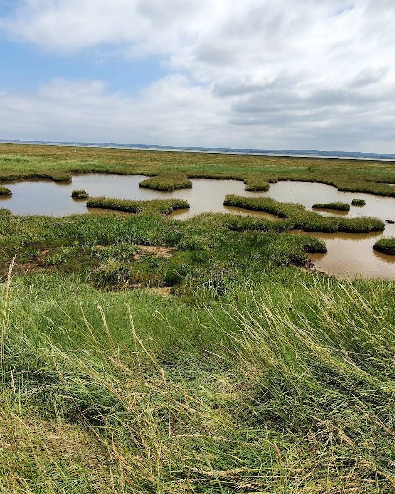
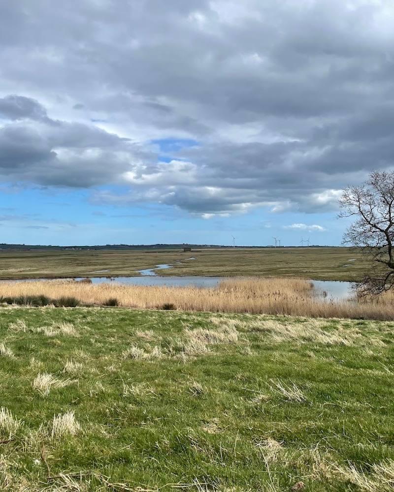
7.0At the eastern edge of the Isle of Sheppey, saltmarsh, grazing marsh and shingle shore meet the tidal Swale estuary. In winter, high-tide roosts and flooded meadows can draw large numbers of waders and wildfowl; birds of prey hunt across the open marsh.
This is a broad, exposed wetland landscape where the best visit is shaped by tide, weather and bird movement rather than a single landmark. The combination of marsh, shingle shore, bird hides and a wartime pillbox gives a walk here both wildlife interest and a tangible sense of the coastline’s history.
Big-sky · Wild · Atmospheric · Remote
Find your way
Open mapShellness Road, Leysdown-on-Sea, Isle of Sheppey, Sheerness ME12, Kent
Opening map…
Know this place a little better?
The experience
A flat but exposed coastal wetland visit best suited to walking and birdwatching. Choose between a short outing to Shellness beach and the pillbox, or a longer circuit across Harty Marshes and the coast. Tide, wind and visibility can change the feel of the day.
Things to do
Watch the high-tide roost
Check the tide and scan the shoreline roost for waders. Birdingplaces names sanderling, dunlin, grey plover and bar-tailed godwit among the birds reported here.
Allow time to observe; no fixed duration verified.
Scan the open marsh for birds of prey
Look across the grazing marsh for hunting merlin, hen harrier and western marsh harrier, particularly during the winter period described by the birding source.
Allow time to observe; no fixed duration verified.
Walk out to Shellness beach
Follow the reported short outing towards Shellness beach and explore the shingle shore beside the estuary. Conditions and access can vary; check before visiting.
Part of the reported 1-hour walk
Find the Shellness pillbox
The short route description includes an out-and-back to a Second World War pillbox among the saltmarsh. Treat it as a historic feature to view, not as a structure to enter.
Part of the reported 1-hour walk
Visit a bird hide
A birding-site description reports a hide reached from the raised bank, with another hide to the north. It notes that reaching the northern hide may involve grazing cattle; check current conditions and access locally.
Make a day of it
Quick escape · About 1 hour, following the reported short route
Quick escape: beach and pillbox
- 01
From the reported small car park, walk towards Shellness beach and explore the shore and estuary edge.
- 02
Continue there and back to the Shellness pillbox, a Second World War fortification described as standing among the saltmarsh.
- 03
Pause to scan the marsh and shoreline for birds; the route source identifies both as features of this short outing.
- 04
Allow for the rough approach track and exposed coastal weather; confirm current access before setting out.
Half day · About 3 hours for the reported 6½-mile circular walk, plus any stops
Make a half day of it: marsh, hide and shoreline
- 01
Use a current route map or navigation to follow the reported longer circular walk across the reserve and Harty Marshes; the supplied source does not provide a turn-by-turn description.
- 02
Look for the reported bird hide and scan the marshes and shoreline for seasonal birdlife.
- 03
Continue towards Shellness beach and the pillbox, allowing time to watch the tide and look for roosting birds.
- 04
The route source mentions the Ferry House Inn and Neptune’s Beach Café as possible stops; verify their opening and access before relying on them.
Verified history
A route description identifies a Second World War pillbox at Shellness, still standing among the saltmarsh. The supplied sources do not establish its construction date, military unit or operational history.
Hidden details
The pillbox in the marsh — The Shellness walk includes a Second World War pillbox standing in the saltmarsh: a visible reminder of coastal defence in a landscape now visited for its wildlife.
Birdlife changes with the tide and season — The birding account distinguishes high-tide wader roosts, wintering birds of prey, birds using flooded meadows and seasonal migration. Bring binoculars if you have them; the source says a telescope is useful.
When to go
· Plan around the tide if hoping to see a high-tide roost. Exact tide times and the best visit time should be checked before travelling.
The supplied birding source identifies winter for roosting waders and birds of prey, autumn for migrants, and spring and autumn for wader passage. Flooded meadows may attract large numbers of wildfowl and waders.
This is a low-lying, exposed area near the sea; the supplied birding source warns it can feel colder than inland and may be misty. Check the forecast and wear suitable layers.
The route
- ascent
- Flat landscape reported; exact ascent not supplied.
- surface
- Not specified; route includes narrow trail and coastal/marsh terrain. Check conditions before visiting.
- distance
- Short route: 1½ miles. Longer circular: 6½ miles.
- duration
- Short route: about 1 hour. Longer route: about 3 hours.
- difficulty
- The birding source describes an average walk and narrow trail; the area is flat and open. Confirm conditions before visiting.
- route shape
- Short route described as an out-and-back. Longer route described as circular.
- start point
- The birding source reports an approach from Leysdown-on-Sea along a rough track to a small car park. The Google main-place pin is not an entrance or parking pin.
- parking start
- Small car park reported at the end of the track from Leysdown-on-Sea; availability, charges and current condition are unverified. The birding source also notes parking can be problematic near Harty Ferry Road.
- shorter alternative
- The reported 1½-mile, approximately 1-hour route to Shellness beach and the pillbox.
- Shellness beach and shingle shore
- Second World War pillbox
- Saltmarsh and grazing marsh
- Reported bird hide
- Seasonal wader and wildfowl watching
Worth pairing with
Ferry House Inn
Mentioned as a possible halfway stop on the longer route. Opening, current operation and whether it suits your route need checking before setting out.
Neptune’s Beach Café
Mentioned as a possible stop on the longer coastal walk. Verify current opening and access before relying on it.
What to look for
- 01
At the shore and marsh edge, scan for roosting waders such as sanderling, dunlin, grey plover and bar-tailed godwit. Look across the marsh for merlin, hen harrier and western marsh harrier
- 02
flooded wet meadows may attract wildfowl and golden plover. Find the Second World War pillbox at Shellness, if following the reported short walk.
The story
War & battle
Best time to go
Winter for high-tide roosts and wintering birds; spring and autumn for migration. Birdingplaces also identifies autumn as a good time for migrants.
Winter is especially rewarding for high-tide wader roosts and hunting birds of prey. Autumn and spring bring migration interest. A calm, clear day may help with observation, but this low-lying coast can be colder and mistier than inland.
How long to spend
About 1 hour for the shorter reported walk; about 3 hours for the longer circuit. Allow extra time for birdwatching and changing conditions.
Perfect for
Birdwatchers · Walkers · Photographers · Wildlife lovers · History lovers
Before you go
Address
Listed hours
- Monday: Open 24 hours
- Tuesday: Open 24 hours
- Wednesday: Open 24 hours
- Thursday: Open 24 hours
- Friday: Open 24 hours
- Saturday: Open 24 hours
- Sunday: Open 24 hours
Check before visiting.
Google rating
Practical information
Opening & access
A reported approach from Leysdown-on-Sea follows a rough, pothole-prone track towards a small car park. Walkers can continue to Shellness beach or along the raised bank beside the marshes. The supplied coordinates identify the main place, not an entrance or parking point. Check local conditions and access before setting out.
Check before visiting
Parking
A small car park is reported at the end of a rough, pothole-prone track from Leysdown-on-Sea. Parking availability, charges and current track conditions are not independently confirmed; check before visiting.
Check before visiting
Toilets
Check before visiting.
Check before visiting
Food & drink
A route description mentions Neptune’s Beach Café and the Ferry House Inn as possible stops on its longer walk; opening and current availability are not verified. Check before visiting.
Check before visiting
Dogs
Dog access and restrictions are not verified. Check current reserve guidance and local signage before visiting.
Check before visiting
Accessibility
The landscape is reported as flat and open, but routes include narrow paths and access along an uneven, badly maintained track. Wheelchair and pushchair suitability are not verified. Check conditions before visiting.
Check before visiting
Cost
Check before visiting
Check before visiting
Water
Estuary, saltmarsh, grazing marsh, mudflats and shingle shore. Swimming or paddling permission is not established; do not assume either is permitted.
Gallery
Place photographsKeep exploring
Around The Swale National Nature Reserve
Within 50 km · approximate straight-line distances
 Place photograph6.6
Eastchurch Aviation Museum
Eastchurch, Sheerness, Isle of Sheppey, Kent
6.1 km away
 Source image7.8
Elmley National Nature Reserve
Kingshill Farm, Elmley, Minster on Sea, Sheerness ME12 3RW
10.0 km away
 Place photograph7.1
Bigbury Camp
Howfield Wood, near Upper Harbledown, Canterbury, Kent CT4 7NG
12.3 km away