6.2
Wildland
1–2 hours
Time
Check
Cost
Wild
Feel
Why it's Wildland
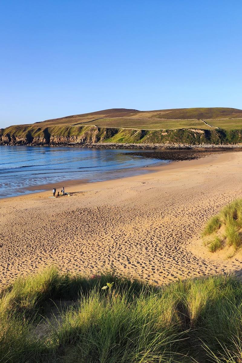
6.2A broad sandy bay meets the River Strathy beneath dunes and the open Atlantic coast.
The combination of a sandy shore, river mouth and dunes gives Strathy Bay a stronger sense of wild coast than a simple beach stop. Its exposed setting rewards a quiet visit, but conditions can change quickly.
Wild · Remote · Peaceful
Find your way
Open mapStrathy, Highlands, Scotland
Opening map…
Know this place a little better?
The experience
Allow around an hour or two to reach the shore, explore the beach and dunes, and take in the meeting of river and sea. Check conditions before setting out; the supplied sources do not verify swimming permission or facilities.
Things to do
Cross the dunes to the beach
Follow the approach from the car park across the dunes to the sandy Atlantic shore. Do not drive on the dunes.
About 75 minutes
Look for the river mouth
At the western side of the bay, the River Strathy enters the sea.
Climb to White Hill
The supplied guide describes a short climb above the bay with views over the beach, dunes, river valley and the Strathy settlements. Check current access and conditions first.
About 45 minutes
Make a day of it
Quick escape · About 75 minutes
Quick Escape: Reach the shore
- 01
Start from the bay car park.
- 02
Cross the dunes to the sandy shore.
- 03
Look towards the western side of the bay, where the River Strathy reaches the Atlantic.
- 04
Return the way you came, taking care on the dunes.
Half day · Check before visiting
Make a half day of it: Beach and viewpoint
- 01
Explore the bay and its dunes.
- 02
If conditions and access allow, take the short climb to White Hill for views over the beach, dunes and River Strathy valley.
- 03
Check the route and current access details before setting out.
Hidden details
The River Strathy’s Atlantic mouth — The river reaches the sea at the western side of the bay, a useful detail to look for while exploring the shore.
When to go
· Morning is suggested for photography in the source row; check wind and coastal conditions.
No sourced month-specific seasonal information is available. The source row warns that the coast is exposed and best avoided in strong winds.
Exposed coastal conditions can make the bay uncomfortable or hazardous. Check the forecast and local conditions before visiting.
Worth pairing with
White Hill
A short climb above the bay with views over the beach, dunes and River Strathy valley.
What to look for
Notice where the River Strathy meets the sea and how the dunes frame the bay.
Best time to go
Check local conditions; the exposed coast can be uncomfortable in strong winds.
The source row recommends morning light for photography. Check the forecast before visiting this exposed coast.
How long to spend
1–2 hours
Perfect for
Walkers · Photographers · Wildlife lovers
Practical information
Opening & access
A sandy bay at the mouth of the River Strathy, with dunes and a car park noted by the supplied Strathy guide. Check current access and conditions before visiting.
Check before visiting
Parking
A car park is noted in the supplied Strathy guide. Check current parking arrangements before travelling.
Check before visiting
Toilets
Check before visiting
Check before visiting
Food & drink
Check before visiting
Check before visiting
Dogs
Check before visiting
Check before visiting
Accessibility
Check before visiting; the source describes dunes and does not establish an accessible route.
Check before visiting
Cost
Check before visiting
Check before visiting
Water
Sea, River
Gallery
Place photographs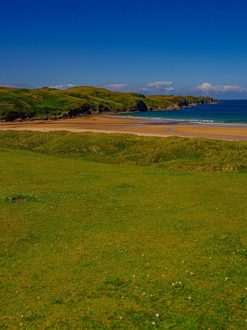
Keep exploring
Around Strathy Bay
Within 50 km · approximate straight-line distances