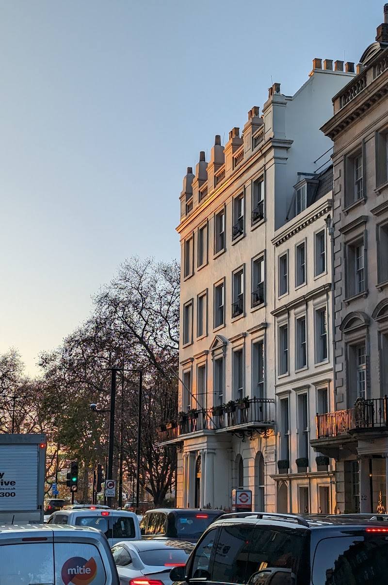
Traffic island at the junction of Edgware Road and Bayswater Road, near Marble Arch, London W1H 7EL
Site of Tyburn Tree
Tiny historic site
Place photograph
2.5
Wildland
Under 1 hour
Time
Check
Cost
Atmospheric
Feel
Why it's Wildland
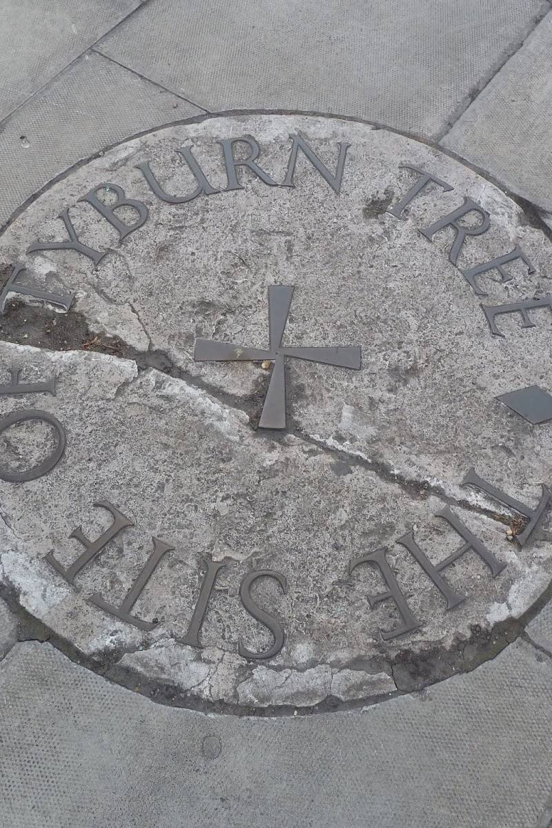
2.5A small plaque marks the site of Tyburn’s notorious public gallows, where London’s condemned were executed for centuries. The name “Tyburn Tree” is memorable, but the landmark was a gallows, not a living tree.
This is a compact urban history stop rather than a wild landscape: its value lies in the arresting contrast between today’s busy Marble Arch junction and a site long associated with public executions. The English Heritage plaque gives that history a tangible, if modest, marker.
Atmospheric
Find your way
Open mapTraffic island at the junction of Edgware Road and Bayswater Road, near Marble Arch, London W1H 7EL
Opening map…
Know this place a little better?
The experience
A brief, self-guided history stop to locate the plaque and consider how the area’s role has changed. It is best treated as one point of interest within a wider London visit, not a standalone day out.
Things to do
Read the ground-level plaque
Find the stone plaque inscribed “THE SITE OF TYBURN TREE”. English Heritage records that it was erected in 1964 and replaced an earlier triangular plaque from 1909.
5–10 minutes
Place the gallows in the modern streetscape
Consider the contrast between the marked site and the busy junction around Marble Arch. The local history account describes Tyburn as a principal London execution site and explains that the gallows were wooden, despite the name “Tyburn Tree”.
5–10 minutes
Make a day of it
Quick escape · Around 15–30 minutes
Find the Tyburn Tree plaque
- 01
Check the safest current pedestrian approach to the traffic island before setting out.
- 02
Locate the ground-level English Heritage plaque and read its inscription.
- 03
Take a moment to picture the historic execution site within today’s Marble Arch streetscape.
Verified history
English Heritage records a ground-level stone plaque at the traffic island junction of Edgware Road and Bayswater Road. Erected in 1964 by the London County Council, it replaced a triangular LCC plaque dating from 1909. The plaque marks the site of Tyburn Tree. A local history account describes Tyburn as a principal site for London public executions and explains that the “tree” was a wooden gallows, not a living tree.
Hidden details
The “tree” was a gallows — Despite its name, Tyburn Tree was a wooden execution structure. The plaque itself is the surviving marker visitors can look for at the site.
Two generations of commemorative plaque — The current ground-level plaque, erected in 1964, replaced a triangular LCC plaque installed in 1909.
When to go
January · February · March · April · May · June · July · August · September · October · November · December · Daylight, when the plaque is easier to locate.
The plaque is an outdoor urban marker and the supplied sources give no seasonal visiting information. Daylight is a practical choice for finding it.
Check the weather and current pedestrian access before visiting. The site is at a traffic junction; take care when approaching.
What to look for
- 01
Look for the ground-level stone plaque. English Heritage notes that it replaced an earlier triangular London County Council plaque erected in 1909
- 02
the current plaque was erected in 1964.
The story
Crime & punishment
Best time to go
Year-round
Visit in daylight so the plaque is easier to locate. Check pedestrian access and crossing arrangements before setting out.
How long to spend
Under 1 hour
Perfect for
Solo · History lovers
Before you go
Address
Website
Google rating
Practical information
Opening & access
The English Heritage plaque is identified at a traffic island. The precise safe approach and current pedestrian access are not confirmed; check before visiting and take care around traffic. Access arrangements are unconfirmed. Check before visiting; do not enter private land or restricted structures.
Check before visiting
Parking
Check before visiting.
Check before visiting
Toilets
Check before visiting.
Check before visiting
Food & drink
Check before visiting.
Check before visiting
Dogs
Check before visiting.
Check before visiting
Accessibility
The plaque is described as ground-level and set into a traffic island. Step-free access, crossing arrangements and suitability for wheelchair users are not confirmed; check before visiting.
Check before visiting
Cost
Check before visiting.
Check before visiting
Gallery
Place photographsKeep exploring
Around Site of Tyburn Tree
Within 50 km · approximate straight-line distances