Wanstead Park, London, E11 3QZ
Shoulder of Mutton Pond
Pond landscape
Place photograph
4.1
Wildland
Under 1 hour
Time
Check
Cost
Atmospheric
Feel
Why it's Wildland
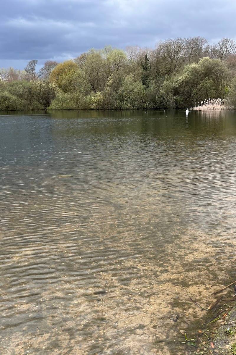
4.1Mapped as ‘House Field Pond’ in 1745, Shoulder of Mutton Pond is part of Wanstead Park’s carefully managed chain of ornamental waters. Its origins are not certain: historic maps suggest changing plans for the lakes, while the pond in roughly its present form was completed by the 1740s.
This is a small, historically layered pond rather than a destination with a documented programme of activities. Its appeal lies in the surviving eighteenth-century water landscape and the questions its old maps leave open about how Wanstead Park was designed.
Atmospheric
Find your way
Open mapWanstead Park, London, E11 3QZ
Opening map…
Know this place a little better?
The experience
A short stop within a wider Wanstead Park walk. Look at the pond as one element in the park’s connected historic water system; swimming and other water activities are not verified.
Things to do
Read the pond in the old maps
The Friends of Wanstead Parklands discusses Rocque’s 1745 map, which labels the pond ‘House Field Pond’, and earlier maps that suggest the design of the park’s waters changed over time.
10–20 minutes
Notice the pond’s place in the water system
The 1779 map described by the Friends shows a channel running from Lake Pond through Shoulder of Mutton Pond towards Heronry Pond, placing it within Wanstead Park’s wider water-management landscape.
10–20 minutes
Make a day of it
Quick escape · Under 1 hour
A brief look at the historic pond
- 01
If you are already visiting Wanstead Park and can reach the pond by an open path, pause to view the water and its setting.
- 02
Notice its relationship to the neighbouring ponds and consider how it formed part of a managed water system.
- 03
Check path conditions before visiting; routes near the southern ponds are described as ill-defined.
Half day · Check before visiting
Add the pond to a Wanstead Park walk
- 01
Use a current park map to plan a walk that includes the southern ponds; the supplied local account describes a wider walk through Wanstead Park but warns that paths near these ponds are ill-defined.
- 02
Visit Shoulder of Mutton Pond as one stop among the park’s historic waters.
- 03
Check current access and route conditions before setting out.
Verified history
Shoulder of Mutton Pond is clearly depicted on Rocque’s 1745 map as ‘House Field Pond’. Its possible relationship to a medieval manor house is uncertain. Maps from 1735 and 1745 appear to show different arrangements for the ponds, and the Friends of Wanstead Parklands outlines several possible explanations, including changes in design, road access, water supply or construction. The pond in something resembling its present form was completed by the 1740s. A 1779 map shows it connected by a channel to neighbouring waters. It survives in broadly the form shown on nineteenth-century maps; the account notes silting and seasonal falls in water level.
Hidden details
The name ‘House Field Pond’ — Rocque’s 1745 map labels the pond ‘House Field Pond’. The connection to a medieval manor house is uncertain: the name may refer to the field rather than prove that the pond and house existed together.
A channel in the historic water system — The Friends’ account of Searles’ 1779 map describes a channel running into the pond from Lake Pond and onwards towards Heronry Pond.
When to go
· No specific time is supported by the supplied sources.
The pond is reported to remain groundwater-fed even in dry years, although its level falls further during summer. No season is identified as the best time to visit.
Paths around the southern ponds may be ill-defined. A local account recommends stout footwear for exploring Wanstead Park because paths can be muddy.
Worth pairing with
Heronry Pond
A neighbouring pond in Wanstead Park’s historic chain of waters; the local park walk account includes it in a route through the southern ponds.
Wanstead Park’s Ornamental Water
The larger historic water feature elsewhere in the park, described in the local walk account alongside the park’s surviving landscape features.
What to look for
- 01
Look for the pond’s broadly oval form and its position among the neighbouring historic waters. Historic maps show a channel linking it with Lake Pond and Heronry Pond
- 02
the Friends of Wanstead Parklands discusses how the maps record changes to the landscape.
The story
Archaeology
Best time to go
No specific best season is verified. The pond’s water level can fall further in summer.
No preferred time of day is established by the supplied sources. Check conditions before setting out, particularly if relying on paths around the southern ponds.
How long to spend
Under 1 hour
Perfect for
Walkers · History lovers
Before you go
Address
Google rating
Practical information
Opening & access
The pond is within Wanstead Park, managed as part of Epping Forest. A local history account notes that paths near the southern ponds are ill-defined; check current access and conditions before visiting, and keep to paths where they are clear. Access arrangements are unconfirmed. Check before visiting; do not enter private land or restricted structures.
Check before visiting
Parking
Check before visiting. The supplied sources do not verify parking for the pond.
Check before visiting
Toilets
Check before visiting
Check before visiting
Food & drink
Check before visiting
Check before visiting
Dogs
Check before visiting
Check before visiting
Accessibility
Check before visiting. Path conditions and step-free access at the pond are not verified; a local park walk account describes paths near the southern ponds as ill-defined.
Check before visiting
Cost
Check before visiting
Check before visiting
Water
Pond
Gallery
Place photographsKeep exploring
Around Shoulder of Mutton Pond
Within 50 km · approximate straight-line distances