Putney Embankment, by Beverley Brook Bridge, Putney, London SW15 1NB
Putney Towpath
route · Waterside walk
Source image
4.2
Wildland
1–2 hours, Half day, Full day
Time
Check
Cost
Peaceful
Feel
Why it's Wildland
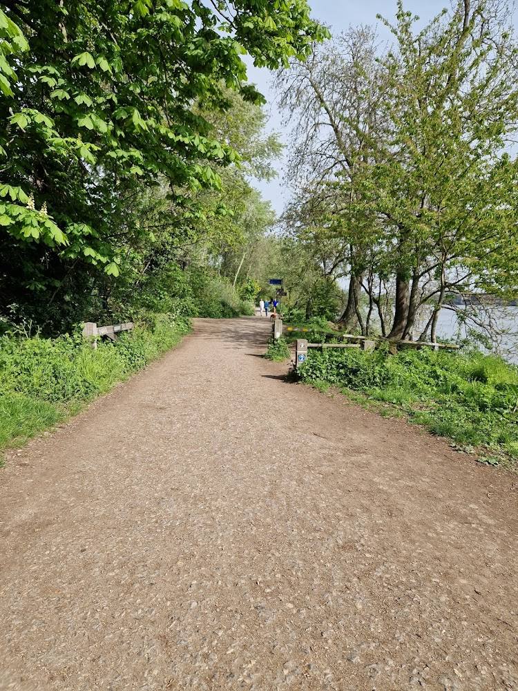
4.2From Putney, the Thames Path follows a tree-lined stretch of the river west towards Richmond, passing bridges, rowing water and riverside neighbourhoods. The longer Putney–Richmond walk is described as 9.3 miles (15 km), with a choice of north- or south-bank sections.
This is a useful urban riverside escape rather than a remote wild walk: its appeal is the changing Thames scenery, tree-lined path and chance to explore the river’s bridges on foot. The sourced Putney–Richmond route offers a substantial, flat outing, but the immediate towpath’s exact length and starting access point are not established here.
Peaceful
Find your way
Open mapPutney Embankment, by Beverley Brook Bridge, Putney, London SW15 1NB
Opening map…
Know this place a little better?
The experience
Use the towpath for a riverside walk, taking in the Thames and its bridges. For a longer outing, the supplied guide describes a 9.3-mile Putney–Richmond walk on flat, all-weather paths, with north- and south-bank options in sections. Confirm your start, crossings and current path conditions before setting off.
Things to do
Walk from Putney to Richmond
The walking guide describes a 9.3-mile (15 km) route with about 3.5 hours’ walking time, flat all-weather paths and options to use either bank in sections. Check the detailed route and current crossings before departure.
About 3.5 hours walking time
Look out for riverside bridges
The Putney–Richmond walking guide describes a route passing ten bridges, with opportunities to cross some of them or walk to the middle for a view. Confirm current pedestrian access before relying on any crossing.
Make a day of it
Quick escape · Check before visiting; no short-loop distance is verified
A short Thames-side wander
- 01
Start from a suitable, confirmed access point on Putney Embankment.
- 02
Walk a section of the riverside path and return the way you came; confirm the path and access point before setting out.
Half day · 9.3 miles (15 km); about 3.5 hours’ walking time
Putney to Richmond on the Thames Path
- 01
Follow the Thames Path west from Putney towards Richmond.
- 02
Choose north- or south-bank sections where the guide describes a choice, checking crossings and diversions as you go.
- 03
Finish in Richmond; the guide notes rail and Underground connections there and at Putney.
Verified history
The supplied walking guide identifies Putney Bridge as a Grade II listed stone-and-granite arch bridge dating to 1886, later widened in the 1930s. These details concern the wider Putney–Richmond route, not a verified history of the towpath itself.
Hidden details
A route with bridge-crossing choices — The walking guide says the longer Putney–Richmond walk passes ten bridges and offers options to cross some for a view or alternate between banks. Access and crossing arrangements should be checked before travel.
When to go
· Winter daylight is recommended for the longer walk; no specific time of day is verified for the short Putney section.
The walking guide describes the longer route as a fine winter walk and advises making the most of winter sunlight. A local Putney guide also highlights autumn riverside scenery.
Check the forecast and daylight, particularly for the longer walk. Current path and crossing conditions are not verified.
The route
- ascent
- None, according to the guide.
- surface
- All-weather paths, according to the guide.
- distance
- The sourced Putney–Richmond walk is 9.3 miles (15 km); this is not a verified distance for Putney Towpath alone.
- duration
- About 3.5 hours walking time for Putney–Richmond.
- difficulty
- Easy; the guide rates the longer walk 1/10.
- route shape
- Linear, Putney to Richmond.
- start point
- The guide describes the route as starting at Putney; the supplied main-place pin is not an entrance pin.
- parking start
- Check before visiting. The guide warns that parking restrictions apply in many areas and weekday parking can be difficult.
- shorter alternative
- Walk a section from a confirmed Putney access point and return the same way; no specific short route or distance is verified.
- Tree-lined Thames Path sections
- Ten bridges along the Putney–Richmond route, according to the guide
- Choice of north- or south-bank sections in parts of the route
Worth pairing with
Richmond
The longer sourced walk ends in Richmond, which the guide identifies as having riverside pubs and cafés and rail and Underground connections. Check current opening and transport information.
Fulham Palace
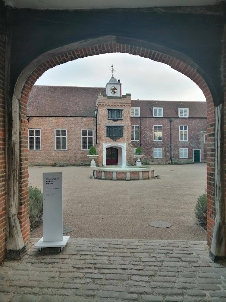
The walking guide lists Fulham Palace and its gardens as an attraction near Putney Bridge. Check current visitor information before making it part of a trip.
What to look for
- 01
Notice how the views and riverside character change between bridges. The Putney–Richmond guide identifies ten bridges along its longer route and describes tree-lined path sections
- 02
its route includes choices between north- and south-bank stretches.
The story
River transport, bridges and the Thames’ riverside landscape
Best time to go
All seasons; the walking guide specifically recommends a winter walk in good daylight.
The walking guide calls this a fine winter walk and recommends making the most of the winter daylight. For other seasons, choose a clear spell and check conditions before you go.
How long to spend
1–2 hours, Half day, Full day
Perfect for
Walkers · Photographers · History lovers
Route at a glance
Duration
1–2 hours, Half day, Full day
Terrain
Riverside, Urban historic
Parking / start
Check before visiting; the walking guide warns that parking restrictions and availability vary along the route, with weekday parking difficult in many areas.
Before you go
Address
Listed hours
- Monday: Open 24 hours
- Tuesday: Open 24 hours
- Wednesday: Open 24 hours
- Thursday: Open 24 hours
- Friday: Open 24 hours
- Saturday: Open 24 hours
- Sunday: Open 24 hours
Check before visiting.
Google rating
Practical information
Opening & access
The supplied walking guide describes the Thames Path from Putney to Richmond. The main-place pin is not confirmed as an entrance; check current access and route conditions before setting out. Access arrangements are unconfirmed. Check before visiting; do not enter private land or restricted structures.
Check before visiting
Parking
Check before visiting; the walking guide warns that parking restrictions and availability vary along the route, with weekday parking difficult in many areas.
Check before visiting
Toilets
Check before visiting
Check before visiting
Food & drink
The walking guide mentions riverside pubs and cafés along the Putney–Richmond route; check current opening and availability.
Check before visiting
Dogs
Check before visiting
Check before visiting
Accessibility
The Putney–Richmond walk is described as flat, with all-weather paths and no ascent. This does not establish step-free access throughout the whole route; check current conditions and access at your chosen start point.
Check before visiting
Cost
Check before visiting
Check before visiting
Water
River
Gallery
Place photographsKeep exploring
Around Putney Towpath
Within 50 km · approximate straight-line distances