Near Llanrhaeadr-ym-Mochnant, Oswestry, Powys
Pistyll Rhaeadr
Waterside landscape
Place photograph
8.0
Wildland
1–2 hours
Time
Check
Cost
Dramatic
Feel
Why it's Wildland
8.0Afon Rhaeadr drops through several tiers at Pistyll Rhaeadr, with a natural rock bridge between the falls. The waterfall is about 73 metres high and lies in the Berwyn Mountains.
The draw here is unmistakably physical: a tall, tiered waterfall, a natural arch in the rock and a short but steep walk to views over Tanat Valley. It makes a worthwhile destination in its own right, with a more demanding upper viewpoint for visitors who want more than the view from below.
Dramatic · Wild
Find your way
Open mapNear Llanrhaeadr-ym-Mochnant, Oswestry, Powys
Opening map…
Know this place a little better?
The experience
Allow around 1–2 hours for the lower viewpoint and, if conditions and ability permit, the uphill path to the top of the falls. The upper route is steep and uneven; check current access and facilities before travelling.
Things to do
See the waterfall from the footbridge
Take the short walk from the car park to the footbridge for a close view of the falls from below.
About 30 minutes for the short falls visit
Climb to the top of the falls
Take the uphill route to the upper viewpoint. The path is described as steep, rocky and uneven; check conditions and your ability before setting out.
Part of a 20–30 minute walk according to the supplied route description; allow extra time for stops and the return
Make a day of it
Quick escape · About 30 minutes
Quick Escape: the falls from below
- 01
Start from the local car park beside the falls.
- 02
Take the short path to the footbridge and view the waterfall from below.
- 03
Look for the natural rock bridge between the tiers.
Half day · About 1–2 hours, allowing time for the walk and viewpoints
Make a half day of it: climb to the upper falls
- 01
Begin at the local car park and take the path towards the falls.
- 02
Visit the lower viewpoint if conditions allow.
- 03
Follow the uphill, uneven rocky path to the top of the falls and look across Tanat Valley.
- 04
Return by the same route; check the path and access conditions before setting out.
Hidden details
The natural bridge between the falls — A natural rock bridge spans the waterfall between its tiers, an unusual feature to seek out from the viewpoints.
When to go
· No evidence supplied to recommend a particular time of day.
No reliable seasonal recommendation is established by the supplied sources.
The upper route is steep and uneven. Check current weather and path conditions before attempting it.
The route
- surface
- Woodland path and rocky incline
- duration
- 20–30 minutes is given for the walk; confirm whether this refers to the full return route before relying on it.
- difficulty
- Steep and uneven on the upper path
- route shape
- Out and back
- start point
- Local car park beside the waterfall
- parking start
- A car park beside the falls is described in the sources; one source says it is a pay car park. Check current arrangements.
- shorter alternative
- Take the short path to the lower viewpoint and return without climbing the upper route.
- View of the falls from below
- Natural rock bridge between waterfall tiers
- Upper viewpoint towards Tanat Valley
What to look for
From the lower viewpoint, look for the natural rock bridge between tiers. On the upper path, notice how the waterfall sits within the wooded valley and opens out towards Tanat Valley.
Best time to go
Check conditions before setting out; the supplied sources do not establish a best season.
The sources do not establish a best time of year or day. Check local conditions before setting out.
How long to spend
1–2 hours
Perfect for
Walkers · Photographers
Before you go
Address
Google rating
Practical information
Opening & access
A waterfall destination reached by a single-lane road. Sources describe a car park beside the falls; check current access and parking arrangements before travelling.
Check before visiting
Parking
Sources describe a car park at the end of the road beside the falls; one identifies it as a pay car park. Check current arrangements before visiting.
Check before visiting
Toilets
A restroom is reported at Pistyll Rhaeadr Café; verify availability before visiting.
Check before visiting
Food & drink
Pistyll Rhaeadr Café is reported beside the car park; check current opening and service details before travelling.
Check before visiting
Dogs
Check before visiting.
Check before visiting
Accessibility
The short route to the upper falls includes a steep incline and uneven, rocky ground. The supplied sources do not establish step-free access.
Cost
Paid parking is reported by a supplied source; check current charges.
Check before visiting
Water
River and waterfall
Gallery
Place photographs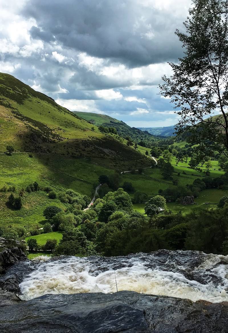
Keep exploring
Around Pistyll Rhaeadr
Within 50 km · approximate straight-line distances