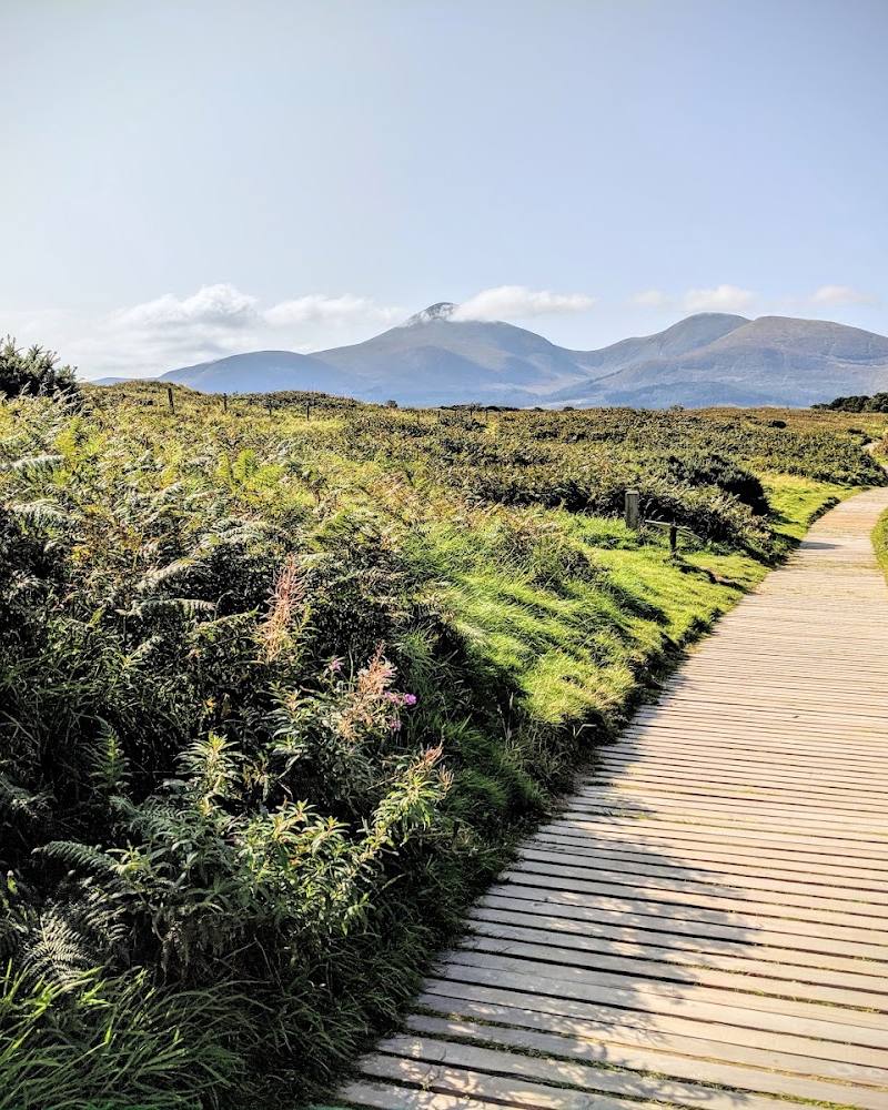
Oxford Island, southern shore of Lough Neagh, near Craigavon, County Armagh, Northern Ireland
Oxford Island Nature Reserve
Mixed-habitat reserve
Place photograph
7.2
Wildland
1–2 hours
Time
Check
Cost
Peaceful
Feel
Why it's Wildland
7.2Despite its name, Oxford Island is a peninsula reaching into Lough Neagh. Its woodland, meadows, reedbeds and shoreline make it a place to explore the changing habitats of the lough’s edge.
Oxford Island pairs a substantial stretch of Lough Neagh shoreline with woodland, meadows and wetland habitat, while surfaced trails and birdwatching hides make the landscape approachable. Its strongest draw is the chance to slow down and watch the lough and its wildlife from close range.
Peaceful · Wild
Find your way
Open mapOxford Island, southern shore of Lough Neagh, near Craigavon, County Armagh, Northern Ireland
Opening map…
Know this place a little better?
The experience
Explore the reserve’s trails at an unhurried pace, pausing at birdwatching hides to look across the reedbeds and Lough Neagh. The visitor centre offers an additional place to learn about the lough and its wildlife. Verify current facilities and opening hours before travelling.
Things to do
Watch the lough from a bird hide
Use a birdwatching hide to scan the reedbeds and open water. The supplied source row names great crested grebe and tufted duck among birds visitors may look for; sightings will vary.
Allow time to watch quietly; exact duration not specified.
Explore the reserve trails
Walk the surfaced trails through the reserve’s woodland, meadows and reedbeds, taking in views towards Lough Neagh.
Visit the Lough Neagh Discovery Centre
Explore the centre’s compact exhibition about the lough’s wildlife and biodiversity. Check current opening hours before planning around it.
Make a day of it
Quick escape · 1–2 hours
Quick Escape: shoreline and hide
- 01
Start at the Lough Neagh Discovery Centre, if open.
- 02
Follow a surfaced trail towards the shoreline and reedbeds.
- 03
Pause at a birdwatching hide and scan the water before returning.
Half day · Half day
Make a Half Day of It: trails, wildlife and the visitor centre
- 01
Check the centre’s current opening hours and begin with its wildlife and biodiversity exhibition.
- 02
Explore the reserve’s surfaced trails through woodland, meadows and wetland.
- 03
Spend time at a hide looking across the reedbeds and Lough Neagh.
- 04
Finish with a stop at the Loughside Café if it is open.
Verified history
Armagh City, Banbridge and Craigavon Borough Council says it has managed Oxford Island as a National Nature Reserve and recreation area since 1972. The council describes the site as a peninsula reaching into Lough Neagh, with woodland, meadows and recreation areas. The supplied source row also describes earlier agricultural and fishing use, but the supplied sources do not provide dates or supporting detail for that account.
Hidden details
An island that is really a peninsula — Despite its name, Oxford Island is a peninsula of land reaching out into Lough Neagh.
A shoreline measured in kilometres — The council describes the reserve as having 3.7 km of shoreline, offering a useful sense of how much of the visit is shaped by the water’s edge.
When to go
· Not specified in the supplied sources.
The supplied listing identifies spring and autumn as strong seasons: spring for wildflowers and breeding-bird activity, autumn for migratory birds and seasonal colour. It also describes Oxford Island as a year-round destination.
No specific weather guidance is supplied. Check the forecast and current path conditions before visiting.
Worth pairing with
Kinnego Marina
The visitor information source identifies Kinnego Marina as part of the wider Oxford Island site. No specific activity, access conditions or booking details are verified here.
What to look for
- 01
Look for the contrast between woodland, meadow, reedbed and open shoreline
- 02
scan the water and wetland from the birdwatching hides for waterbirds. Great crested grebe and tufted duck are named in the supplied source row, but sightings are not guaranteed.
The story
The supplied source row describes a history of agricultural and fishing use; no dates or further historical detail are verified by the supplied sources.
Best time to go
Spring and autumn are highlighted for wildflowers, birdsong and migratory birds; the reserve can be visited year-round.
Spring and autumn are the best-supported seasons in the supplied information: spring for wildflowers and breeding-bird activity, and autumn for migrating and wintering birds. A calm, clear spell may make looking across the lough more comfortable, but no specific time of day is verified.
How long to spend
1–2 hours; allow half a day to combine trails, hides and the visitor centre.
Perfect for
Walkers · Wildlife lovers · Photographers · Families
Practical information
Opening & access
A public nature reserve and recreation area managed by Armagh City, Banbridge and Craigavon Borough Council. Check current opening hours and visitor information before setting out.
Check before visiting
Parking
On-site parking is reported in the supplied listing; check current arrangements before visiting.
Check before visiting
Toilets
Toilets are reported on-site in the supplied listing; check current availability.
Check before visiting
Food & drink
The supplied listing reports a café offering light refreshments. Check opening times before visiting.
Check before visiting
Dogs
The supplied listing describes the reserve as dog-friendly; check current reserve guidance and signage.
Check before visiting
Accessibility
The supplied listing reports level paths, ramps and wheelchair accessibility across much of the reserve. Check current route and facility details before visiting.
Check before visiting
Cost
Check before visiting
Check before visiting
Water
Lough Neagh shoreline, reedbeds and ponds. Swimming or paddling permission is not established by the supplied evidence.
Gallery
Place photographs

Keep exploring
Around Oxford Island Nature Reserve
Within 50 km · approximate straight-line distances