Between Callander and Strathyre, Loch Lomond and The Trossachs National Park, Scotland
Loch Lubnaig
Lake
Place photograph
7.4
Wildland
1–2 hours
Time
Paid
Cost
Dramatic
Feel
Why it's Wildland
7.4A long Highland loch between Callander and Strathyre, with Ben Ledi, Benvane and Ben Vorlich shaping its mountain setting.
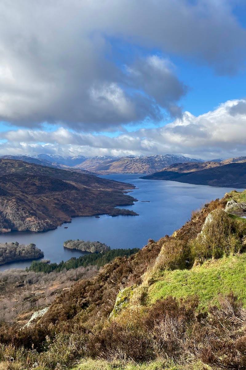
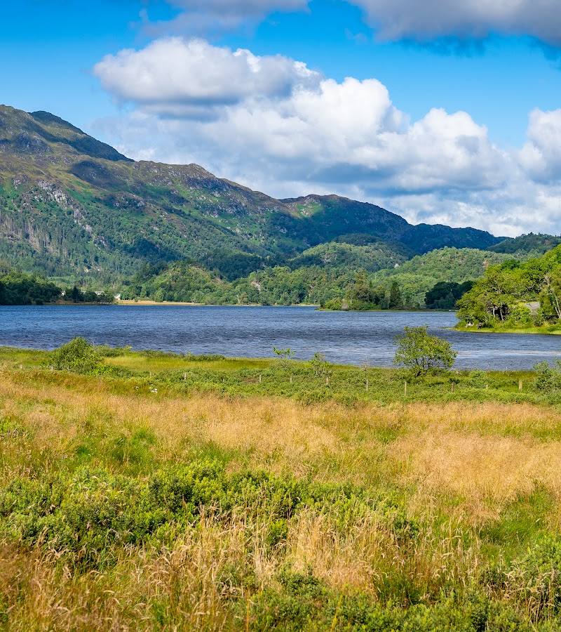
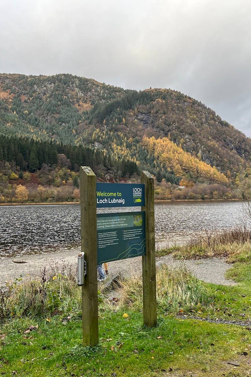
Loch Lubnaig makes a striking first encounter with Highland scenery: a mountain-framed loch with access points for taking in the shoreline and, where conditions and current rules allow, getting onto the water. Its road-side access makes it an easy stop, but the scale of the landscape gives it more than passing-view appeal.
Dramatic · Peaceful · Big-sky
Find your way
Open mapBetween Callander and Strathyre, Loch Lomond and The Trossachs National Park, Scotland
Opening map…
Know this place a little better?
The experience
Come for the loch-and-mountain setting. Take time at a shoreline access point for the view, or explore the loch by bike on the west-shore National Cycle Network route. The supplied guide also identifies the loch as popular with open-water swimmers and canoe and kayak users; water gets deep quickly and can be very cold.
Things to do
Take in the mountain-framed loch
Pause at a shoreline access point and look for Ben Ledi, Benvane and Ben Vorlich around Loch Lubnaig.
30–60 minutes
Cycle beside the western shore
Explore a section of National Cycle Network Route 7, also known as the Lochs and Glens Way, which follows the loch's western shore.
Get onto the water
The supplied guide describes Loch Lubnaig as popular with open-water swimmers and canoe and kayak users. The loch gets deep quickly and the water can be very cold; check current conditions and access before attempting water activities.
Make a day of it
Quick escape · 1–2 hours
Quick escape: lochside views
- 01
Use a Loch Lubnaig car park and check its current charges and opening arrangements.
- 02
Spend time taking in the loch and its mountain setting from an accessible shoreline point.
- 03
Look for Ben Ledi, Benvane and Ben Vorlich around the loch.
Half day · Half day
Make a half day of it: shore and cycle route
- 01
Start at Loch Lubnaig and take in the loch from a shoreline access point.
- 02
Explore a section of National Cycle Network Route 7, which follows the western shore.
- 03
Finish with takeaway food or a drink at The Cabin if it is open; check current hours before setting out.
Folklore & legend
A supplied travel article says local tradition associated Beltane fires and solitary retreats for reflection and prayer with nearby Ben Ledi. These are presented as traditions, not established history of Loch Lubnaig itself.
Hidden details
The loch's mountain frame — The supplied guide names Benvane, Ben Vorlich and Ben Ledi as surrounding mountains; use them as landmarks when looking across the water.
When to go
· No specific time of day is established by the supplied sources.
The supplied sources mention summer visits but do not establish seasonal wildlife, scenery peaks or a best month. Check local weather and water conditions.
Check the forecast and current water conditions. The supplied guide warns that the loch gets deep quickly and the water can be very cold.
Worth pairing with
Callander
Loch Lubnaig lies between Callander and Strathyre; Callander is identified as the nearest named town in the supplied source material.
What to look for
Look across the loch to the surrounding mountains: Benvane, Ben Vorlich and Ben Ledi are identified in the supplied guide. Notice how the loch runs through the valley between Callander and Strathyre.
Best time to go
Check conditions before visiting; the supplied sources describe both summer visits and open-water use but do not establish a best season.
The supplied sources do not establish a best time of day. Check weather and water conditions before setting out, especially for water activities.
How long to spend
1–2 hours
Perfect for
Photographers · Walkers · Swimmers · Cyclists
Before you go
Address
Google rating
Practical information
Opening & access
The A84 runs along the eastern shore. The supplied guide describes north and south car parks; check current access and charges before travelling.
Check before visiting
Parking
The supplied guide describes north and south car parks, both pay and display. Check current charges, opening arrangements and availability before travelling.
Check before visiting
Toilets
The Cabin at the north car park is reported to have toilets; check current facilities and opening status before visiting.
Check before visiting
Food & drink
The Cabin at the north car park is reported to offer takeaway food and drink; check current opening status before visiting.
Check before visiting
Dogs
Check before visiting.
Check before visiting
Accessibility
The A84 follows the eastern shore and the guide describes car parks. Path and shore accessibility details are not established; check before visiting.
Check before visiting
Cost
Paid
Water
Lake
Gallery
Place photographs
Keep exploring
Around Loch Lubnaig
Within 50 km · approximate straight-line distances