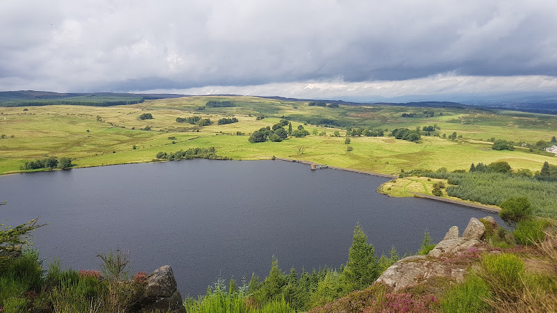
Fallin, about 3 miles east of Stirling, Scotland
Fallin Bing
route · Countryside walk
Source image
6.2
Wildland
1–2 hours
Time
Check
Cost
Open
Feel
Why it's Wildland
6.2A former coal-spoil heap rises above Fallin, now a short walk to wide views across the Forth Valley and a reminder of the area’s mining past.
This is a compact walk with a strong sense of place: a reclaimed mining landscape, an open-air display of mining machinery and a summit panorama that reaches towards Stirling, the Wallace Monument, the meandering Forth and the Ochils.
Open · Industrial heritage
Find your way
Open mapFallin, about 3 miles east of Stirling, Scotland
Opening map…
Know this place a little better?
The experience
Walk from the open-air mining museum towards the obvious path up the bing. Pause at the summit for views towards Stirling, the Wallace Monument, Ben Ledi, the River Forth and the Ochils. Add the former mineral railway trackbed and wooden trestle bridge for a longer outing.
Things to do
Climb the former bing
Follow the obvious path from near the open-air mining museum up the low rise. From the summit, the guide reports views towards Stirling, the Wallace Monument, Ben Ledi, the River Forth and the Ochils.
About 1 mile for the bing walk
Browse the open-air mining museum
See the mining machinery and equipment displayed beside the described walk start. The walking guide says it is free to browse; confirm current availability before travelling.
Follow the former mineral railway trackbed
Extend the walk from the village along the old mineral connection, crossing a wooden trestle bridge described by the guide as the only surviving example of its construction in Scotland. The guide gives a possible out-and-back extension to Bannock Burn of 1.5 miles each way.
Make a day of it
Quick escape · About 1 mile; allow 1–2 hours
Quick Escape: up the bing
- 01
Start beside the open-air mining museum in Fallin, subject to confirming current access and parking.
- 02
Follow the obvious path towards the bing and climb the low rise.
- 03
Pause at the summit to take in the Forth Valley panorama, then descend by the same route.
- 04
Browse the mining machinery and read the information board if available.
Half day · Allow a half day; the extension is described as about 1.5 miles each way beyond the village
Make a Half Day of It: bing, mining heritage and trestle bridge
- 01
Begin with the bing walk and summit views.
- 02
Visit the open-air mining museum and its displays of mining machinery and equipment.
- 03
For a longer walk, skirt the football field, pass through the housing estate and join the former mineral railway trackbed.
- 04
Continue to the wooden trestle bridge; the guide describes a possible extension as far as Bannock Burn, then return by the same route.
Verified history
Fallin’s landscape is tied to Polmaise Colliery, which closed in 1987 according to the walking guide. The village community history describes Fallin as an ex-mining community and says its miners were the first in the UK to organise strikes during the 1980s; it also describes the pit as the last to close. The bing walk’s information board interprets changes to the landscape, while the nearby open-air museum displays mining machinery and equipment.
Hidden details
The mining story at the walk’s starting point — Look for the open-air display of mining machinery beside the described start, and the information board explaining how the landscape has changed.
The wooden trestle bridge — On the longer railway-path extension, the guide identifies a remarkable wooden trestle bridge and describes it as Scotland’s only surviving example of this construction.
When to go
· No specific time is established by the supplied sources; choose clear conditions if prioritising the views.
The supplied sources do not identify a season-specific highlight.
Check local weather and path conditions before setting out; the bing route climbs a rise and no detailed surface or wet-weather information is supplied.
The route
- ascent
- Low rise; no measured ascent supplied.
- stiles
- Not specified; check before visiting.
- surface
- Not specified; check before visiting.
- distance
- About 1 mile for the bing walk; optional extension to Bannock Burn is described as 1.5 miles each way from the village.
- duration
- Not specified; allow 1–2 hours for the short walk as an editorial estimate.
- difficulty
- Easy stroll, according to the walking guide; includes a climb up the bing.
- waymarking
- The guide describes an obvious path to the bing; formal waymarking is not specified.
- route shape
- Out and back; descend by the reverse route. Longer railway-path extension also returns by the same route.
- start point
- Car park beside the open-air mining museum, just off the main road through Fallin, according to the walking guide.
- parking start
- The guide describes a car park beside the open-air mining museum. The source row does not confirm nearby parking; verify current availability.
- shorter alternative
- Walk up the bing and return by the same path; the guide describes this as about 1 mile.
- Reclaimed former coal-spoil heap
- Summit views towards Stirling, the Wallace Monument, Ben Ledi, the River Forth and the Ochils
- Open-air mining machinery display and landscape information board
- Optional former mineral railway path and wooden trestle bridge
Worth pairing with
Wester Moss nature reserve
Fallin Community Voice identifies Wester Moss as a nearby peatland nature reserve on a former coal bing, with legally protected SSSI status. Check reserve access and guidance before visiting.
River Forth walks
Fallin Community Voice notes walks along the River Forth near the village. No specific route details are provided in the supplied source.
What to look for
The changing shape of the reclaimed spoil heap, the mining machinery at the open-air museum, the information board describing landscape change, and the panoramic landmarks visible from the summit.
The story
Coal mining and the reclaimed industrial landscape of Polmaise Colliery.
Best time to go
No specific season is established by the supplied sources; check conditions before visiting.
No best time is specified in the supplied sources. Choose a clear day if the valley views are a priority, and check conditions before visiting.
How long to spend
1–2 hours
Perfect for
Walkers · History lovers · Photographers
Route at a glance
Duration
1–2 hours
Terrain
Village, Valley
Parking / start
A walking guide describes a car park beside the open-air mining museum, just off the main road through Fallin. Confirm availability before travelling.
Practical information
Opening & access
A walking guide describes an easy stroll up the former bing from the village, with a start beside the open-air mining museum. Confirm current access and conditions before setting out.
Parking
A walking guide describes a car park beside the open-air mining museum, just off the main road through Fallin. Confirm availability before travelling.
Toilets
Check before visiting
Check before visiting
Food & drink
Check before visiting
Check before visiting
Dogs
The source row marks this as dog-friendly; check current local signage and access conditions.
Check before visiting
Accessibility
The described route climbs the bing; surface, gradients and accessibility details are not established. Check before visiting.
Check before visiting
Cost
Check before visiting
Check before visiting
Water
River Forth nearby; no water activity or access is established.
Gallery
Place photographsKeep exploring
Around Fallin Bing
Within 50 km · approximate straight-line distances