6.3
Wildland
1–2 hours
Time
Check
Cost
Atmospheric
Feel
Why it's Wildland
6.3For nearly five centuries, a farming community lived inside this great ring of Iron Age defences. Today, the ramparts, hidden gateway and dips left by grain-storage pits still make the hilltop legible as a lived-in place.
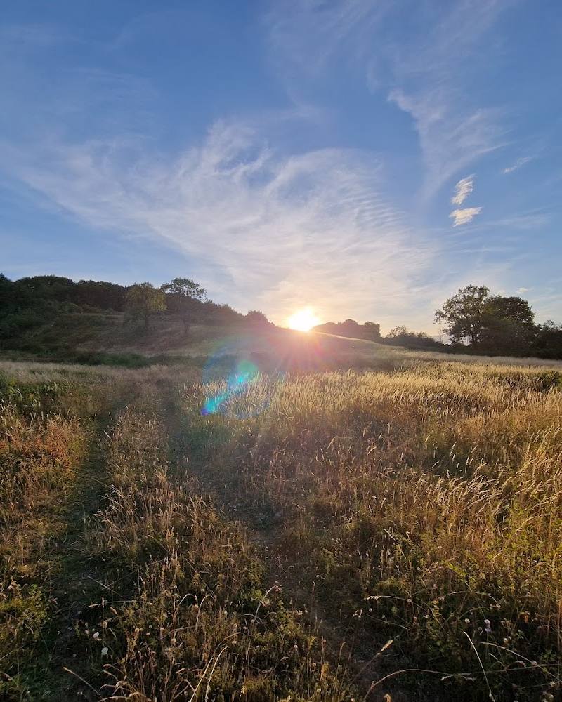
Danebury brings a nationally important archaeological landscape together with open chalk downland, a climb to the hilltop and far-reaching views. Its interest lies not just in the size of the ramparts, but in the traces of daily life still visible in the earth.
Atmospheric · Big-sky · Ancient-feeling
Find your way
Open mapNear Stockbridge, Hampshire
Opening map…
Know this place a little better?
The experience
Climb to the hillfort, follow the ring of ramparts and pause at the gateway and central high point. The walk is short, but the earthworks reward a slower circuit: subtle ground dips mark former storage pits, while the surrounding downland gives the fort its commanding setting.
Things to do
Walk the ring of ramparts
Follow the fort’s circular earthworks and compare the inner rampart with the outer ring. The route guide describes a choice of clockwise or anticlockwise circuit.
About 40 minutes for the basic walk; longer if exploring
Find the hidden gateway
At the entrance, look at how the earthworks turn and overlap; Hampshire County Council notes that the gateway was once hidden and that the entrance defences show how the fort was protected.
Spot the grain-store dips
Look for subtle hollows in the ground inside the ring. These are the visible traces Hampshire County Council identifies as former grain-storage pits.
Take in the downland and hilltop views
Pause at the high point and look out across the surrounding countryside; the setting and views are noted in the supplied route accounts.
Make a day of it
Quick escape · Around 40 minutes walking; allow 1–2 hours to explore
Quick escape: the rampart circuit
- 01
Start from the upper car park if it is open and available.
- 02
Climb the short, steep hill to the fort.
- 03
Walk around the ramparts and look for the gateway and central high ground.
- 04
Pause for the views, then return by the same approach.
Verified history
Hampshire County Council says evidence suggests the fort was built around 2,500 years ago and occupied for nearly 500 years. A community of about 300–400 people lived here, chiefly farming and keeping sheep and cattle; the site relied on trade for materials including iron, tin, copper, salt, shale and stone. Excavations led by Professor Barry Cunliffe ran from 1969 to 1988, with 57% of the interior excavated. They revealed evidence of 73 roundhouses, 500 rectangular buildings and thousands of deep storage pits, alongside large quantities of pottery, bone and other artefacts. The ramparts, gateway earthworks and shallow storage-pit depressions are among the traces visitors can still look for. The site is a Scheduled Ancient Monument and is of national importance for archaeology and nature conservation.
Folklore & legend
No specific local legend is established by the supplied sources. Hampshire County Council describes religious gatherings, shrines and offerings as part of its account of Iron Age life at Danebury; these are historical interpretations, not folklore presented as fact.
Hidden details
The gateway was designed to be hard to read — The entrance earthworks once concealed the gateway. Look at the turns and banks around the entrance to see how the approach formed part of the fort’s defences.
The hollows are clues to stored food — Subtle dips in the interior are the only visible evidence Hampshire County Council identifies for the excavated grain-storage pits.
A busy prehistoric landscape beyond the fort — Aerial archaeology has mapped traces of smaller ancient or Celtic fields beneath modern fields around Danebury, visible as crop marks or changes in soil colour.
When to go
April · May · June · Choose a clear day; check conditions before travelling.
Hampshire County Council identifies herb-rich downland grassland and blue butterflies at the site. Spring and early summer are a sensible time to look for this seasonal interest, though sightings and peak timing are not guaranteed.
The exposed hilltop can be windy, and the approach includes a steep climb over rough or chalky paths. Check the forecast and wear footwear suited to uneven ground.
The route
- surface
- Rough, chalky paths and sloping ground
- distance
- 2.2 km / 1.4 miles
- duration
- Around 40 minutes for the basic walk; allow longer for exploring
- difficulty
- Easy to moderate: one short, steep climb, followed by sloping and uneven ground
- waymarking
- A Hampshire County Council story trail is available; other waymarking not confirmed
- route shape
- Out and back to the hillfort, then a circuit around the ramparts; the circuit can be walked clockwise or anticlockwise
- start point
- Danebury Hill Fort car park; use the route guide and check current access
- parking start
- Route guide describes two car parks off Old Stockbridge Road and gives postcode SO20 6HZ. Confirm current availability and arrangements.
- shorter alternative
- Walk to the fort and explore a short section of the ramparts, returning by the same approach.
- Ramparts and entrance earthworks
- Central high ground and former storage-pit depressions
- Hilltop views and surrounding downland
Worth pairing with
Museum of the Iron Age, Andover
A worthwhile history pairing: Hampshire County Council says visitors can see a selection of finds from Danebury at the museum. Check current opening and admission information before planning a visit.
Stockbridge
The route guide recommends stopping in Stockbridge after the walk and describes it as a town on the River Test. Check local businesses and access details before setting out.
What to look for
- 01
The ring of ramparts and ditches
- 02
the once-hidden entrance and its defensive earthworks
- 03
the higher central ground associated with gatherings
- 04
subtle dips marking former grain-storage pits
- 05
and the contrast between the earthworks and the surrounding chalk grassland.
The story
Iron Age settlement, farming, trade and defence
Best time to go
Spring to early summer for the downland grassland and blue butterflies; clear days suit the hilltop views. Check conditions before visiting.
Choose a clear day for the broad hilltop views. Spring and early summer are worth considering for the herb-rich downland and blue butterflies; exact wildlife sightings are not guaranteed.
How long to spend
1–2 hours
Perfect for
Walkers · History lovers · Wildlife lovers · Families
Before you go
Address
Phone
Website
Listed hours
- Monday: Open 24 hours
- Tuesday: Open 24 hours
- Wednesday: Open 24 hours
- Thursday: Open 24 hours
- Friday: Open 24 hours
- Saturday: Open 24 hours
- Sunday: Open 24 hours
Check before visiting.
Google rating
Practical information
Opening & access
A Hampshire County Council Local Nature Reserve and Scheduled Ancient Monument. The site is described as open all day, but check current access and conditions before setting out. Paths climb steeply and can be rough or chalky underfoot.
Check before visiting
Parking
Parking is listed among the site’s facilities. Visitor accounts describe two car parks; confirm current arrangements before travel. SO20 6HZ is the supplied postcode.
Toilets
Visitor accounts report toilets at the upper car park; availability may vary. Check before visiting.
Check before visiting
Food & drink
Check before visiting.
Check before visiting
Dogs
Dogs are restricted at the reserve. Check current Hampshire County Council guidance and on-site signs before visiting.
Check before visiting
Accessibility
The source listing reports a wheelchair-accessible car park and entrance, but the hilltop route is steep and includes rough, sloping paths. A wheelchair-accessible toilet is not reported.
Cost
Check before visiting
Check before visiting
Gallery
Place photographs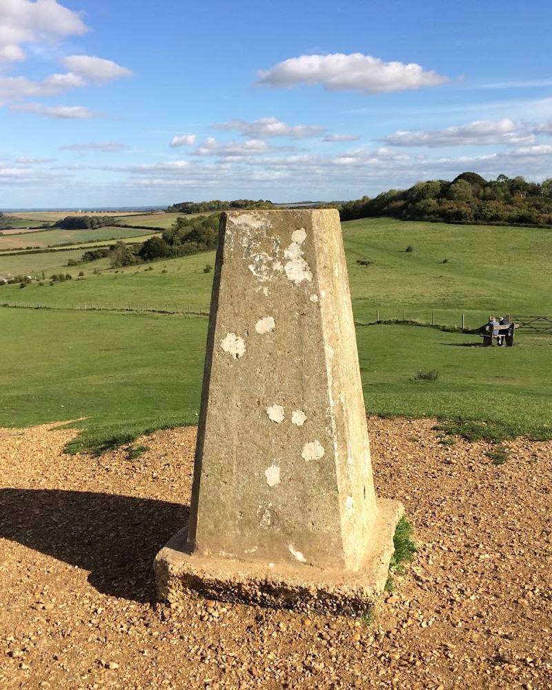
Keep exploring
Around Danebury Iron Age Hillfort
Within 50 km · approximate straight-line distances