7.1
Wildland
1–2 hours
Time
Check
Cost
Atmospheric
Feel
Why it's Wildland
7.1In a wooded Cotswold valley, Castle Combe’s honey-coloured stone buildings line the Bybrook. Its compact historic centre brings together a 14th-century market cross, St Andrew’s Church and the old bridge.
Castle Combe earns its place through the way its historic details sit within a real landscape: stone cottages, a river and a wooded valley, with the market cross and church giving a short visit more to notice than a photo stop alone.
Atmospheric · Photographers
Find your way
Open mapCastle Combe, Wiltshire
Opening map…
Know this place a little better?
The experience
Take a slow walk through the historic centre, pausing at the market cross, the bridge and St Andrew’s Church. The village is compact; allow extra time to explore its details rather than treating it as only a photo stop.
Things to do
Find the market cross
Look for the 14th-century market cross, one of the historic centre’s signature features.
10–15 minutes
Cross the old bridge over the Bybrook
Pause at the village bridge and take in the Bybrook beside the stone buildings. The river’s presence is a feature to observe, not evidence of permission for water activities.
10–15 minutes
Look closely at St Andrew’s Church
Visit if open and look for the church’s distinctive faceless clock, mentioned in the supplied source material.
Allow time to explore; visit duration depends on access
Walk Water Lane
Follow the village street past its honey-coloured cottages and notice how the buildings sit within the wooded valley.
15–30 minutes
Make a day of it
Quick escape · About 1–2 hours
1 — Quick Escape: the historic village centre
- 01
Walk the compact historic centre and take in the honey-coloured cottages.
- 02
Pause at the 14th-century market cross.
- 03
Continue to the bridge over the Bybrook and look along the waterside street.
- 04
If open, visit St Andrew’s Church; check access before setting out.
Half day · Half day
2 — Make a Half Day of It: linger over the village details
- 01
Explore the market cross, bridge and historic streets at an unhurried pace.
- 02
Visit St Andrew’s Church if it is open, and look for its distinctive faceless clock.
- 03
Add a walk beyond the centre only after checking a current route and conditions.
- 04
Choose a café or pub from current local listings; opening and availability need checking.
Verified history
The supplied local guide says the village takes its name partly from a 12th-century Norman castle built about 600 metres north of the village by Reginald de Dunstanville during the civil war of 1135–1154. It says the castle was abandoned by the 14th century. The historic centre includes a 14th-century market cross and the Grade I parish church of St Andrew. The source also describes buildings that have changed little since the 15th century.
When to go
· No verified time-of-day recommendation in the supplied sources; check locally for quieter visiting conditions.
The supplied sources do not establish a particular season as best.
Check the forecast and local conditions before travelling; no specific weather guidance is established in the supplied sources.
What to look for
- 01
The 14th-century market cross
- 02
the old stone bridge over the Bybrook
- 03
the honey-coloured cottages along Water Lane
- 04
St Andrew’s Church and its faceless clock. The supplied local guide also identifies nearby castle earthworks.
The story
Historic village; medieval market cross; St Andrew’s Church; former 12th-century castle nearby.
Best time to go
Check locally for seasonal conditions and quieter visiting times.
No specific best time is established by the supplied sources. Check locally for quieter times and current conditions.
How long to spend
1–2 hours
Perfect for
History lovers · Photographers · Walkers
Before you go
Address
Practical information
Opening & access
A village visitors can explore on foot. The supplied sources mention a car park at the top of the hill; check current parking and access arrangements before travelling.
Check before visiting
Parking
A car park at the top of the hill is mentioned in the supplied source. Check current arrangements before visiting.
Check before visiting
Toilets
Public toilets by the bridge are mentioned in the supplied source; check availability before visiting.
Check before visiting
Food & drink
The supplied local guide discusses places to eat and drink, but current opening and availability are not established. Check before visiting.
Check before visiting
Dogs
Check before visiting for current rules and signage.
Check before visiting
Accessibility
Check before visiting for current access information and route conditions.
Check before visiting
Cost
Check before visiting
Check before visiting
Water
River — the Bybrook flows through the village; no water activities or access permission are established.
Gallery
Place photographs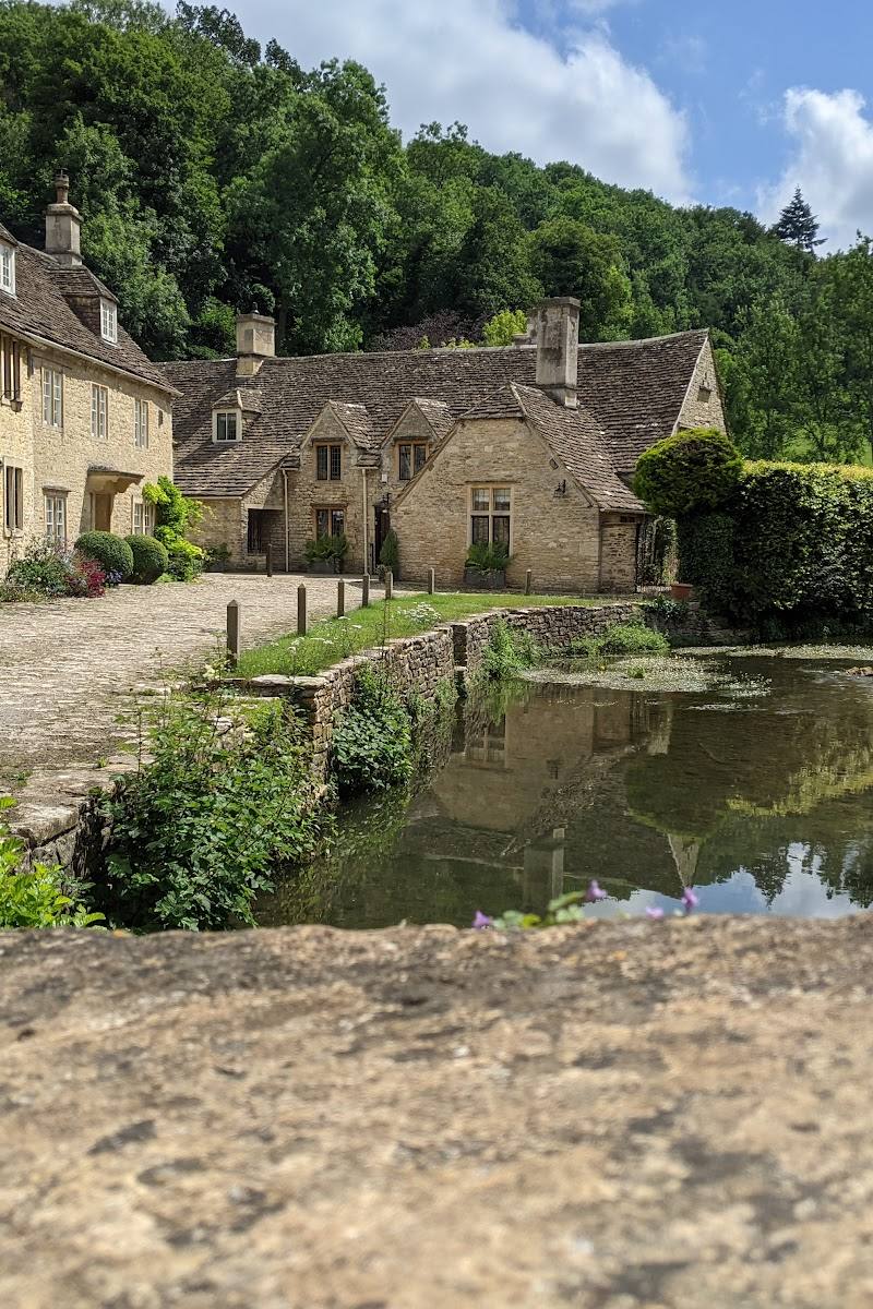

Keep exploring
Around Castle Combe
Within 50 km · approximate straight-line distances