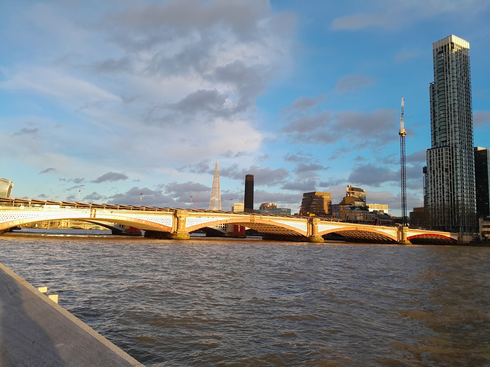
North bank of the Thames, below and west of Blackfriars Bridge, London EC4Y 0DZ
Bazalgette Embankment
Parkland
Place photograph
6.2
Wildland
Under 1 hour
Time
Check
Cost
Dramatic
Feel
Why it's Wildland
6.2A new piece of London’s river edge: Bazalgette Embankment adds around an acre of public space to the Thames, built as part of the Tideway project and named for Victorian engineer Sir Joseph Bazalgette.
This is an unusual urban riverside public space where contemporary engineering, public art and the Thames meet. Its appeal is a short, accessible pause by the water and the chance to see a newly created section of river frontage—not a wild or secluded landscape.
Dramatic · Quirky
Find your way
Open mapNorth bank of the Thames, below and west of Blackfriars Bridge, London EC4Y 0DZ
Opening map…
Know this place a little better?
The experience
A compact riverside stop for views, public art and a look at how a major piece of new public realm has been made. Pair it with a walk along the Thames Path; don’t mistake the water-facing setting for permission to swim or paddle.
Things to do
See Stages and the water wall
Look for Nathan Coley’s five sculptures, which frame views to and from the river and create focal points in the space. One feature is described as a water wall.
10–20 minutes
Look for the reinstated river fittings
Find the listed sturgeon lamp standards and lion-head mooring rings, which were removed, repaired and reinstated as the space was completed.
5–10 minutes
Read the River Fleet poems
Look at the ventilation columns for poems by Dorothea Smartt relating to the area’s history and the lost River Fleet.
5–10 minutes
Pause for Thames views
Use the viewing platforms and seating to take in the river and the space’s new connection with the water.
10–20 minutes
Make a day of it
Quick escape · 20–40 minutes
Quick riverside pause
- 01
Enter the public space below and west of Blackfriars Bridge.
- 02
Walk through the riverside area and pause at the viewing platforms for Thames views.
- 03
Find the Stages sculptures and the water wall.
- 04
Continue along the Thames Path if conditions and access allow.
Half day · About 1–2 hours; route length not verified
Make a short Thames-side walk of it
- 01
Explore Bazalgette Embankment, taking time to notice the artwork, restored river fittings and poetry on the ventilation columns.
- 02
Walk a section of the Thames Path from the site, turning back when you have had enough; no specific route distance is verified.
- 03
Check local information for a nearby place to eat or visit if you want to extend the outing.
Verified history
Bazalgette Embankment is part of the Tideway project and is named after Victorian engineer Sir Joseph Bazalgette. Tideway says the Blackfriars site intercepts spills into the Thames, including more than 500,000 tonnes of sewage that previously spilled each year from the Fleet Sewer. The new public space occupies reclaimed land at the river edge. Existing listed sturgeon lamp standards and lion-head mooring rings at Blackfriars Embankment were repaired and reinstated; ventilation columns feature poems by Dorothea Smartt about the area and the lost River Fleet.
Hidden details
The restored sturgeon lamp standards — The existing listed sturgeon lamp standards were removed, stored, repaired and reinstated during the works.
Poems on the ventilation columns — The columns carry poems by Dorothea Smartt connecting the site to the history of the area and the lost River Fleet.
Five sculptures, not just a riverside backdrop — Stages by Nathan Coley consists of five sculptures, reported at 4–9 metres high, designed to frame views and provide focal points.
When to go
· Daytime, preferably in clear weather for river views; no specific time-of-day guidance was verified.
The supplied evidence describes a year-round public realm but gives no seasonal highlights. A clear day is a practical choice for the views.
Exposed riverside setting; check the forecast and current conditions before travelling. No site-specific weather guidance was supplied.
Worth pairing with
Thames Path
The public space connects with an enhanced Thames Path route. Tideway describes the path here as a wide route with places to pause and enjoy the river.
Blackfriars Bridge
The embankment is located below and west of Blackfriars Bridge; the bridge provides the immediate orientation point for a visit.
What to look for
- 01
Look for the five-part public artwork Stages by Nathan Coley, including the water wall
- 02
the restored sturgeon lamp standards and lion-head mooring rings
- 03
and poems by Dorothea Smartt on the ventilation columns, relating to the area’s history and the lost River Fleet.
The story
Industry
Best time to go
Year-round; choose a clear day for the river views.
A clear daytime visit should give the best chance of appreciating the river views and the sculptures. No specific seasonal programme or opening hours were verified.
How long to spend
Under 1 hour
Perfect for
Solo · Couples · Families · Photographers · Walkers · History lovers
Before you go
Address
Website
Google rating
Practical information
Opening & access
Tideway describes this as a public riverside space for Londoners and visitors. Check current access and any event arrangements before visiting.
Check before visiting
Parking
Check before visiting; parking information was not provided.
Check before visiting
Toilets
Public toilets are reported in the undercroft near the bridge; check availability before visiting.
Check before visiting
Food & drink
Commercial spaces are reported in the undercroft; food and opening details are not specified. Check before visiting.
Check before visiting
Dogs
Check before visiting; dog rules were not specified in the supplied sources.
Check before visiting
Accessibility
Tideway reports level access across the space, smooth granite paving, ramped areas to most viewing platforms and seating designed to accommodate wheelchair users alongside others. The Thames Path is reported as a wide, accessible route here. Check current conditions before visiting.
Check before visiting
Cost
Check before visiting
Check before visiting
Water
River
Gallery
Place photographsKeep exploring
Around Bazalgette Embankment
Within 50 km · approximate straight-line distances