Reigate Hill, Wray Lane, Reigate, Surrey RH2 0HX, United Kingdom
Reigate Hill Viewpoint
Viewpoint
Place photograph
6.3
Wildland
1–2 hours
Time
Check
Cost
Dramatic
Feel
Why it's Wildland
6.3A chalk ridge walk with far-reaching views, a 1909 horse-trough memorial and a landscape that still holds traces of London’s defences and a tragic wartime crash.
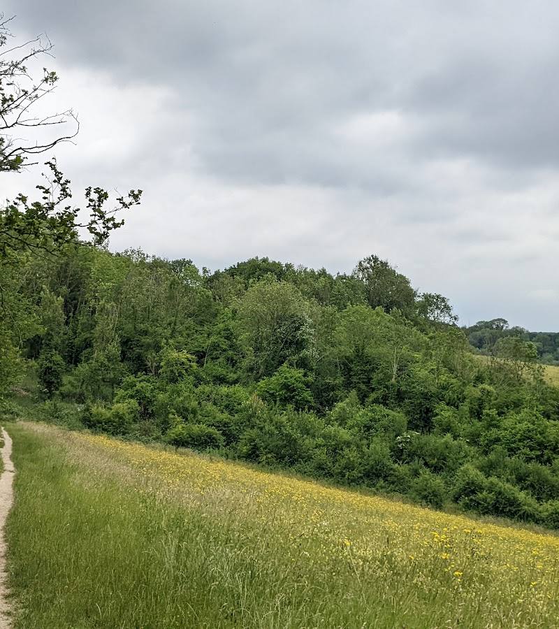
Reigate Hill earns its place through more than the view: the North Downs ridge leads past the distinctive Inglis Memorial, a historic fort and the site of a 1945 bomber crash. Chalk grassland and woodland give the walk variety, while the ridge opens towards the Weald and the South Downs.
Dramatic · Atmospheric
Find your way
Open mapReigate Hill, Wray Lane, Reigate, Surrey RH2 0HX, United Kingdom
Opening map…
Know this place a little better?
The experience
Walk the North Downs ridge for open views, chalk downland and woodland, with stops at the Inglis Memorial, Reigate Fort and the wartime bomber crash site. The National Trust’s full walk is 3.3 miles and takes about two to two hours and 15 minutes.
Things to do
Follow the Reigate Hill walk
Walk the National Trust’s 3.3-mile route from Wray Lane car park along the North Downs Way. It is not waymarked and includes steps and steep sections.
2–2¼ hours
Stop at the Inglis Memorial
See the circular-pillared memorial donated in 1909 and built as a drinking fountain for horses. Use its viewpoint indicator to identify the surrounding landscape.
Look for Reigate Fort
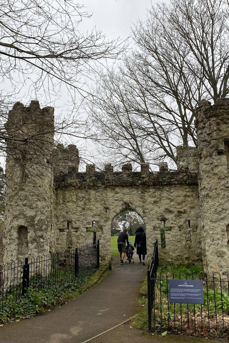
The fort was built in 1898 as part of the defences intended to protect London. The National Trust walk passes its entrance; check current arrangements before entering the site or buildings.
Find the bomber crash clearing
The open area on the hill marks the site where a US B-17 Flying Fortress crashed on 19 March 1945. A memorial commemorates the nine airmen who died.
Take in the ridge views
From the Inglis Memorial, the National Trust describes views towards Box Hill and Leith Hill to the west and the South Downs to the south.
Make a day of it
Quick escape · About 1–2 hours
Quick ridge-and-view walk
- 01
Start at Wray Lane car park and join the North Downs Way.
- 02
Walk towards the Inglis Memorial and pause at the viewpoint.
- 03
Enjoy the ridge views, then return by the same path; check local route conditions before setting off.
Half day · About 2–2¼ hours
The Reigate Hill history walk
- 01
Start at Wray Lane car park and follow the National Trust’s 3.3-mile route along the North Downs Way.
- 02
Look out for the Reigate footbridge and the entrance to Reigate Fort.
- 03
Continue past the former bomber crash site and stop at the Inglis Memorial to take in the views.
- 04
Follow the route back to the start, noting that it is not waymarked and includes steps and steep chalk sections.
Verified history
Reigate Fort was built in 1898 as part of a defence line intended to protect London. On 19 March 1945, a US B-17 Flying Fortress crashed into Reigate Hill while returning from a bombing raid; the National Trust identifies the surviving clearing and a memorial to the nine airmen who died. The Inglis Memorial was donated to Reigate in 1909 by Lieutenant Colonel Sir Robert William Inglis and built as a drinking fountain for horses. The Reigate Hill footbridge was designed in 1908 and completed in 1910.
Hidden details
The footbridge’s engineering — The National Trust says the footbridge was built using the French Mouchel Hennebique reinforced-concrete system. Its single-span arch measures about 30 metres.
The Inglis Memorial’s original purpose — This hilltop structure was not originally built as a viewpoint shelter: it was a drinking fountain for horses using the old route over Reigate Hill.
When to go
April · May · June · July · August · September · October · Choose a clear day; no specific time of day is verified as best.
Spring to autumn is a practical choice for exploring the ridge and its historic stops. No season-specific wildlife or flowering claims are established by the supplied sources.
Views depend on visibility. The route includes steep chalk sections, so check conditions and wear suitable footwear; paths may be more difficult after wet weather.
The route
- surface
- Mostly good-quality, fairly level surfaced paths, with a steep descent on a surfaced path and an ascent on a natural chalk path.
- distance
- 3.3 miles (5.28 km)
- duration
- 2 hours to 2 hours 15 minutes
- difficulty
- Moderate
- waymarking
- Not waymarked
- start point
- Wray Lane car park, Reigate Hill
- parking start
- Wray Lane car park is the stated start. Check current parking availability and charges before visiting.
- shorter alternative
- Walk a shorter out-and-back section from Wray Lane car park towards the Inglis Memorial and return the same way; check path conditions and access locally.
- Reigate footbridge
- Reigate Fort
- 1945 US bomber crash site
- Inglis Memorial
- Views towards Box Hill, Leith Hill and the South Downs
Worth pairing with
Gatton Park
A broader landscape pairing: the National Trust describes a ‘Capability’ Brown-designed park with sweeping views, woodland and ponds. Some gardens are open only on selected days, so check arrangements before planning a visit.
Reigate Fort
A worthwhile history stop along the Reigate Hill walk. The fort complex is described as open daily, while the buildings are open only by special arrangement; confirm current access before visiting.
What to look for
Look for the Inglis Memorial’s circular pillars and carved stone roof, the old Reigate footbridge, the approach to Reigate Fort and the open clearing marking the 1945 bomber crash site. On the ridge, watch for Belted Galloway cattle grazing the chalk downland.
The story
War & battle, Aviation
Best time to go
Spring to autumn
Choose a clear day for the broadest views. The National Trust describes the ridge as offering views towards Box Hill, Leith Hill and the South Downs; check conditions and path suitability before you go.
How long to spend
1–2 hours
Perfect for
Walkers · Photographers · History lovers · Dogs
Before you go
Address
Phone
Website
Listed hours
- Monday: Open 24 hours
- Tuesday: Open 24 hours
- Wednesday: Open 24 hours
- Thursday: Open 24 hours
- Friday: Open 24 hours
- Saturday: Open 24 hours
- Sunday: Open 24 hours
Check before visiting.
Google rating
Practical information
Opening & access
The National Trust describes the surrounding open countryside as open to everyone. The viewpoint and walks are reached via local paths; check current access and parking arrangements before setting out.
Check before visiting
Parking
Wray Lane car park is the stated start for the National Trust’s 3.3-mile walk. Parking details and charges can vary by car park; check before visiting.
Check before visiting
Toilets
Toilets are listed at Wray Lane car park. The National Trust’s main property information says the accessible toilet is open during kiosk opening hours; check current arrangements.
Check before visiting
Food & drink
A takeaway servery at Wray Lane car park serves hot and cold drinks, snacks and ice cream; it is not run by the National Trust. Check opening times before visiting.
Check before visiting
Dogs
Dogs are welcome. Keep them on a lead around grazing livestock.
Accessibility
The 3.3-mile walk is rated moderate. Most paths are fairly level and surfaced, but the route includes steps and a steep descent and ascent on chalk paths; it is not suitable for wheelchairs or pushchairs. Other paths and access points differ, so check route details before visiting.
Check before visiting
Cost
Paid (parking may be chargeable; check before visiting)
Check before visiting
Gallery
Place photographsKeep exploring
Around Reigate Hill Viewpoint
Within 50 km · approximate straight-line distances