101 Chase Road, Brownhills, Walsall WS8 6JE
McClean Way Aqueduct
Industrial heritage
Place photograph
3.9
Wildland
1–2 hours
Time
Check
Cost
[]
Feel
Why it's Wildland
3.9A small piece of infrastructure associated with the McClean Way, a greenway following the former South Staffordshire Railway between the Walsall area, Brownhills and Lichfield. A local post describes a canal aqueduct on the way, but its precise history and visitor access are not established by the available evidence.
The appeal here is a glimpse of overlooked local infrastructure within a much larger former-railway greenway. The McClean Way combines transport history with a green corridor and views towards Ryders Hayes Mere; the aqueduct itself needs more on-the-ground verification before it can be presented as a standalone destination.
[]
Find your way
Open map101 Chase Road, Brownhills, Walsall WS8 6JE
Opening map…
Know this place a little better?
The experience
A brief stop to look for the aqueduct may be possible as part of exploring the McClean Way, but its exact access point and history need checking. The wider greenway follows a former railway and includes other named railway features; do not assume the aqueduct is on a particular walking or cycling itinerary without checking the route locally.
Things to do
Explore a section of the McClean Way
Walk or cycle a section of the former railway greenway. Confirm the access point and route length that suit your visit; no aqueduct-specific approach is verified.
Notice the railway heritage along the greenway
The route follows a former railway line and its published route information identifies features including Railswood Bridge and former station sites.
Make a day of it
Quick escape · Under 1 hour
A short look along the McClean Way
- 01
Use the McClean Way information to identify a suitable access point; the supplied aqueduct pin is not confirmed as an entrance.
- 02
Follow the greenway only as far as the aqueduct feature if its location and access are confirmed locally.
- 03
Return by the same route.
Verified history
The McClean Way follows part of the former South Staffordshire Railway, built in 1848 and named after John Robinson McClean, who was associated with the South Staffordshire Railway and Waterworks Companies. The railway closed between 1984 and 1987. Parts of the corridor were reopened as a greenway between 2014 and 2017; the route organisation reports an official opening in May 2025. A local Facebook post describes an aqueduct on the McClean Way, but the supplied sources do not verify the aqueduct’s own date or construction history.
Hidden details
The railway line beneath the greenway — The wider route reuses a former railway alignment. Its published route information names surviving or commemorated railway features, including Railswood Bridge and station locations.
When to go
· No specific time of day is verified; check current route conditions before visiting.
The supplied sources do not identify a best season. Weather may affect path surfaces.
The route organisation notes that weather conditions can affect path surfaces. Use your judgement and check current conditions.
Worth pairing with
Ryders Hayes Mere and Clayhanger SSSI views
The McClean Way route information notes views over Ryders Hayes Mere and the adjacent Clayhanger Site of Special Scientific Interest. The evidence supports these as features along the wider route, not as a verified aqueduct itinerary.
What to look for
Look for the aqueduct feature described in a local McClean Way post. The available sources do not establish its construction details or other distinctive features.
The story
Industry
Best time to go
No specific best season is established. Check route conditions before visiting, as weather can affect path surfaces.
No verified seasonal or time-of-day advantage is available. Check route conditions before setting out.
How long to spend
1–2 hours
Perfect for
["Walkers" · "Cyclists" · "History lovers"]
Before you go
Address
Website
Listed hours
- Monday: Open 24 hours
- Tuesday: Open 24 hours
- Wednesday: Open 24 hours
- Thursday: Open 24 hours
- Friday: Open 24 hours
- Saturday: Open 24 hours
- Sunday: Open 24 hours
Check before visiting.
Google rating
Practical information
Opening & access
The aqueduct is identified in a local McClean Way post, but access to the feature itself has not been independently confirmed. The wider McClean Way is a greenway; check current route conditions and access before setting out. The supplied map pin is a place pin, not a confirmed entrance or parking location. Access arrangements are unconfirmed. Check before visiting; do not enter private land or restricted structures.
Check before visiting
Parking
Parking at or near the aqueduct is not verified. The supplied pin is not a parking or entrance pin; check local arrangements before travelling.
Check before visiting
Toilets
Check before visiting
Check before visiting
Food & drink
Check before visiting
Check before visiting
Dogs
Check before visiting
Check before visiting
Accessibility
Surface, gradients and step-free access at the aqueduct are not verified. Check current route conditions and suitability before visiting.
Check before visiting
Cost
Check before visiting
Check before visiting
Water
Canal
Gallery
Place photographsKeep exploring
Around McClean Way Aqueduct
Within 50 km · approximate straight-line distances

Pipehill Fisheries
Pipehill Farm, Walsall Road, Lichfield, Staffordshire WS13 8JT
4.1 km away

 Source image6.4
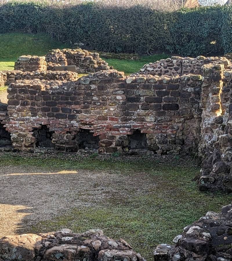
Wall Roman Site (Letocetum)
Watling Street, Wall, Lichfield, Staffordshire WS14 0AW
4.6 km away