5.8
Wildland
Under 1 hour
Time
Check
Cost
Atmospheric
Feel
Why it's Wildland
5.8A substantial Neolithic long barrow beside the South Downs Way, its long, wedge-shaped mound still marking a prominent place in the landscape.
Long Burgh makes a worthwhile short stop for its scale and setting: a 56-metre prehistoric mound beside an ancient route across the Downs. Its story is especially tangible in the mound’s shape, the traces of flanking ditches and the damaged area at its northern end.
Atmospheric · Ancient-feeling
Find your way
Open mapNear Alfriston, East Sussex
Opening map…
Know this place a little better?
The experience
A focused visit for the landscape and archaeology. From the South Downs Way, take time to view the mound from the path and notice its wedge-like form. Do not climb or disturb the monument.
Things to do
Take in the mound’s full shape
From the path, look along the long, wedge-shaped mound and note its north–south alignment and wider northern end.
10–20 minutes
Look for traces of the flanking ditches
The ditches formed when chalk was dug out to build the mound; only traces remain.
5–10 minutes
Notice the barrow’s position beside a long-distance route
The barrow stands at the junction of the South Downs Way and smaller paths. The source suggests the trails may follow prehistoric droveways.
5–10 minutes
Make a day of it
Quick escape · Under 1 hour
Quick Escape: Read the barrow
- 01
Approach on foot via the South Downs Way; the supplied map pin is not an entrance or parking location.
- 02
View the mound from the path and take in its long, wedge-shaped profile.
- 03
Look for the wider northern end and the surviving traces of the flanking ditches.
- 04
Keep to the path and avoid climbing on or disturbing the monument.
Verified history
Long Burgh is a Neolithic long barrow and a Scheduled Monument, listed on 9 October 1981. Britain Express dates its construction to sometime between 3400 and 2400 BCE and records a 1767 investigation by a local landowner, during which a skeleton and pottery urn were reportedly found; those objects have since been lost. The source says archaeologists suggest the burial remains may have been a later insertion, possibly Bronze Age or Saxon. The mound measures about 56 metres long, 28 metres wide and up to 1.8 metres high. Its northern end, where the main chamber is thought to have been, has been damaged.
Hidden details
A chamber thought to have been at the northern end — Archaeologists suggest the barrow’s main chamber was at the northern end, an area that has been badly damaged. The chamber’s position is an archaeological interpretation, not a visible feature visitors can confirm.
The mound’s surviving ditch traces — The flanking ditches were created by digging chalk for the mound. Only traces remain, so they may not be easy to distinguish on the ground.
When to go
· No specific time is evidenced.
The supplied sources do not establish a best season. The mound may be harder to make out when summer grass overgrows it.
Check the forecast and current path conditions before visiting; surface and terrain details are not verified.
What to look for
Look for the mound’s north–south alignment and wider northern end. Traces of the flanking ditches survive, and the northern end—where the main chamber is thought to have been—has been damaged.
The story
Archaeology
Best time to go
No season-specific advantage is verified. Check current path conditions before setting out.
No particular time of day is verified as best. Check the forecast and path conditions before visiting.
How long to spend
Under 1 hour
Perfect for
History lovers · Walkers · Photographers
Before you go
Practical information
Opening & access
The barrow is described as lying beside the South Downs Way, with a walking approach from Alfriston. Confirm current access and follow the signed path; the supplied Google pin is a place pin, not an entrance or parking location.
Parking
Parking arrangements are not verified. The supplied map pin is not a parking or entrance pin.
Toilets
Check before visiting
Check before visiting
Food & drink
Check before visiting
Check before visiting
Dogs
Check before visiting
Check before visiting
Accessibility
Accessibility is not verified. The source record reports no wheelchair-accessible car park or entrance; check conditions and route suitability before travelling.
Check before visiting
Cost
Check before visiting
Check before visiting
Gallery
Place photographs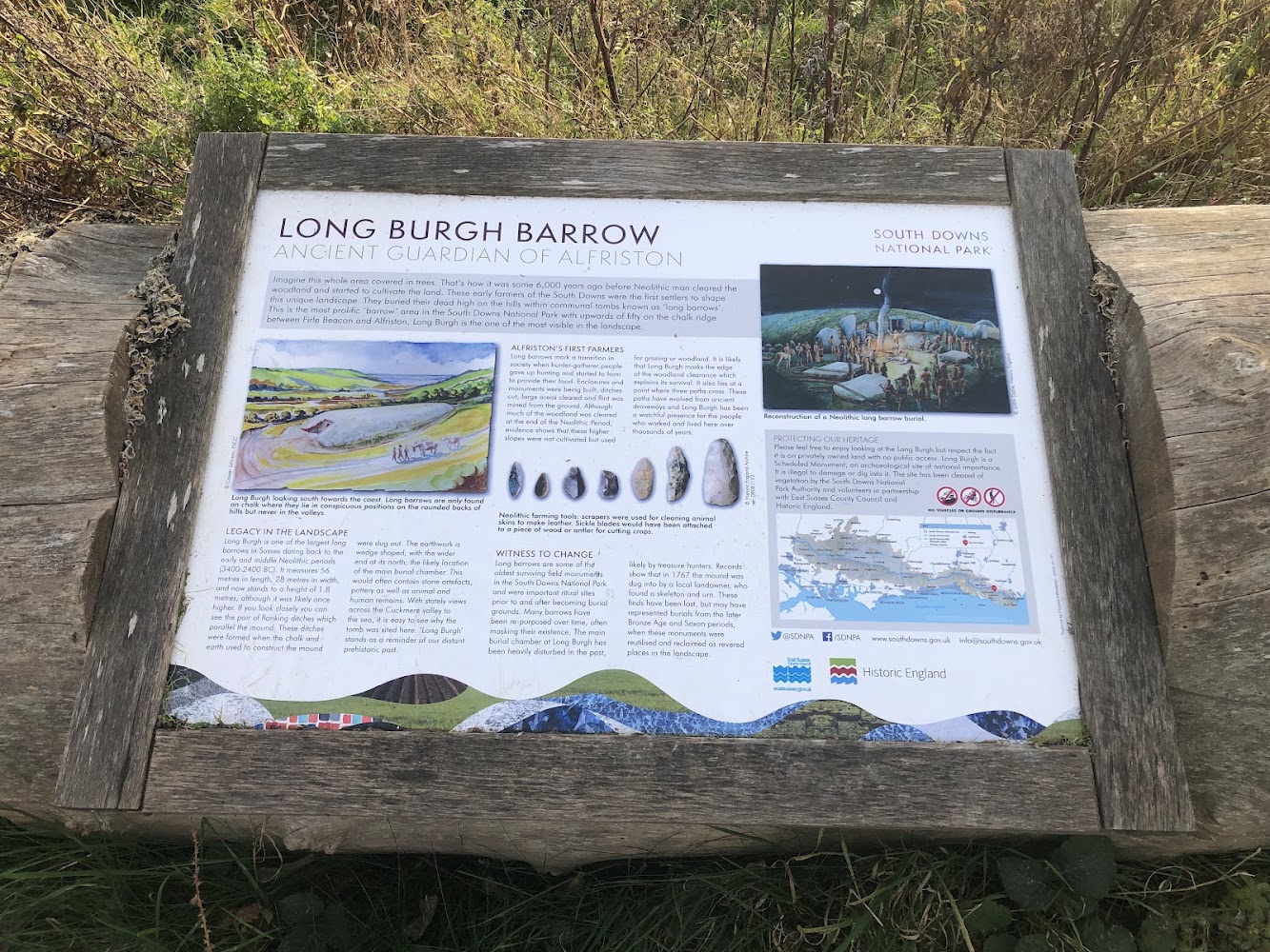
Keep exploring
Around Long Burgh Long Barrow
Within 50 km · approximate straight-line distances